 |
|
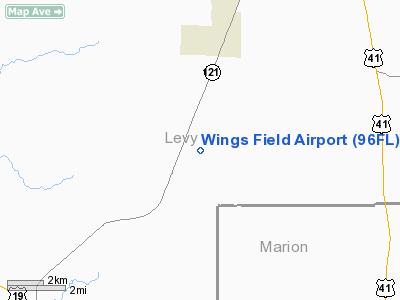
Location
& QuickFacts
|
FAA Information Effective: |
2007-01-18 |
|
Airport
Identifier: |
96FL |
|
Airport
Status: |
Operational |
|
Longitude/Latitude: |
082-32-43.3790W/29-14-32.8920N
-82.545383/29.242470 (Estimated) |
|
Elevation: |
100 ft / 30.48 m (Estimated) |
|
Land: |
20
acres |
|
From
nearest city: |
10 nautical miles SW of Williston, FL |
|
Location: |
Levy County, FL |
|
Magnetic Variation: |
02W (1985) |
Owner
& Manager
|
Ownership: |
Privately owned |
|
Owner: |
Robert Obert & R Scott Kemper |
|
Address: |
8035 Se 140th St
Inglis, FL 34449 |
|
Phone
number: |
352-447-2777 |
|
Manager: |
Robert V. Obert |
|
Address: |
8035 Se 140th St
Inglis, FL 34449 |
|
Phone number: |
352-447-2777 |
Airport
Operations and Facilities
|
Airport Use: |
Private |
|
Wind
indicator: |
Yes |
|
Segmented
Circle: |
No |
|
Control
Tower: |
No |
|
Sectional
chart: |
Jacksonville |
|
Region: |
ASO - Southern |
|
Boundary
ARTCC: |
ZJX - Jacksonville |
|
Tie-in
FSS: |
GNV - Gainesville |
|
FSS
Phone: |
850-377-3291 |
|
FSS
Toll Free: |
1-800-WX-BRIEF |
|
Runway Information
Runway 18/36
|
Dimension: |
3300 x 100 ft / 1005.8 x 30.5 m |
|
Surface: |
TURF, |
|
|
Runway 18 |
Runway 36 |
|
Traffic
Pattern: |
Left |
Left |
|
Displaced
threshold: |
1250.00
ft |
1250.00
ft |
|
Obstruction: |
45 ft trees, 200.0 ft from runway |
55 ft trees, 300.0 ft from runway |
|
Radio Navigation
Aids
|
ID |
Type |
Name |
Ch |
Freq |
Var |
Dist |
|
GN |
NDB |
Wynds |
|
269.00 |
04W |
32.3 nm |
|
IAK |
NDB |
Palatka |
|
243.00 |
05W |
45.6 nm |
|
LEE |
NDB |
Leesburg |
|
335.00 |
04W |
46.4 nm |
|
OCF |
VORTAC |
Ocala |
084X |
113.70 |
00E |
17.2 nm |
|
GNV |
VORTAC |
Gators |
109X |
116.20 |
04W |
30.6 nm |
|
CTY |
VORTAC |
Cross City |
057X |
112.00 |
02W |
34.0 nm |
Remarks
Wings Field Airport
Address:
Levy County, FL
Tel:
352-447-2777
Images
and information placed above are from
http://www.airport-data.com/airport/96FL/
We
thank them for the data!
| General
Info |
| Country |
United
States |
| State |
FLORIDA
|
| FAA ID |
96FL
|
| Latitude |
29-14-32.892N
|
| Longitude |
082-32-43.379W
|
| Elevation |
100 feet
|
| Near City |
WILLISTON
|
We don't guarantee the information is fresh and accurate. The data may
be wrong or outdated.
For more up-to-date information please refer to other sources.
|
|


