 |
|
Whiting Field Naval Air Station South Airport |
Coordinates: 30°42′16″N 087°01′23″W / 30.70444°N 87.02306°W / 30.70444; -87.02306
| NAS Whiting Field - South |
| IATA: none – ICAO: KNDZ – FAA LID: NDZ |
| Summary |
| Airport type |
Military: Naval Air Station |
| Operator |
United States Navy |
| Location |
Santa Rosa County, near Milton, Florida |
| Elevation AMSL |
177 ft / 54 m |
| Website |
wwwcfs.cnet.navy.mil/... |
| Runways |
| Direction |
Length |
Surface |
| ft |
m |
| 5/23 |
5,997 |
1,828 |
Asphalt |
| 14/32 |
6,001 |
1,829 |
Asphalt |
| Helipads |
| Number |
Length |
Surface |
| ft |
m |
| H1 |
100 |
30 |
Asphalt |
| H2 |
100 |
30 |
Asphalt |
| H3 |
100 |
30 |
Asphalt |
| H4 |
100 |
30 |
Asphalt |
| H5 |
100 |
30 |
Asphalt |
| H6 |
75 |
23 |
Asphalt |
| H-A |
100 |
30 |
Asphalt |
| H-B |
100 |
30 |
Asphalt |
| H-C |
100 |
30 |
Asphalt |
| H-D |
100 |
30 |
Asphalt |
| H-E |
100 |
30 |
Asphalt |
| H-F |
100 |
30 |
Asphalt |
| Source: Federal Aviation Administration |
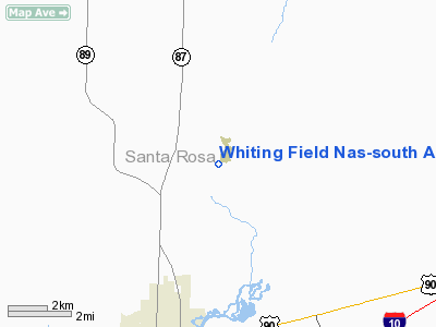
NAS Whiting Field - South (ICAO: KNDZ, FAA LID: NDZ), also known as South Whiting Field, is located three miles (5 km) north of the central business district of Milton, in Santa Rosa County, Florida, United States. This military airport is owned by the US Navy. It is one of two airfields located at Naval Air Station Whiting Field, the other airfield being NAS Whiting Field - North.
Although most U.S. airports use the same three-letter location identifier for the FAA and IATA, instead NAS Whiting Field - South is assigned NDZ by the FAA but has no designation from the IATA (which assigned NDZ to Nordholz, Cuxhaven, Lower Saxony, Germany). Facilities
Whiting Field NAS-South has two runways and 12 helipads:
- Runway 5/23: 5,997 x 200 ft. (1,828 x 61 m), Surface: Asphalt
- Runway 14/32: 6,001 x 200 ft. (1,829 x 61 m), Surface: Asphalt
- Helipads H1,H2,H3,H4,H5: 100 x 100 ft. (30 x 30 m), Surface: Asphalt
- Helipad H6: 75 x 100 ft. (23 x 30 m), Surface: Asphalt
- Helipads H-A,B,C,D,E,F: 100 x 100 ft. (30 x 30 m), Surface: Asphalt
The above content comes from Wikipedia and is published under free licenses – click here to read more.
Location
& QuickFacts
|
FAA Information Effective: |
2007-01-18 |
|
Airport
Identifier: |
NDZ |
|
Airport
Status: |
Operational |
|
Longitude/Latitude: |
087-01-22.6810W/30-42-15.8090N
-87.022967/30.704391 (Estimated) |
|
Elevation: |
177 ft / 53.95 m (Estimated) |
|
Land: |
0
acres |
|
From
nearest city: |
3 nautical miles N of Milton, FL |
|
Location: |
Santa Rosa County, FL |
|
Magnetic Variation: |
01E (1985) |
Owner
& Manager
|
Ownership: |
Navy owned |
|
Owner: |
Us Navy |
|
Address: |
Oceanographic Ofc-code 3142
Washington, DC 20373 |
|
Manager: |
Commanding Officer |
|
Address: |
Naval Air Station Whiting Fld
Milton, FL 32570 |
Airport
Operations and Facilities
|
Airport Use: |
Private |
|
Segmented
Circle: |
No |
|
Control
Tower: |
Yes |
|
Lighting
Schedule: |
DUSK-DAWN |
|
Beacon
Color: |
Clear-Green (lighted land airport) |
|
Sectional
chart: |
New Orleans |
|
Region: |
ASO - Southern |
|
Boundary
ARTCC: |
ZJX - Jacksonville |
|
Tie-in
FSS: |
GNV - Gainesville
FSS-GAINESVILLE GNV-DL-NOTAM PNS |
|
FSS Phone: |
850-377-3291 |
|
FSS Toll Free: |
1-800-WX-BRIEF |
Airport
Services
|
Fuel available: |
100LL |
|
Airframe Repair: |
NONE |
|
Power Plant Repair: |
NONE |
|
Bottled
Oxygen: |
NONE |
|
Bulk
Oxygen: |
NONE |
|
Runway Information
Runway 05/23
|
Dimension: |
5997 x 200 ft / 1827.9 x 61.0 m |
|
Surface: |
ASPH, |
|
Pavement
Class: |
33 /F/B/W/T |
|
Edge
Lights: |
High |
|
|
Runway 05 |
Runway 23 |
|
Longitude: |
087-01-09.5850W |
087-00-19.2740W |
|
Latitude: |
30-41-40.6190N |
30-42-21.0310N |
|
Elevation: |
161.00
ft |
170.00
ft |
|
Traffic
Pattern: |
Left |
Left |
|
VASI: |
4-light PAPI on left side |
4-light PAPI on left side |
|
Runway 14/32
|
Dimension: |
6001 x 200 ft / 1829.1 x 61.0 m |
|
Surface: |
ASPH, |
|
Pavement
Class: |
36 /F/A/W/T |
|
Edge
Lights: |
High |
|
|
Runway 14 |
Runway 32 |
|
Longitude: |
087-01-22.6810W |
087-00-35.9060W |
|
Latitude: |
30-42-10.6670N |
30-41-27.1440N |
|
Elevation: |
170.00
ft |
164.00
ft |
|
ILS
Type: |
|
ILS/DME |
|
Traffic
Pattern: |
Left |
Left |
|
VASI: |
4-light PAPI on left side |
4-light PAPI on left side |
|
Helipad H-A
|
Dimension: |
100 x 100 ft / 30.5 x 30.5 m |
|
Surface: |
ASPH, |
|
|
Runway H-A |
Runway |
|
Traffic
Pattern: |
Left |
Left |
|
Helipad H-B
|
Dimension: |
100 x 100 ft / 30.5 x 30.5 m |
|
Surface: |
ASPH, |
|
|
Runway H-B |
Runway |
|
Traffic
Pattern: |
Left |
Left |
|
Helipad H-C
|
Dimension: |
100 x 100 ft / 30.5 x 30.5 m |
|
Surface: |
ASPH, |
|
|
Runway H-C |
Runway |
|
Traffic
Pattern: |
Left |
Left |
|
Helipad H-D
|
Dimension: |
100 x 100 ft / 30.5 x 30.5 m |
|
Surface: |
ASPH, |
|
|
Runway H-D |
Runway |
|
Traffic
Pattern: |
Left |
Left |
|
Helipad H-E
|
Dimension: |
100 x 100 ft / 30.5 x 30.5 m |
|
Surface: |
ASPH, |
|
|
Runway H-E |
Runway |
|
Traffic
Pattern: |
Left |
Left |
|
Helipad H-F
|
Dimension: |
100 x 100 ft / 30.5 x 30.5 m |
|
Surface: |
ASPH, |
|
|
Runway H-F |
Runway |
|
Traffic
Pattern: |
Left |
Left |
|
Helipad H1
|
Dimension: |
100 x 100 ft / 30.5 x 30.5 m |
|
Surface: |
ASPH, |
|
|
Runway H1 |
Runway |
|
Traffic
Pattern: |
Left |
Left |
|
Helipad H2
|
Dimension: |
100 x 100 ft / 30.5 x 30.5 m |
|
Surface: |
ASPH, |
|
|
Runway H2 |
Runway |
|
Traffic
Pattern: |
Left |
Left |
|
Helipad H3
|
Dimension: |
100 x 100 ft / 30.5 x 30.5 m |
|
Surface: |
ASPH, |
|
|
Runway H3 |
Runway |
|
Traffic
Pattern: |
Left |
Left |
|
Helipad H4
|
Dimension: |
100 x 100 ft / 30.5 x 30.5 m |
|
Surface: |
ASPH, |
|
|
Runway H4 |
Runway |
|
Traffic
Pattern: |
Left |
Left |
|
Helipad H5
|
Dimension: |
100 x 100 ft / 30.5 x 30.5 m |
|
Surface: |
ASPH, |
|
|
Runway H5 |
Runway |
|
Traffic
Pattern: |
Left |
Left |
|
Helipad H6
|
Dimension: |
75 x 100 ft / 22.9 x 30.5 m |
|
Surface: |
ASPH, |
|
|
Runway H6 |
Runway |
|
Traffic
Pattern: |
Left |
Left |
|
Radio Navigation
Aids
|
ID |
Type |
Name |
Ch |
Freq |
Var |
Dist |
|
PKZ |
NDB |
Pickens |
|
326.00 |
01E |
18.0 nm |
|
DTS |
NDB |
Destin |
|
254.00 |
01W |
33.6 nm |
|
ESU |
NDB |
Summerdale |
|
204.00 |
01E |
38.4 nm |
|
JUY |
NDB |
Judd |
|
264.00 |
02W |
48.6 nm |
|
NSE |
TACAN |
Whiting |
070X |
|
01E |
1.2 nm |
|
NGS |
TACAN |
Santa Rosa |
063X |
|
01E |
7.0 nm |
|
HRT |
TACAN |
Hurlburt |
045X |
|
00E |
23.9 nm |
|
NPA |
TACAN |
Pensacola |
119X |
|
01E |
25.8 nm |
|
DWG |
TACAN |
Warrington |
002X |
|
00E |
29.3 nm |
|
NUN |
VOR |
Saufley |
|
108.80 |
01E |
21.4 nm |
|
UIA |
VOR |
Andalusia |
|
110.20 |
00E |
48.8 nm |
|
CEW |
VORTAC |
Crestview |
106X |
115.90 |
03E |
19.2 nm |
|
MVC |
VORTAC |
Monroeville |
115X |
116.80 |
04E |
48.5 nm |
Remarks
- PPR
ALL TRANSIENT AIRCRAFT. AUTOVON 868-7598.
- RSTD:
PPR ALL TRAN ACFT. DSN 868-7598. PPR FOR PRACTICE APCH BY TRAN ACFT.
24 HR NTC FOR PPR.
- CAUTION:
EXTV COPTER TRNG OPR ALL TIMES. PONDING OCCURS AFTER MODERATE TO HVY
RAIN-BA POOR. STEEP TERRACE AT ROLL-OUT END OF RWY 23. NO OVRN.
- MISC:
LTD TRAN PRK AVBL. CTC OMD DSN 868-7717, 5 DAYS IN ADVANCE FOR GND SUPPORT
EQPT. TRAN ACFT EXP RADAR VECTORS TO PAR RWY 32. BDRY LGTD HELIPORT
LCTD N OF ARPT; SAR AND VIP USE ONLY. TRAN
ACFT CTC BASE OPS 10 MIN PRIOR ARR.
- LTD
TRAN PRKG AVBL, FOR GND SUP EQPT, CTC OMD V868-7630, 5 DAYS IN ADV.
- JASU:
1(NC-8)
- FUEL:
J8
Whiting Field Naval Air Station South
Airport
Address:
Santa Rosa County, FL
Tel:
Images
and information placed above are from
http://www.airport-data.com/airport/NDZ/
We
thank them for the data!
| General
Info |
| Country |
United
States |
| State |
FLORIDA
|
| FAA ID |
NDZ
|
| Latitude |
30-41-49.686N
|
| Longitude |
087-00-58.874W
|
| Elevation |
178 feet
|
| Near City |
MILTON
|
We don't guarantee the information is fresh and accurate. The data may
be wrong or outdated.
For more up-to-date information please refer to other sources.
|
|


