 |
|
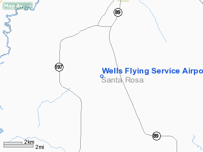
Wells Flying Service Airport |
Location
& QuickFacts
|
FAA Information Effective: |
2007-01-18 |
|
Airport
Identifier: |
14FL |
|
Airport
Status: |
Operational |
|
Longitude/Latitude: |
087-10-39.8950W/30-51-55.6690N
-87.177749/30.865464 (Estimated) |
|
Elevation: |
240 ft / 73.15 m (Estimated) |
|
Land: |
0
acres |
|
From
nearest city: |
6 nautical miles SS of Jay, FL |
|
Location: |
Santa Rosa County, FL |
|
Magnetic Variation: |
01E (1985) |
Owner
& Manager
|
Ownership: |
Privately owned |
|
Owner: |
James B. Wells |
|
Address: |
Rt 2, Box 172
Jay, FL 32565 |
|
Phone number: |
904-675-4334 |
|
Manager: |
James B. Wells |
|
Address: |
Rt 2, Box 172
Jay, FL 32565 |
|
Phone number: |
904-675-4334 |
Airport
Operations and Facilities
|
Airport Use: |
Private |
|
Wind indicator: |
Yes |
|
Segmented Circle: |
No |
|
Control Tower: |
No |
|
Landing fee charge: |
No |
|
Sectional chart: |
New Orleans |
|
Region: |
ASO - Southern |
|
Boundary ARTCC: |
ZJX - Jacksonville |
|
Tie-in FSS: |
GNV - Gainesville |
|
FSS on Airport: |
No |
|
FSS Phone: |
850-377-3291 |
|
FSS Toll Free: |
1-800-WX-BRIEF |
Airport
Services
|
Runway Information
Runway 09/27
|
Dimension: |
2000 x 60 ft / 609.6 x 18.3 m |
|
Surface: |
TURF, |
|
|
Runway 09 |
Runway 27 |
|
Traffic
Pattern: |
Right |
Left |
|
Radio Navigation
Aids
|
ID |
Type |
Name |
Ch |
Freq |
Var |
Dist |
|
PKZ |
NDB |
Pickens |
|
326.00 |
01E |
25.8 nm |
|
ESU |
NDB |
Summerdale |
|
204.00 |
01E |
35.9 nm |
|
DTS |
NDB |
Destin |
|
254.00 |
01W |
45.7 nm |
|
JUY |
NDB |
Judd |
|
264.00 |
02W |
48.4 nm |
|
NSE |
TACAN |
Whiting |
070X |
|
01E |
11.8 nm |
|
NGS |
TACAN |
Santa Rosa |
063X |
|
01E |
19.5 nm |
|
NPA |
TACAN |
Pensacola |
119X |
|
01E |
31.3 nm |
|
HRT |
TACAN |
Hurlburt |
045X |
|
00E |
36.4 nm |
|
DWG |
TACAN |
Warrington |
002X |
|
00E |
41.2 nm |
|
NUN |
VOR |
Saufley |
|
108.80 |
01E |
25.0 nm |
|
UIA |
VOR |
Andalusia |
|
110.20 |
00E |
48.5 nm |
|
CEW |
VORTAC |
Crestview |
106X |
115.90 |
03E |
25.8 nm |
|
MVC |
VORTAC |
Monroeville |
115X |
116.80 |
04E |
36.9 nm |
|
BFM |
VORTAC |
Brookley |
075X |
112.80 |
04E |
47.8 nm |
Remarks
- VFR;
PVT USE. TFC PATS ESTABD SOUTH SIDE RWY CNTRLN; OPNL AGREEMENT MAINTAINED
WITH OPERATOR OF PINE LEVEL ARPT.
Based
Aircraft
|
Aircraft
based on field: |
1 |
|
Single
Engine Airplanes: |
1 |
Wells Flying Service Airport
Address:
Santa Rosa County, FL
Tel:
904-675-4334
Images
and information placed above are from
http://www.airport-data.com/airport/14FL/
We
thank them for the data!
| General
Info |
| Country |
United
States |
| State |
FLORIDA
|
| FAA ID |
14FL
|
| Latitude |
30-51-55.669N
|
| Longitude |
087-10-39.895W
|
| Elevation |
240 feet
|
| Near City |
JAY
|
We don't guarantee the information is fresh and accurate. The data may
be wrong or outdated.
For more up-to-date information please refer to other sources.
|
|


