|
|
Vero Beach Municipal Airport |
Coordinates: 27°39′20″N 080°25′04.60″W / 27.65556°N 80.417944°W / 27.65556; -80.417944
| Vero Beach Municipal Airport |
| IATA: VRB – ICAO: KVRB – FAA LID: VRB |
| Summary |
| Airport type |
Public use |
| Owner |
City of Vero Beach |
| Operator |
Eric Menger |
| Serves |
Vero Beach, Florida |
| Location |
Indian River County, Florida |
| Elevation AMSL |
24 ft / 7 m |
| Website |
Vero Beach Municipal Airport |
| Runways |
| Direction |
Length |
Surface |
| ft |
m |
| 4/22 |
4,975 |
1,516 |
Asphalt |
| 11L/29R |
3,504 |
1,068 |
Asphalt |
| 11R/29L |
7,414 |
2,260 |
Asphalt |
| Statistics (2008) |
| Aircraft operations |
164,665 |
| Based aircraft |
224 |
| Source: Federal Aviation Administration |
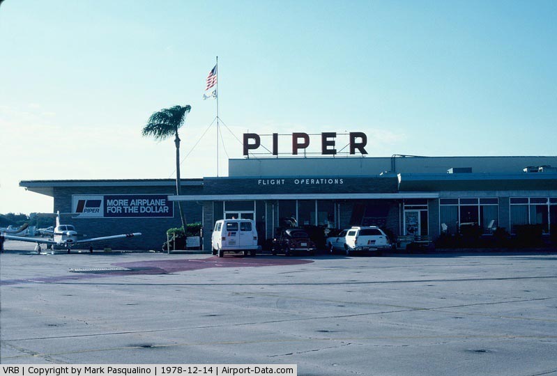
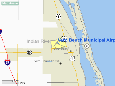
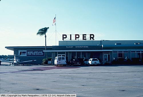
Vero Beach Municipal Airport (IATA: VRB, ICAO: KVRB, FAA LID: VRB) is a public-use airport located 1 mile (1.6 km) northwest of the central business district of the city of Vero Beach in Indian River County, Florida, United States. The airport is publicly owned. Vero Beach Municipal Airport also is the home of Piper Aircraft.
History
Vero Beach Municipal Airport was dedicated in 1930 and commercial airline service began in 1932 when Eastern Air Lines (EAL) began using the airfield for refueling stops. In 1935, EAL instituted passenger and mail service from Vero Beach. AirportBy the end of the decade, war clouds were gathering and some far sighted local citizens initiated further development of the airport facility by installing permanent runway lights and adding radio and teletype machines. In 1939, using Public Assistance workers, the runways were extended and one year later the Civil Aviation Administration (CAA) spent an additional $250,000 on additional improvements. With the beginning of the 1940s, the airport would become a major player as the U.S. became involved in World War II.
In the early 1940s, the focus was on war. In 1942, the U.S. Navy notified Vero Beach officials that it had selected their municipal airport as the site for a naval air station and purchased an additional 1,500 acres surrounding Vero Beach Airport. The base was formally commissioned as Naval Air Station Vero Beach in 1942 and pilot training began at NAS Vero Beach in February 1943. At the peak of its activity, NAS Vero Beach was home to 1,400 U.S. Navy and U.S. Marine Corps servicemen and 250 aircraft. After the war ended, NAS Vero Beach was reduced to a skeletal staff, and in 1947 the Navy closed NAS Vero Beach and returned the airport to the city.
In 1948, major league baseball came to Vero Beach as Bud Holman, a local businessman, invited the Brooklyn Dodgers to take over former barracks facilities from the closed naval air station as a winter and spring training facility. The Dodgers liked the area so much that Dodgertown was born, a 109 acre tract adjacent to the airport, as their winter and spring training grounds. The Dodgers continued to use the facility even after they moved to California and became the Los Angeles Dodgers. This facility remained in operation until 2008, when the Dodgers moved to a new spring training facility in Glendale, Arizona.
In 1957, Piper Aircraft selected Vero Beach for their research and development center, which was also built on part of the grounds of the former naval air station. In 1961, Piper moved its administrative and manufacturing operations here after completing building additions. By 1967, Piper had expanded its facility to eleven acres and its work force to over 2,000 employees. Manufacturing of Piper Aircraft at the Vero Beach facility ceased in the mid-1980s when, together with other sellers of light aircraft in the USA, as increasing product liability insurance premiums made continued operation financially impossible. Upon limitation of liability provided by new legislation by the U.S. Congress in the early 1990s, manufacturing re-commenced in 1995.
FlightSafety Academy, a leading flight training school and an integral part of FlightSafety International, is also located at VRB. The facility's primary focus is on ab initio flight training for prospective U.S. and international commercial airline pilots who are not graduates of a military flight training program.
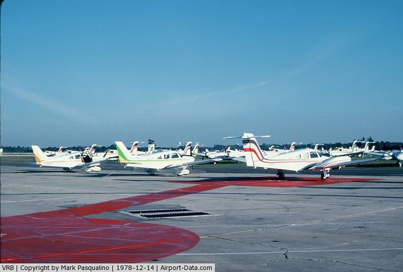
Today, VRB is a 1,707 acre tower-controlled facility with a full FAR Part 139 operating certificate. Although the airport has had commercial service, primarily regional service, in the recent past, it currently has no scheduled commercial airline service.
The above content comes from Wikipedia and is published under free licenses – click here to read more.
|
 |
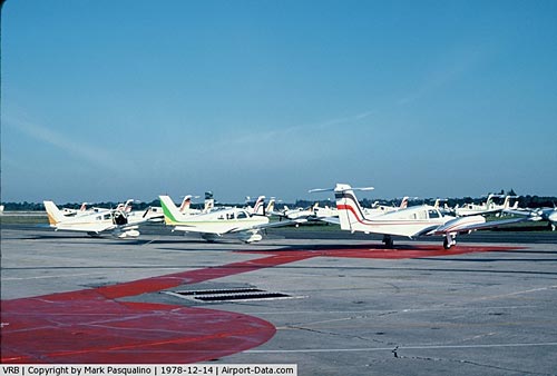
(Click on the photo to enlarge) |
|
 |
(Click on the photo to enlarge) |
Location
& QuickFacts
|
FAA Information Effective: |
2007-01-18 |
|
Airport
Identifier: |
VRB |
|
Airport
Status: |
Operational |
|
Longitude/Latitude: |
080-25-04.6000W/27-39-20.0000N
-80.417944/27.655556 (Estimated) |
|
Elevation: |
24
ft / 7.32 m (Surveyed) |
|
Land: |
1707 acres |
|
From
nearest city: |
1 nautical miles NW of Vero Beach, FL |
|
Location: |
Indian River County, FL |
|
Magnetic Variation: |
04W (1990) |
Owner
& Manager
|
Ownership: |
Publicly owned |
|
Owner: |
City Of Vero Beach |
|
Address: |
Po Box 1389
Vero Beach, FL 32960 |
|
Phone
number: |
772-978-5151 |
|
Manager: |
Mr. Eric Menger |
|
Address: |
Po Box 1389
Vero Beach, FL 32961-1389 |
|
Phone number: |
772-978-4930 |
Airport
Operations and Facilities
|
Airport Use: |
Open to public |
|
Wind
indicator: |
Yes |
|
Segmented
Circle: |
Yes |
|
Control
Tower: |
Yes |
|
Lighting
Schedule: |
DUSK-DAWN
ACTVT MIRL RY 11R/29L AND REIL RYS 11R & 29L - CTAF. |
|
Beacon
Color: |
Clear-Green (lighted land airport) |
|
Landing
fee charge: |
No |
|
Sectional
chart: |
Miami |
|
Region: |
ASO - Southern |
|
Boundary
ARTCC: |
ZMA - Miami |
|
Tie-in
FSS: |
PIE - Saint Petersburg |
|
FSS
Toll Free: |
1-800-WX-BRIEF |
|
NOTAMs
Facility: |
VRB (NOTAM-d service avaliable) |
|
Certification
type/date: |
I A U 11/1974
CLSD TO ACR OPNS WITH MORE THAN 30 PSGR SEATS EXCP 24 HR
PPR CALL AMGR (772) 978-4930. |
|
Federal Agreements: |
NGPRY3 |
Airport
Communications
|
CTAF: |
126.300 |
|
Unicom: |
122.950 |
Airport
Services
|
Fuel available: |
100
A |
|
Airframe Repair: |
MAJOR |
|
Power Plant Repair: |
MAJOR |
|
Bottled
Oxygen: |
HIGH/LOW |
|
Bulk
Oxygen: |
NONE |
|
Runway Information
Runway 04/22
|
Dimension: |
4975 x 100 ft / 1516.4 x 30.5 m |
|
Surface: |
ASPH, Good Condition |
|
Surface
Treatment: |
Saw-cut or plastic Grooved |
|
Weight
Limit: |
Single wheel: 30000 lbs.
Dual wheel: 115000 lbs.
Dual
tandem wheel: 220000 lbs. |
|
Edge
Lights: |
Medium |
|
|
Runway 04 |
Runway 22 |
|
Longitude: |
080-25-35.9730W |
080-25-03.3150W |
|
Latitude: |
27-38-58.7790N |
27-39-38.5260N |
|
Elevation: |
23.00 ft |
20.00 ft |
|
Alignment: |
36 |
127 |
|
Traffic
Pattern: |
Left |
Left |
|
Markings: |
Basic, Good Condition |
Basic, Good Condition |
|
Crossing
Height: |
45.00
ft |
42.00
ft |
|
VASI: |
4-box on left side |
4-light PAPI on left side |
|
Visual
Glide Angle: |
3.00� |
3.00� |
|
Runway
End Identifier: |
Yes |
Yes |
|
Obstruction: |
33 ft trees, 1200.0 ft from runway, 150 ft
right of centerline, 30:1 slope to clear |
48 ft trees, 1300.0 ft from runway, 250 ft
left of centerline, 23:1 slope to clear |
|
Runway 11L/29R
|
Dimension: |
3504 x 75 ft / 1068.0 x 22.9 m |
|
Surface: |
ASPH, Good Condition |
|
Weight
Limit: |
Single wheel: 12500 lbs. |
|
Edge
Lights: |
Medium |
|
|
Runway 11L |
Runway 29R |
|
Longitude: |
080-25-00.8360W |
080-24-24.4280W |
|
Latitude: |
27-39-37.3820N |
27-39-25.0180N |
|
Elevation: |
20.00 ft |
19.00 ft |
|
Alignment: |
111 |
127 |
|
Traffic
Pattern: |
Left |
Left |
|
Markings: |
Basic, Good Condition |
Basic, Good Condition |
|
Crossing
Height: |
37.00
ft |
35.00
ft |
|
VASI: |
2-light PAPI on left side |
2-light PAPI on left side |
|
Visual
Glide Angle: |
3.00� |
3.50� |
|
Obstruction: |
59 ft tree, 2000.0 ft from runway, 30:1 slope
to clear |
33 ft poles, 1300.0 ft from runway, 150 ft
right of centerline, 33:1 slope to clear |
|
Runway 11R/29L
|
Dimension: |
7314 x 100 ft / 2229.3 x 30.5 m |
|
Surface: |
ASPH, Good Condition |
|
Surface
Treatment: |
Saw-cut or plastic Grooved |
|
Weight
Limit: |
Single wheel: 85000 lbs.
Dual wheel: 115000 lbs.
Dual
tandem wheel: 220000 lbs. |
|
Edge
Lights: |
Medium |
|
|
Runway 11R |
Runway 29L |
|
Longitude: |
080-25-43.0270W |
080-24-26.9030W |
|
Latitude: |
27-39-28.3020N |
27-39-02.8030N |
|
Elevation: |
23.00 ft |
20.00 ft |
|
Alignment: |
111 |
127 |
|
Traffic
Pattern: |
Left |
Right |
|
Markings: |
Precision instrument, Good Condition |
Non-precision instrument, Good Condition |
|
Crossing
Height: |
41.00
ft |
58.00
ft |
|
VASI: |
4-light PAPI on left side |
4-light PAPI on left side |
|
Visual
Glide Angle: |
3.00� |
0.00� |
|
Runway
End Identifier: |
Yes |
Yes |
|
Obstruction: |
41 ft trees, 1800.0 ft from runway, 39:1 slope
to clear |
, 50:1 slope to clear |
|
Radio Navigation
Aids
|
ID |
Type |
Name |
Ch |
Freq |
Var |
Dist |
|
VEP |
NDB |
Vero Beach |
|
392.00 |
04W |
0.5 nm |
|
FPR |
NDB |
Fort Pierce |
|
275.00 |
04W |
10.4 nm |
|
SQT |
NDB |
Satellite |
|
257.00 |
03W |
30.6 nm |
|
COI |
NDB |
Merritt Island |
|
247.00 |
05W |
43.6 nm |
|
UTX |
NDB |
United |
|
405.00 |
03W |
45.1 nm |
|
COF |
TACAN |
Patrick |
097X |
|
04W |
36.5 nm |
|
MLB |
VOR/DME |
Melbourne |
037X |
110.00 |
02W |
29.4 nm |
|
VRB |
VORTAC |
Vero Beach |
120X |
117.30 |
04W |
4.1 nm |
|
VRB |
VOT |
Vero Beach |
|
111.00 |
|
0.1 nm |
Remarks
- EXTENSIVE
FLIGHT TRNG.
- NOISE
SENSITIVE ARPT; JET ACFT USE NATIONAL BUSINESS ACFT ASSOCIATION NOISE
ABATEMENT PROCEDURES.
- NO
TGL OPNS 2200-0700 EXCPT PPR.
- VOLUNTARY
LOCAL NOISE ABATEMENT PROCEDURES IN EFFECT, CALL 772-978-4930.
- NO
INTERSECTION DEPARTURES EXCEPT BY ATC REQUEST.
Based
Aircraft
|
Aircraft
based on field: |
243 |
|
Single
Engine Airplanes: |
153 |
|
Multi
Engine Airplanes: |
84 |
|
Jet Engine
Airplanes: |
4 |
|
Helicopters: |
2 |
Operational Statistics
Time Period: 2005-03-29
- 2006-03-28
|
Aircraft
Operations: |
402/Day |
|
Air Taxi: |
2.7% |
|
General
Aviation Local: |
42.7% |
|
General
Aviation Itinerant: |
54.5% |
|
Military: |
0.1% |
Vero Beach Municipal Airport
Address:
Indian River County, FL
Tel:
772-978-5151,
772-978-4930
Images
and information placed above are from
http://www.airport-data.com/airport/VRB/
We
thank them for the data!
| General
Info |
| Country |
United
States |
| State |
FLORIDA
|
| FAA ID |
VRB
|
| Latitude |
27-39-20.000N
|
| Longitude |
080-25-04.600W
|
| Elevation |
24 feet
|
| Near City |
VERO BEACH
|
We don't guarantee the information is fresh and accurate. The data may
be wrong or outdated.
For more up-to-date information please refer to other sources.
|
|