 |
|
Coordinates: 27°57′39.1″N 080°33′30.0″W / 27.960861°N 80.55833°W / 27.960861; -80.55833
| Valkaria Airport |
| IATA: none – ICAO: none – FAA LID: X59 |
| Summary |
| Airport type |
Public use |
| Owner |
Brevard County |
| Operator |
Steve Borowski |
| Serves |
Grant-Valkaria, Florida |
| Location |
Brevard County, Florida |
| Elevation AMSL |
26 ft / 8 m |
| Runways |
| Direction |
Length |
Surface |
| ft |
m |
| 09/27 |
4,000 |
1,219 |
Asphalt |
| 14/32 |
4,000 |
1,219 |
Asphalt |
| Statistics (2001) |
| Aircraft operations |
14,404 |
| Based aircraft |
49 |
| Source: Federal Aviation Administration |
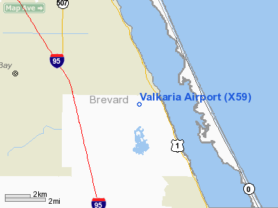
Valkaria Airport (FAA LID: X59) is a public-use airport located 1 mile (1.6 km) west of the central business district of the city of Grant-Valkaria in Brevard County, Florida, United States. The airport is publicly owned.
The airport was originally constructed by the U.S. Navy during World War II as Outlying Field Valkaria (OLF Valkaria), an auxiliary airfield to Naval Air Station Melbourne, now Melbourne International Airport. OLF Valkaria was closed in late 1945 and did not reopen for flight operations until 1959. During the 1950s, 60s and 70s, the site was used as a Missile Trajectory Measurement (MISTRAM) station by the U.S. Air Force and NASA in support of launch operations at Cape Canaveral AFS and Kennedy Space Center.
In 1959, the United States Department of Defense and the General Services Administration conveyed that part of the Valkaria facility not dedicated to MISTRAM to the county government of Brevard County, Florida for use as a public airport.
The above content comes from Wikipedia and is published under free licenses – click here to read more.
Location
& QuickFacts
|
FAA Information Effective: |
2007-01-18 |
|
Airport
Identifier: |
X59 |
|
Airport
Status: |
Operational |
|
Longitude/Latitude: |
080-33-35.1920W/27-57-43.0730N
-80.559776/27.961965 (Estimated) |
|
Elevation: |
26
ft / 7.92 m (Surveyed) |
|
Land: |
630 acres |
|
From
nearest city: |
1 nautical miles W of Valkaria, FL |
|
Location: |
Brevard County, FL |
|
Magnetic Variation: |
03W (1985) |
Owner
& Manager
|
Ownership: |
Publicly owned |
|
Owner: |
Brevard County |
|
Address: |
2725 Judge Fran Jamieson Way
Melbourne, FL 32940 |
|
Phone number: |
407-633-2010 |
|
Manager: |
Jim Shimkus |
|
Address: |
2865 Greenbrooke Street
Valkaria, FL 32950 |
|
Phone number: |
407-952-4590 |
Airport
Operations and Facilities
|
Airport Use: |
Open to public |
|
Wind
indicator: |
Yes |
|
Segmented
Circle: |
No |
|
Control
Tower: |
No |
|
Landing
fee charge: |
No |
|
Sectional
chart: |
Miami |
|
Region: |
ASO - Southern |
|
Traffic
Pattern Alt: |
1000 ft |
|
Boundary
ARTCC: |
ZMA - Miami |
|
Responsible
ARTCC: |
ZJX - Jacksonville |
|
Tie-in
FSS: |
PIE - Saint Petersburg |
|
FSS
on Airport: |
No |
|
FSS
Toll Free: |
1-800-WX-BRIEF |
|
NOTAMs
Facility: |
PIE (NOTAM-d service avaliable) |
|
Federal Agreements: |
NPY |
Airport
Communications
|
CTAF: |
122.725 |
|
Unicom: |
122.725
AUTOMATED UNICOM. |
Airport
Services
|
Fuel available: |
100LL |
|
Bottled
Oxygen: |
NONE |
|
Bulk
Oxygen: |
NONE |
|
Runway Information
Runway 09/27
|
Dimension: |
4000 x 75 ft / 1219.2 x 22.9 m |
|
Surface: |
ASPH, Good Condition |
|
Weight
Limit: |
Single wheel: 12500 lbs. |
|
|
Runway 09 |
Runway 27 |
|
Traffic
Pattern: |
Left |
Left |
|
Markings: |
Basic, Good Condition |
Basic, Good Condition |
|
Displaced
threshold: |
327.00
ft |
450.00
ft |
|
Obstruction: |
30 ft trees, 672.0 ft from runway, 15:1 slope
to clear
RY 09 APCH RATIO 33:1 TO DSPLCD THLD. |
28 ft trees, 340.0 ft from runway, 5:1 slope
to clear
RY 27 APCH RATIO 20:1 TO DSPLCD THLD. |
|
Runway 14/32
|
Dimension: |
4000 x 75 ft / 1219.2 x 22.9 m |
|
Surface: |
ASPH, Good Condition |
|
Weight
Limit: |
Single wheel: 12500 lbs. |
|
|
Runway 14 |
Runway 32 |
|
Traffic
Pattern: |
Left |
Left |
|
Markings: |
Basic, Fair Condition |
Basic, Fair Condition |
|
Displaced
threshold: |
390.00
ft |
0.00 ft |
|
Obstruction: |
32 ft trees, 445.0 ft from runway, 7:1 slope
to clear
RY 14 APCH RATIO 28:1 TO DSPLCD THLD. |
38 ft trees, 1160.0 ft from runway, 25:1 slope
to clear |
|
Radio Navigation
Aids
|
ID |
Type |
Name |
Ch |
Freq |
Var |
Dist |
|
SQT |
NDB |
Satellite |
|
257.00 |
03W |
11.1 nm |
|
VEP |
NDB |
Vero Beach |
|
392.00 |
04W |
19.4 nm |
|
COI |
NDB |
Merritt Island |
|
247.00 |
05W |
23.8 nm |
|
FPR |
NDB |
Fort Pierce |
|
275.00 |
04W |
30.2 nm |
|
GGL |
NDB |
Geiger Lake |
|
375.00 |
05W |
40.3 nm |
|
COF |
TACAN |
Patrick |
097X |
|
04W |
16.8 nm |
|
TTS |
TACAN |
Kennedy Space Center |
059Y |
|
00E |
40.6 nm |
|
MLB |
VOR/DME |
Melbourne |
037X |
110.00 |
02W |
9.5 nm |
|
VRB |
VORTAC |
Vero Beach |
120X |
117.30 |
04W |
17.4 nm |
|
VRB |
VOT |
Vero Beach |
|
111.00 |
|
20.0 nm |
Remarks
- NOISE
ABATEMENT PROCEDURES IN EFFECT. CTC AMGR 321-952-4590. RY 09 DEPS &
RY 27 APCHS AVOID OVERFLIGHT OF HOUSES IMMEDIATELY EAST OF ARPT.
- PPR
FOR OVERNIGHT PARKING CALL 321-952-4590.
- NO
TOUCH AND GO LDGS ON RY 14/32 1800-0800.
- DAYLIGHT
OPNS ONLY.
- RY
14/32 IS PREFERRED RY.
- NO
TOUCH & GO LNDGS OR STOP & GO LNDGS ON RY 09/27.
- EXISTED
PRIOR TO 1959.
Based Aircraft
|
Aircraft
based on field: |
42 |
|
Single
Engine Airplanes: |
37 |
|
Helicopters: |
1 |
|
Ultralights: |
4 |
Operational Statistics
Time Period: 2000-11-07
- 2001-11-06
|
Aircraft
Operations: |
277/Week |
|
General
Aviation Local: |
20.8% |
|
General
Aviation Itinerant: |
79.2% |
Valkaria Airport
Address:
Brevard County, FL
Tel:
407-633-2010, 407-952-4590
Images
and information placed above are from
http://www.airport-data.com/airport/X59/
We
thank them for the data!
| General
Info |
| Country |
United
States |
| State |
FLORIDA
|
| FAA ID |
X59
|
| Latitude |
27-57-43.073N
|
| Longitude |
080-33-35.192W
|
| Elevation |
26 feet
|
| Near City |
VALKARIA
|
We don't guarantee the information is fresh and accurate. The data may
be wrong or outdated.
For more up-to-date information please refer to other sources.
|
|


