 |
|
Tallahassee Commercial Airport |
| Tallahassee Commercial Airport |
| IATA: none – ICAO: none – FAA LID: 68J |
| Summary |
| Airport type |
Privately owned / Public use |
| Owner |
J. W. Hinson, Jr. |
| Location |
Tallahassee, Florida |
| Elevation AMSL |
155 ft / 47 m |
| Coordinates |
30°32′50″N 84°22′26″W / 30.54722°N 84.37389°W / 30.54722; -84.37389 |
| Runways |
| Direction |
Length |
Surface |
| ft |
m |
| 16/34 |
3,249 |
990 |
Asphalt |
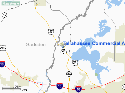
Tallahassee Commercial Airport (FAA LID: 68J) is a privately owned airport open to the public located 8 miles (13 km) northwest of the central business district (CBD) of Tallahassee, the county seat of Leon County, Florida, United States.
Facilities
Tallahassee Commercial Airport covers 184 acres (74 ha) and has one runway:
- Runway 16/34: 3,249 x 50 ft. (990 x 15 m), Surface: Asphalt
- The runway is described as being in poor condition, with surface cracking
- The first 50 feet of Runway 16 are closed indefinitely
The above content comes from Wikipedia and is published under free licenses – click here to read more.
Location
& QuickFacts
|
FAA Information Effective: |
2007-01-18 |
|
Airport
Identifier: |
68J |
|
Airport
Status: |
Operational |
|
Longitude/Latitude: |
084-22-25.8000W/30-32-50.3000N
-84.373833/30.547306 (Estimated) |
|
Elevation: |
155 ft / 47.24 m (Surveyed) |
|
Land: |
283 acres |
|
From
nearest city: |
8 nautical miles NW of Tallahassee /havana/,
FL |
|
Location: |
Leon County, FL |
|
Magnetic Variation: |
01W (1985) |
Owner
& Manager
|
Ownership: |
Privately owned |
|
Owner: |
J. W. Hinson, Jr. |
|
Address: |
6601 N. Monroe St
Tallahassee, FL 32303 |
|
Phone
number: |
850-562-1945 |
|
Manager: |
Johnnie H Stephens |
|
Address: |
6601 N. Monroe St
Tallahassee, FL 32303 |
|
Phone number: |
850-562-1945 |
Airport
Operations and Facilities
|
Airport Use: |
Open to public |
|
Wind
indicator: |
Yes |
|
Segmented
Circle: |
Yes |
|
Control
Tower: |
No |
|
Lighting
Schedule: |
DUSK-DAWN |
|
Beacon
Color: |
Clear-Green (lighted land airport) |
|
Landing
fee charge: |
No |
|
Sectional
chart: |
Jacksonville |
|
Region: |
ASO - Southern |
|
Boundary
ARTCC: |
ZJX - Jacksonville |
|
Tie-in
FSS: |
GNV - Gainesville |
|
FSS
on Airport: |
No |
|
FSS
Phone: |
850-377-3291 |
|
FSS
Toll Free: |
1-800-WX-BRIEF |
|
NOTAMs
Facility: |
GNV (NOTAM-d service avaliable) |
Airport
Communications
|
CTAF: |
122.800 |
|
Unicom: |
122.800 |
Airport
Services
|
Fuel available: |
100LLA |
|
Bottled
Oxygen: |
NONE |
|
Bulk
Oxygen: |
NONE |
|
Runway Information
Runway 16/34
|
Dimension: |
3249 x 50 ft / 990.3 x 15.2 m |
|
Surface: |
ASPH, Poor Condition
SFC CRACKING. |
|
Weight
Limit: |
Single wheel: 12500 lbs. |
|
Edge
Lights: |
Non-standard lighting system
NON-FAA APPROVED LOW INTENSITY LIGHTS. |
|
|
Runway 16 |
Runway 34 |
|
Longitude: |
084-22-32.5360W |
084-22-19.0840W |
|
Latitude: |
30-33-05.3030N |
30-32-35.3330N |
|
Elevation: |
154.00
ft |
149.00
ft |
|
Alignment: |
127 |
127 |
|
Traffic
Pattern: |
Left |
Left |
|
Markings: |
Basic, Good Condition |
Basic, Good Condition |
|
Displaced
threshold: |
253.00
ft |
1189.00
ft |
|
Obstruction: |
82 ft trees, 1389.0 ft from runway, 14:1 slope
to clear
/34 - 50 FT TREES 150 FT EAST OF RY CNTRLN.
RY
16 APCH RATIO 20:1 AT DSPLCD THLD. |
48 ft trees, 500.0 ft from runway, 135 ft right
of centerline, 6:1 slope to clear
RY 34 APCH RATIO 26:1 TO DSPLCD THLD FROM 81 FT TREES 951
FT FROM EOR. |
|
Radio Navigation
Aids
|
ID |
Type |
Name |
Ch |
Freq |
Var |
Dist |
|
TL |
NDB |
Wakul |
|
379.00 |
01W |
13.3 nm |
|
CYR |
NDB |
Caidy |
|
338.00 |
01W |
23.3 nm |
|
LYZ |
NDB |
Willis |
|
359.00 |
01W |
26.8 nm |
|
GTP |
NDB |
Patten |
|
245.00 |
02W |
37.5 nm |
|
CXU |
NDB |
Camilla |
|
369.00 |
02W |
40.7 nm |
|
SMY |
NDB |
Soyya |
|
329.00 |
02W |
48.1 nm |
|
MGR |
VOR/DME |
Moultrie |
025X |
108.80 |
02W |
43.6 nm |
|
SZW |
VORTAC |
Seminole |
122X |
117.50 |
02E |
0.5 nm |
|
GEF |
VORTAC |
Greenville |
027X |
109.00 |
01E |
30.6 nm |
|
MAI |
VORTAC |
Marianna |
087X |
114.00 |
00E |
41.4 nm |
|
TLH |
VOT |
Tallahassee Muni |
|
111.00 |
|
8.9 nm |
Remarks
- RY
16 FIRST 250 FT CLSD INDEFLY.
Based
Aircraft
|
Aircraft
based on field: |
10 |
|
Single
Engine Airplanes: |
6 |
|
Multi
Engine Airplanes: |
3 |
|
Ultralights: |
1 |
Operational Statistics
Time Period: 2001-03-15
- 2002-03-14
|
Aircraft
Operations: |
51/Week |
|
General
Aviation Local: |
59.4% |
|
General
Aviation Itinerant: |
39.6% |
|
Military: |
1.0% |
Tallahassee Commercial Airport
Address:
Leon County, FL
Tel:
850-562-1945
Images
and information placed above are from
http://www.airport-data.com/airport/68J/
We
thank them for the data!
| General
Info |
| Country |
United
States |
| State |
FLORIDA
|
| FAA ID |
68J
|
| Latitude |
30-32-50.300N
|
| Longitude |
084-22-25.800W
|
| Elevation |
155 feet
|
| Near City |
TALLAHASSEE
/HAVANA/ |
We don't guarantee the information is fresh and accurate. The data may
be wrong or outdated.
For more up-to-date information please refer to other sources.
|
|


