 |
|
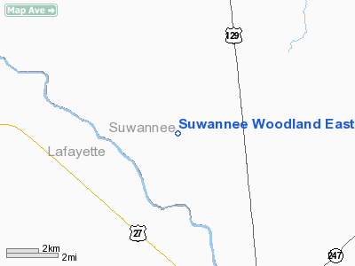
Suwannee Woodland East/west Airport |
Location
& QuickFacts
|
FAA Information Effective: |
2007-01-18 |
|
Airport
Identifier: |
FD71 |
|
Airport
Status: |
Operational |
|
Longitude/Latitude: |
082-59-02.0000W/30-02-54.0000N
-82.983889/30.048333 (Estimated) |
|
Elevation: |
55
ft / 16.76 m (Estimated) |
|
Land: |
25
acres |
|
From
nearest city: |
6 nautical miles NW of Branford, FL |
|
Location: |
Suwannee County, FL |
|
Magnetic Variation: |
02W (1985) |
Owner
& Manager
|
Ownership: |
Privately owned |
|
Owner: |
Suwannee Woodlands E/w Arpt Assn |
|
Address: |
412 Ne 16th Ave
Gainesville, FL 32602 |
|
Phone
number: |
904-334-1976 |
|
Manager: |
Lisa Davis |
|
Address: |
412 Ne 16th Ave
Gainesville, FL 32602 |
|
Phone number: |
904-334-1976 |
Airport
Operations and Facilities
|
Airport Use: |
Private |
|
Wind
indicator: |
Yes |
|
Segmented
Circle: |
No |
|
Control
Tower: |
No |
|
Sectional
chart: |
Jacksonville |
|
Region: |
ASO - Southern |
|
Boundary
ARTCC: |
ZJX - Jacksonville |
|
Tie-in
FSS: |
GNV - Gainesville |
|
FSS
on Airport: |
No |
|
FSS
Phone: |
850-377-3291 |
|
FSS
Toll Free: |
1-800-WX-BRIEF |
|
Runway Information
Runway 18/36
|
Dimension: |
2400 x 100 ft / 731.5 x 30.5 m |
|
Surface: |
TURF, Good Condition |
|
|
Runway 18 |
Runway 36 |
|
Traffic
Pattern: |
Left |
Left |
|
Radio Navigation
Aids
|
ID |
Type |
Name |
Ch |
Freq |
Var |
Dist |
|
LCQ |
NDB |
Lake City |
|
204.00 |
03W |
22.6 nm |
|
FPY |
NDB |
Foley |
|
254.00 |
03W |
31.5 nm |
|
GN |
NDB |
Wynds |
|
269.00 |
04W |
48.0 nm |
|
OTK |
VOR/DME |
Valdosta |
095X |
114.80 |
02W |
46.6 nm |
|
CTY |
VORTAC |
Cross City |
057X |
112.00 |
02W |
27.2 nm |
|
TAY |
VORTAC |
Taylor |
076X |
112.90 |
03W |
35.4 nm |
|
GNV |
VORTAC |
Gators |
109X |
116.20 |
04W |
42.8 nm |
Remarks
- CTN:LOW
FLYING MILITARY ACFT IN VICINITY OF ARPT.
- VFR,
PRIVATE USE ONLY.
Suwannee Woodland East/west Airport
Address:
Suwannee County, FL
Tel:
904-334-1976
Images
and information placed above are from
http://www.airport-data.com/airport/FD71/
We
thank them for the data!
| General
Info |
| Country |
United
States |
| State |
FLORIDA
|
| FAA ID |
FD71
|
| Latitude |
30-02-54.000N
|
| Longitude |
082-59-02.000W
|
| Elevation |
55 feet
|
| Near City |
BRANFORD
|
We don't guarantee the information is fresh and accurate. The data may
be wrong or outdated.
For more up-to-date information please refer to other sources.
|
|


