 |
|
|
|
|
|
Location
& QuickFacts
|
FAA Information Effective: |
2007-01-18 |
|
Airport
Identifier: |
3FL9 |
|
Airport
Status: |
Operational |
|
Longitude/Latitude: |
081-30-35.2700W/27-32-19.1200N
-81.509797/27.538644 (Estimated) |
|
Elevation: |
156 ft / 47.55 m (Estimated) |
|
Land: |
0
acres |
|
From
nearest city: |
6 nautical miles N of Sebring, FL |
|
Location: |
Highlands County, FL |
|
Magnetic Variation: |
04W (1995) |
Owner
& Manager
|
Ownership: |
Privately owned |
|
Owner: |
Adventist Health System
D/B/A FLORIDA HOSPITAL HEARTLAND DIVISION. |
|
Address: |
4200 Sun N Lake Blvd
Sebring, FL 33872 |
|
Phone
number: |
941-314-4469 |
|
Manager: |
John Negley
FLORIDA HOSPITAL HEARTLAND DIVISION. |
|
Address: |
4200 Sun N Lake Blvd
Sebring, FL 33872 |
|
Phone number: |
941-314-4469 |
Airport
Operations and Facilities
|
Airport Use: |
Private |
|
Wind
indicator: |
Yes |
|
Segmented
Circle: |
No |
|
Control
Tower: |
No |
|
Lighting
Schedule: |
PHONE REQ
FOR PERIMETER LGTS CALL 941-314-4469. |
|
Sectional
chart: |
Miami |
|
Region: |
ASO - Southern |
|
Boundary
ARTCC: |
ZMA - Miami |
|
Tie-in
FSS: |
PIE - Saint Petersburg |
|
FSS
Toll Free: |
1-800-WX-BRIEF |
|
Runway Information
Helipad H1
|
Dimension: |
65 x 65 ft / 19.8 x 19.8 m |
|
Surface: |
CONC, |
|
|
Runway H1 |
Runway |
|
Traffic
Pattern: |
Left |
Left |
|
Radio Navigation
Aids
|
ID |
Type |
Name |
Ch |
Freq |
Var |
Dist |
|
CHN |
NDB |
Wauchula |
|
261.00 |
04W |
20.0 nm |
|
PCM |
NDB |
Plant City |
|
346.00 |
02W |
44.3 nm |
|
ISM |
NDB |
Kissimmee |
|
329.00 |
05W |
45.3 nm |
|
PGD |
VOR |
Punta Gorda |
|
110.20 |
03W |
45.4 nm |
|
LAL |
VORTAC |
Lakeland |
107X |
116.00 |
01E |
38.0 nm |
|
LBV |
VORTAC |
La Belle |
041X |
110.40 |
01E |
43.2 nm |
Remarks
- PRVDD
VFR/PVT OPNS ONLY, APCH/DEP OPNS CONDUCTED FROM 050 CLKWS 190 USING
PAD AS CENTER, MKD PER FAA GUIDANCE, WIND INDICATOR MAINTAINED.
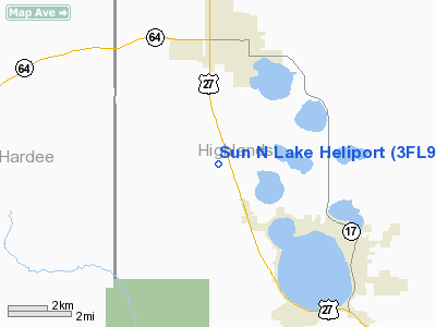
Sun N Lake Heliport
Address:
Highlands County, FL
Tel:
941-314-4469
Images
and information placed above are from
http://www.airport-data.com/airport/3FL9/
We
thank them for the data!
| General
Info |
| Country |
United
States |
| State |
FLORIDA
|
| FAA ID |
3FL9
|
| Latitude |
27-32-19.120N
|
| Longitude |
081-30-35.270W
|
| Elevation |
156 feet
|
| Near City |
SEBRING
|
We don't guarantee the information is fresh and accurate. The data may
be wrong or outdated.
For more up-to-date information please refer to other sources.
|
|


