 |
|
|
|
|
|
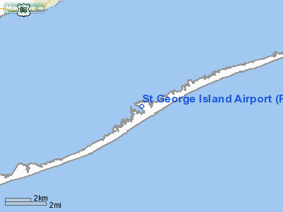
Location
& QuickFacts
|
FAA Information Effective: |
2007-01-18 |
|
Airport
Identifier: |
F47 |
|
Airport
Status: |
Operational |
|
Longitude/Latitude: |
084-54-59.6680W/29-38-45.7730N
-84.916574/29.646048 (Estimated) |
|
Elevation: |
3
ft / 0.91 m (Estimated) |
|
Land: |
0
acres |
|
From
nearest city: |
8 nautical miles SE of Apalachicola, FL |
|
Location: |
Franklin County, FL |
|
Magnetic Variation: |
01W (1985) |
Owner
& Manager
|
Ownership: |
Privately owned |
|
Owner: |
St George Plantation Owners |
|
Address: |
1712 Magnolia Rd
St George Island, FL 32328 |
|
Phone
number: |
850-927-2312 |
|
Manager: |
Thom Bartlett |
|
Address: |
1712 Magnolia Rd
St George Island, FL 32328 |
|
Phone number: |
850-927-2312 |
Airport
Operations and Facilities
|
Airport Use: |
Open to public |
|
Wind
indicator: |
Yes |
|
Segmented
Circle: |
No |
|
Control
Tower: |
No |
|
Landing
fee charge: |
Yes |
|
Sectional
chart: |
Jacksonville |
|
Region: |
ASO - Southern |
|
Boundary
ARTCC: |
ZJX - Jacksonville |
|
Tie-in
FSS: |
GNV - Gainesville |
|
FSS
Phone: |
850-377-3291 |
|
FSS
Toll Free: |
1-800-WX-BRIEF |
|
NOTAMs
Facility: |
GNV (NOTAM-d service avaliable) |
Airport
Communications
|
Runway Information
Runway 14/32
|
Dimension: |
3500 x 65 ft / 1066.8 x 19.8 m |
|
Surface: |
ASPH, Poor Condition
RY 14/32 HAS SEVERE SURFACE CRACKING. RY
CONDITION UNMONITORED. |
|
|
Runway 14 |
Runway 32 |
|
Traffic
Pattern: |
Left |
Left |
|
Markings: |
Basic, Good Condition |
Basic, Good Condition |
|
Displaced
threshold: |
0.00 ft |
65.00
ft |
|
Obstruction: |
, 50:1 slope to clear |
20 ft trees, 75 ft right of centerline
RY 32 APCH SLOPE 20:1 FROM DSPLCD THLD DUE TO 23 FT TREES,
395 FT FROM RY END ON BOTH SIDES.. |
|
Decleard
distances: |
Take off run available 3500.00 ft
Take off distance available 3500.00 ft
Actual stop distance available 3435.00 ft
Landing distance available 3435.00 ft
DAY USE ONLY.
DAY
USE ONLY.
DAY USE ONLY.
DAY USE ONLY. |
|
|
Radio Navigation
Aids
|
ID |
Type |
Name |
Ch |
Freq |
Var |
Dist |
|
AAF |
NDB |
Apalachicola |
|
349.00 |
02W |
7.4 nm |
|
PAM |
TACAN |
Tyndall |
124X |
|
00W |
42.8 nm |
Remarks
- GROUND
ACCESS BY PERMISSION ONLY.
- RY
14/32 HAS 20-30 FT TREES 75 FT FROM RY CNTRLN ON BOTH SIDES OF RY.
- 3
FT FENCE IN PRIMARY SURFACE 105 FT WEST OF A FIRST 300 OF RY 32.
- LARGE
BIRDS ON AND INVOF RY.
- VFR
USE ONLY.
Operational
Statistics
Time Period: 2001-06-29
- 2002-06-28
|
Aircraft
Operations: |
10/Week |
|
General
Aviation Itinerant: |
100.0% |
St George Island Airport
Address:
Franklin County, FL
Tel:
850-927-2312
Images
and information placed above are from
http://www.airport-data.com/airport/F47/
We
thank them for the data!
| General
Info |
| Country |
United
States |
| State |
FLORIDA
|
| FAA ID |
F47
|
| Latitude |
29-38-45.773N
|
| Longitude |
084-54-59.668W
|
| Elevation |
3 feet
|
| Near City |
APALACHICOLA
|
We don't guarantee the information is fresh and accurate. The data may
be wrong or outdated.
For more up-to-date information please refer to other sources.
|
|


