 |
|
Location
& QuickFacts
|
FAA Information Effective: |
2007-01-18 |
|
Airport
Identifier: |
39FA |
|
Airport
Status: |
Operational |
|
Longitude/Latitude: |
082-00-33.3450W/29-39-44.8840N
-82.009262/29.662468 (Estimated) |
|
Elevation: |
150 ft / 45.72 m (Estimated) |
|
Land: |
0
acres |
|
From
nearest city: |
4 nautical miles SE of Melrose, FL |
|
Location: |
Putnam County, FL |
|
Magnetic Variation: |
03W (1985) |
Owner
& Manager
|
Ownership: |
Privately owned |
|
Owner: |
Dr. D. A. Sanders Jr. |
|
Address: |
1611 Baden Powell Road
Hawthorne, FL 32640 |
|
Phone number: |
352-475-5298 |
|
Address: |
|
Airport
Operations and Facilities
|
Airport Use: |
Private |
|
Wind indicator: |
Yes |
|
Segmented Circle: |
No |
|
Control Tower: |
No |
|
Landing fee charge: |
No |
|
Sectional chart: |
Jacksonville |
|
Region: |
ASO - Southern |
|
Boundary ARTCC: |
ZJX - Jacksonville |
|
Tie-in FSS: |
GNV - Gainesville |
|
FSS on Airport: |
No |
|
FSS Phone: |
850-377-3291 |
|
FSS Toll Free: |
1-800-WX-BRIEF |
Airport
Communications
Airport
Services
|
Airframe Repair: |
NONE |
|
Power Plant Repair: |
NONE |
|
Bottled
Oxygen: |
NONE |
|
Bulk
Oxygen: |
NONE |
|
Runway Information
Runway 11/29
|
Dimension: |
3000 x 100 ft / 914.4 x 30.5 m |
|
Surface: |
TURF, |
|
|
Runway 11 |
Runway 29 |
|
Traffic
Pattern: |
Left |
Left |
|
Runway
End Identifier: |
No |
No |
|
Centerline
Lights: |
No |
No |
|
Touchdown
Lights: |
No |
No |
|
Obstruction: |
|
450 ft tower, 2640.0 ft from runway |
|
Radio Navigation
Aids
|
ID |
Type |
Name |
Ch |
Freq |
Var |
Dist |
|
GN |
NDB |
Wynds |
|
269.00 |
04W |
8.5 nm |
|
IAK |
NDB |
Palatka |
|
243.00 |
05W |
10.3 nm |
|
HEG |
NDB |
Herlong |
|
332.00 |
02W |
38.4 nm |
|
LCQ |
NDB |
Lake City |
|
204.00 |
03W |
43.2 nm |
|
JA |
NDB |
Dinns |
|
344.00 |
03W |
49.4 nm |
|
NZC |
TACAN |
Cecil/dcmsnd |
088X |
|
04W |
34.3 nm |
|
NIP |
TACAN |
Jacksonville |
19X |
|
04W |
38.6 nm |
|
VQQ |
VOR |
Cecil |
|
117.90 |
03W |
33.7 nm |
|
SGJ |
VOR/DME |
St Augustine |
031X |
109.40 |
06W |
39.6 nm |
|
GNV |
VORTAC |
Gators |
109X |
116.20 |
04W |
13.9 nm |
|
OCF |
VORTAC |
Ocala |
084X |
113.70 |
00E |
31.3 nm |
|
CRG |
VORTAC |
Craig |
092X |
114.50 |
03W |
48.3 nm |
Remarks
- E111
VFR; PERSONAL USE ONLY.
Based
Aircraft
|
Aircraft
based on field: |
2 |
|
Single
Engine Airplanes: |
2 |
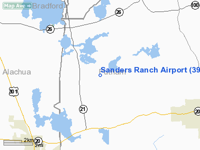
Sanders Ranch Airport
Address:
Putnam County, FL
Tel:
352-475-5298
Images
and information placed above are from
http://www.airport-data.com/airport/39FA/
We
thank them for the data!
| General
Info |
| Country |
United
States |
| State |
FLORIDA
|
| FAA ID |
39FA
|
| Latitude |
29-39-44.884N
|
| Longitude |
082-00-33.345W
|
| Elevation |
150 feet
|
| Near City |
MELROSE
|
We don't guarantee the information is fresh and accurate. The data may
be wrong or outdated.
For more up-to-date information please refer to other sources.
|
|


