Coordinates: 30°35′52.30″N 084°33′26.70″W / 30.597861°N 84.557417°W / 30.597861; -84.557417
| Quincy Municipal Airport |
| IATA: none – ICAO: none – FAA LID: 2J9 |
| Summary |
| Airport type |
Public use |
| Owner |
Quincy-Gadsden Airport Authority |
| Operator |
Quincy-Gadsden Airport Authority |
| Serves |
Quincy, Florida |
| Location |
Gadsden County, Florida |
| Elevation AMSL |
221 ft / 67 m |
| Runways |
| Direction |
Length |
Surface |
| ft |
m |
| 14/32 |
2,964 |
903 |
Asphalt |
| Statistics (1999) |
| Aircraft operations |
5,247 |
| Based aircraft |
59 |
| Source: Federal Aviation Administration |
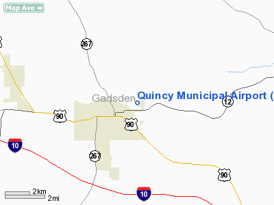
The Quincy Municipal Airport (FAA LID: 2J9) is a public-use airport located 2 miles (3.2 km) northeast of the central business district of the city of Quincy in Gadsden County, Florida, United States. The airport is publicly owned. The nearest airline service and jet fuel is 20 miles (32 km) away at Tallahassee Regional Airport (KTLH). The airport appears on the western edge of the Jacksonville VFR sectional. Runways and facilities
The Quincy Airport does have a single 2,964' X 75', paved, lighted runway. Runway 14/32 has low intensity edge lighting. Both ends of the runway have displaced thresholds for landing. Full length of the paved surface is available for takeoff in both directions. There are no paved taxiways.
Runway 14: Runway heading- 137 magnetic, 136 true Displaced threshold: approx 150 ft.
Runway 32: Runway heading- 317 magnetic, 316 true; Displaced threshold: 324 ft.
There is a lighted windsock and a rotating beacon near the FBO building on the east side of the runway. 100LL avgas is available at the FBO. Maintenance is available on the field. The turf area on the east side of/and parallel to the paved runway is an unofficial turf runway. This area is used by ultralights, gliders, skydivers, homebuilt aircraft, helicopters and occasionally regular aircraft during normal operations. There is a VOR approach off the Seminole (SZW) VOR near Tallahassee and a GPS approach.
For the last 14 years, the airport has been home to The School of Human Flight (also known as "Skydive Tallahassee") - the only USPA Member dropzone in the Florida panhandle. Extensive parachute operations take place at the airport, with several thousands jumps made annually.
Nearby radio and navigation aids
VOR radial/distance VOR name Freq Var
SZW r283/9.8 SEMINOLE VORTAC 117.50 02E
MAI r111/31.4 MARIANNA VORTAC 114.00 00E
CTAF/UNICOM: 122.7
TALLAHASSEE APPROACH/DEPARTURE: 128.7
WX ASOS at TLH (16 nm SE): PHONE 850-576-3665
APCH/DEP SERVICE PRVDD BY JAX ARTCC ON FREQS 135.325/343.8 (TALLAHASSEE RCAG) WHEN TALLAHASSEE APCH CTL CLSD.
The airport serves all of the normal functions of a small city airport but seems to specialize in recreational aviation. The sometimes high volume of sport aviation activities warrant vigilance when operating at or near the airport. For more information you can go to http://www.airnav.com/airport/2J9.
Airport governance
The airport is now an independently chartered entity which is run by the Quincy-Gadsden Airport Authority. The authority has five volunteer members, two appointed by the city, two by the county and one person who is jointly appointed by both.
The airports phone and mailing addresses are:
- QUINCY GADSDEN ARPT AUTH
- BOX 1905
- QUINCY, FL 32351
- Phone 850-875-4747 (disconnected?)
The above content comes from Wikipedia and is published under free licenses – click here to read more.
Location
& QuickFacts
|
FAA Information Effective: |
2007-01-18 |
|
Airport
Identifier: |
2J9 |
|
Airport
Status: |
Operational |
|
Longitude/Latitude: |
084-33-26.7000W/30-35-52.3000N
-84.557417/30.597861 (Estimated) |
|
Elevation: |
221 ft / 67.36 m (Surveyed) |
|
Land: |
212 acres |
|
From
nearest city: |
2 nautical miles NE of Quincy, FL |
|
Location: |
Gadsden County, FL |
|
Magnetic Variation: |
01W (1985) |
Owner
& Manager
|
Ownership: |
Publicly owned |
|
Owner: |
Quincy Gadsden Arpt Auth
GEORGE BURNETT, CHAIRMAN ARPT AUTHORITY. |
|
Address: |
Box 1905
Quincy, FL 32351 |
|
Phone number: |
850-875-4747 |
|
Manager: |
Quincy Gadsden Arpt Auth |
|
Address: |
Box 1905
Quincy, FL 32351 |
|
Phone number: |
850-875-4747 |
Airport
Operations and Facilities
|
Airport Use: |
Open to public |
|
Wind
indicator: |
Yes |
|
Segmented
Circle: |
No |
|
Control
Tower: |
No |
|
Lighting
Schedule: |
DUSK-DAWN |
|
Beacon
Color: |
Clear-Green (lighted land airport) |
|
Landing
fee charge: |
No |
|
Sectional
chart: |
Jacksonville |
|
Region: |
ASO - Southern |
|
Boundary
ARTCC: |
ZJX - Jacksonville |
|
Tie-in
FSS: |
GNV - Gainesville |
|
FSS
on Airport: |
No |
|
FSS
Phone: |
850-377-3291 |
|
FSS
Toll Free: |
1-800-WX-BRIEF |
|
NOTAMs
Facility: |
GNV (NOTAM-d service avaliable) |
|
Federal Agreements: |
N |
Airport
Communications
|
CTAF: |
122.700 |
|
Unicom: |
122.700 |
Airport
Services
|
Fuel available: |
100LL |
|
Airframe Repair: |
MAJOR |
|
Power Plant Repair: |
MAJOR |
|
Bottled
Oxygen: |
NONE |
|
Bulk
Oxygen: |
NONE |
|
Runway Information
Runway 14/32
|
Dimension: |
2964 x 75 ft / 903.4 x 22.9 m |
|
Surface: |
ASPH, Good Condition |
|
Weight
Limit: |
Single wheel: 20000 lbs. |
|
Edge
Lights: |
Low |
|
|
Runway 14 |
Runway 32 |
|
Longitude: |
084-33-38.6100W |
084-33-14.8500W |
|
Latitude: |
30-36-02.8000N |
30-35-41.8690N |
|
Elevation: |
221.00 ft |
203.00 ft |
|
Alignment: |
127 |
127 |
|
Traffic
Pattern: |
Right |
Left |
|
Markings: |
Basic, Good Condition |
Basic, Good Condition |
|
Displaced
threshold: |
266.00 ft |
324.00 ft |
|
Obstruction: |
51 ft trees, 1350.0 ft from runway, 20:1 slope
to clear
RY 14 APCH RATIO 31:1 FM TREES TO DSPLCD THLD. |
54 ft trees, 1005.0 ft from runway, 15:1 slope
to clear
RY 32 APCH RATIO 24:1 FROM TREES TO DSPLCD THR. |
|
Decleard
distances: |
Take off run available 2964.00 ft
Take off distance available 2964.00 ft
Actual stop distance available 2964.00 ft
Landing distance available 2700.00 ft |
Take off run available 2964.00 ft
Take off distance available 2964.00 ft
Actual stop distance available 2755.00 ft
Landing distance available 2431.00 ft |
|
Radio Navigation
Aids
|
ID |
Type |
Name |
Ch |
Freq |
Var |
Dist |
|
TL |
NDB |
Wakul |
|
379.00 |
01W |
19.3 nm |
|
LYZ |
NDB |
Willis |
|
359.00 |
01W |
22.6 nm |
|
CYR |
NDB |
Caidy |
|
338.00 |
01W |
27.0 nm |
|
SMY |
NDB |
Soyya |
|
329.00 |
02W |
38.2 nm |
|
CXU |
NDB |
Camilla |
|
369.00 |
02W |
40.6 nm |
|
GTP |
NDB |
Patten |
|
245.00 |
02W |
43.5 nm |
|
MGR |
VOR/DME |
Moultrie |
025X |
108.80 |
02W |
48.6 nm |
|
SZW |
VORTAC |
Seminole |
122X |
117.50 |
02E |
9.8 nm |
|
MAI |
VORTAC |
Marianna |
087X |
114.00 |
00E |
31.4 nm |
|
GEF |
VORTAC |
Greenville |
027X |
109.00 |
01E |
40.2 nm |
|
TLH |
VOT |
Tallahassee Muni |
|
111.00 |
|
15.8 nm |
Remarks
- EXTENSIVE
PARACHUTE JUMPING OPS ON ARPT.
- UNMARKED
TURF LNDG AREA ADJ RY 14/32 ALONG NE SIDE.
- EXISTED
PRIOR TO 1959.
Based Aircraft
|
Aircraft
based on field: |
59 |
|
Single
Engine Airplanes: |
47 |
|
Multi
Engine Airplanes: |
2 |
|
Gliders: |
3 |
|
Ultralights: |
7 |
Operational Statistics
Time Period: 1998-11-19
- 1999-11-18
|
Aircraft
Operations: |
120/Week |
|
General
Aviation Local: |
65.0% |
|
General
Aviation Itinerant: |
35.0% |
Quincy Municipal Airport
Address:
Gadsden County, FL
Tel:
850-875-4747
Images
and information placed above are from
http://www.airport-data.com/airport/2J9/
We
thank them for the data!
| General
Info |
| Country |
United
States |
| State |
FLORIDA
|
| FAA ID |
2J9
|
| Latitude |
30-35-52.300N
|
| Longitude |
084-33-26.700W
|
| Elevation |
221 feet
|
| Near City |
QUINCY
|
We don't guarantee the information is fresh and accurate. The data may
be wrong or outdated.
For more up-to-date information please refer to other sources.
|


