 |
|
Location
& QuickFacts
|
FAA Information Effective: |
2007-01-18 |
|
Airport
Identifier: |
52FD |
|
Airport
Status: |
Operational |
|
Longitude/Latitude: |
086-51-59.8550W/30-24-08.7160N
-86.866626/30.402421 (Estimated) |
|
Elevation: |
20 ft / 6.10 m (Estimated) |
|
Land: |
0 acres |
|
From
nearest city: |
0 nautical miles N of Navarre, FL |
|
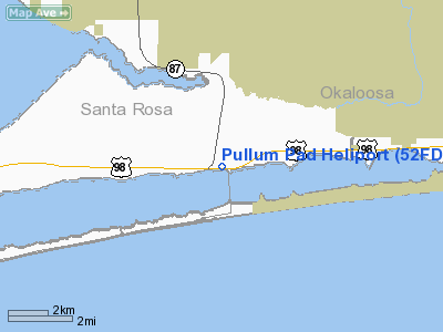
Location: |
Santa Rosa County, FL |
|
Magnetic Variation: |
00E (1990) |
Owner
& Manager
|
Ownership: |
Privately owned |
|
Owner: |
Helicopters Of Nw Florida Inc |
|
Address: |
P O Box 5041
Navarre, FL 32566 |
|
Manager: |
Bill Pullum |
|
Address: |
5144 Navarre Pkwy
Navarre, FL 32566 |
|
Phone number: |
904-939-2363 |
Airport
Operations and Facilities
|
Airport Use: |
Private |
|
Wind
indicator: |
Yes |
|
Segmented
Circle: |
No |
|
Control
Tower: |
No |
|
Sectional
chart: |
New Orleans |
|
Region: |
ASO - Southern |
|
Boundary
ARTCC: |
ZJX - Jacksonville |
|
Tie-in
FSS: |
GNV - Gainesville |
|
FSS
on Airport: |
No |
|
FSS
Phone: |
850-377-3291 |
|
FSS
Toll Free: |
1-800-WX-BRIEF |
|
Runway Information
Helipad H1
|
Dimension: |
20
x 20 ft / 6.1 x 6.1 m |
|
Surface: |
CONC, |
|
|
Runway H1 |
Runway |
|
Traffic
Pattern: |
Left |
Left |
|
Radio Navigation
Aids
|
ID |
Type |
Name |
Ch |
Freq |
Var |
Dist |
|
PKZ |
NDB |
Pickens |
|
326.00 |
01E |
16.3 nm |
|
DTS |
NDB |
Destin |
|
254.00 |
01W |
20.4 nm |
|
ESU |
NDB |
Summerdale |
|
204.00 |
01E |
44.9 nm |
|
HRT |
TACAN |
Hurlburt |
045X |
|
00E |
9.3 nm |
|
NGS |
TACAN |
Santa Rosa |
063X |
|
01E |
13.3 nm |
|
DWG |
TACAN |
Warrington |
002X |
|
00E |
18.5 nm |
|
NSE |
TACAN |
Whiting |
070X |
|
01E |
20.9 nm |
|
NPA |
TACAN |
Pensacola |
119X |
|
01E |
23.5 nm |
|
NUN |
VOR |
Saufley |
|
108.80 |
01E |
24.7 nm |
|
CEW |
VORTAC |
Crestview |
106X |
115.90 |
03E |
27.3 nm |
Remarks
- PVT
USE; VFR WX CONDS; ALL APCH OPNS CONDUCTED ON HEADING OF 180 AND ALL
DEPARTURES ON HEADING OF 360; AVOID OVERFLIGHT OF RESIDENTIAL AREA -
1 MILE NORTH; TKOF/LNDG AREA MKD; WIND INDICATOR MAINTD.
Based
Aircraft
|
Aircraft
based on field: |
1 |
|
Helicopters: |
1 |
Pullum Pad Heliport
Address:
Santa Rosa County, FL
Tel:
904-939-2363
Images
and information placed above are from
http://www.airport-data.com/airport/52FD/
We
thank them for the data!
| General
Info |
| Country |
United
States |
| State |
FLORIDA
|
| FAA ID |
52FD
|
| Latitude |
30-24-08.716N
|
| Longitude |
086-51-59.855W
|
| Elevation |
20 feet
|
| Near City |
NAVARRE
|
We don't guarantee the information is fresh and accurate. The data may
be wrong or outdated.
For more up-to-date information please refer to other sources.
|
|


