 |
|
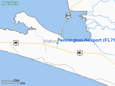
Location
& QuickFacts
|
FAA Information Effective: |
2007-01-18 |
|
Airport
Identifier: |
FL71 |
|
Airport
Status: |
Operational |
|
Longitude/Latitude: |
086-10-45.7900W/30-22-27.7100N
-86.179386/30.374364 (Estimated) |
|
Elevation: |
40 ft / 12.19 m (Estimated) |
|
Land: |
0 acres |
|
From
nearest city: |
25 nautical miles N of De Funiak Springs,
FL |
|
Location: |
Walton County, FL |
|
Magnetic Variation: |
02W (2000) |
Owner
& Manager
|
Ownership: |
Privately owned |
|
Owner: |
Walton County Sheriff's Office |
|
Address: |
72 North 6th Street
De Funiak Springs, FL 32433 |
|
Phone
number: |
850-892-8186 |
|
Manager: |
Capt. Gregory K. Gandy |
|
Address: |
25221 Hwy 331 South
Santa Rosa Beach, FL 32459 |
|
Phone number: |
850-267-2700 |
Airport
Operations and Facilities
|
Airport Use: |
Private |
|
Wind
indicator: |
Yes |
|
Segmented
Circle: |
No |
|
Control
Tower: |
No |
|
Sectional
chart: |
New Orleans |
|
Region: |
ASO - Southern |
|
Boundary
ARTCC: |
ZJX - Jacksonville |
|
Tie-in
FSS: |
GNV - Gainesville |
|
FSS
Phone: |
850-377-3291 |
|
FSS
Toll Free: |
1-800-WX-BRIEF |
|
Runway Information
Helipad H1
|
Dimension: |
100 x 100 ft / 30.5 x 30.5 m |
|
Surface: |
CONC, |
|
|
Runway H1 |
Runway |
|
Traffic
Pattern: |
Left |
Left |
|
Radio Navigation
Aids
|
ID |
Type |
Name |
Ch |
Freq |
Var |
Dist |
|
DTS |
NDB |
Destin |
|
254.00 |
01W |
15.4 nm |
|
BKK |
NDB |
Tri County |
|
275.00 |
02W |
41.4 nm |
|
DWG |
TACAN |
Warrington |
002X |
|
00E |
18.8 nm |
|
HRT |
TACAN |
Hurlburt |
045X |
|
00E |
26.7 nm |
|
PAM |
TACAN |
Tyndall |
124X |
|
00W |
36.3 nm |
|
NGS |
TACAN |
Santa Rosa |
063X |
|
01E |
41.8 nm |
|
NSE |
TACAN |
Whiting |
070X |
|
01E |
48.2 nm |
|
FYL |
VOR |
Tri County |
|
108.40 |
08W |
40.8 nm |
|
PFN |
VORTAC |
Panama City |
090X |
114.30 |
00W |
27.6 nm |
|
CEW |
VORTAC |
Crestview |
106X |
115.90 |
03E |
37.5 nm |
Remarks
- PRVDD
VFR OPNS, PVT USE, ALL APCH/DEP FROM 280 CLKWS TO 100 DEGS, AREA IS
MKD, WIND INDICATOR IS MAINTAINED.
Based Aircraft
|
Aircraft
based on field: |
3 |
|
Helicopters: |
3 |
Pennington Heliport
Address:
Walton County, FL
Tel:
850-892-8186,
850-267-2700
Images
and information placed above are from
http://www.airport-data.com/airport/FL71/
We
thank them for the data!
| General
Info |
| Country |
United
States |
| State |
FLORIDA
|
| FAA ID |
FL71
|
| Latitude |
30-22-27.710N
|
| Longitude |
086-10-45.790W
|
| Elevation |
40 feet
|
| Near City |
DE FUNIAK
SPRINGS |
We don't guarantee the information is fresh and accurate. The data may
be wrong or outdated.
For more up-to-date information please refer to other sources.
|
|


