|
 |
|
||||
|
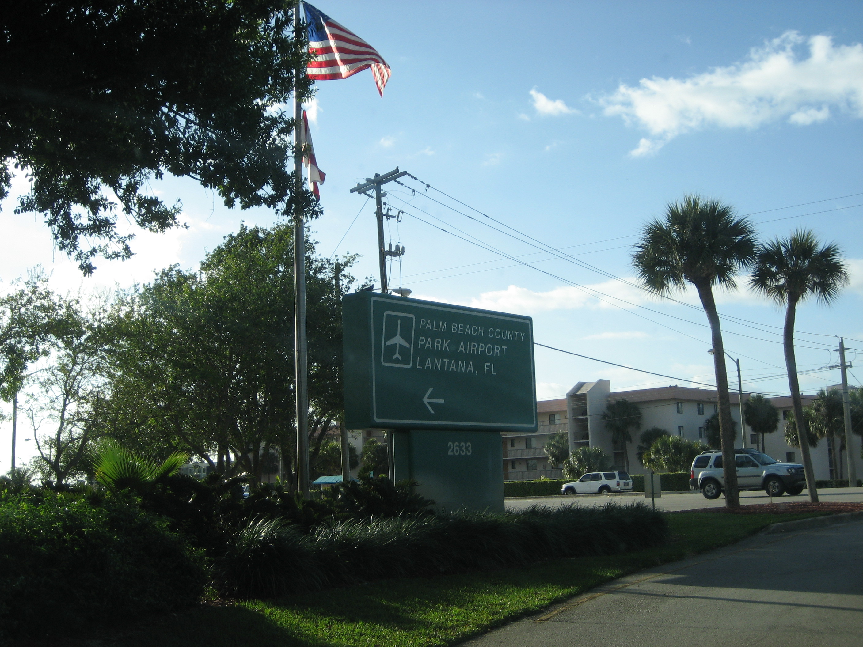
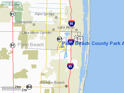
Palm Beach County Park Airport (IATA: LNA, ICAO: KLNA) is a general aviation airport located in Lantana, Florida, 6 miles south of West Palm Beach, Florida. It is also commonly referred to as the Lantana Airport. LNA has three runways laid out in a triangle. All three runways have an asphalt surface and a PAPI system. Runway 3/21 is 3256 feet (992 m) long and 75 feet (23 m) wide. Runway 15/33 is 3421 feet (1,043 m) long and 100 feet (30 m) wide. Runway 9/27 is 3489 feet (1,063 m) long and 75 feet (23 m) wide. It does not have a control tower. The maximum aircraft weight for Lantana is 12,500 pounds (5,670 kg) although the runways are rated for 30,000 pounds (13,600 kg) per wheel. Local ordinances also prohibit jet aircraft from using the field. The airfield is home to 380 aircraft:
Lantana averages 384 flight per day, 69% of which are local aviation. 31% are transient flights with the remainder being air taxi and military flights. The airport has one fixed base operator, Florida Airmotive, Inc. Two flight training schools are also located at the airport- Palm Beach Flight Training and Skywalker Aviation. The Palm Beach County Park Airport is owned by Palm Beach County and operated by the Palm Beach County Airport Department. The airport is on the west side of Lake Osborne. History1940sThe land the airport was to be built on was donated to Palm Beach County by philanthropic minded families under the condition that the land be dedicated to serving the public. Recognizing the growing presence of aircraft in Florida and realizing that the number of aircraft would soon overwhelm local fields, the county decided to build an airport on the land. Prior to the United States entry into World War II, the Office of Civilian Defense was responsible for preparing for threats to the United States. They determined that this location would be an ideal location for planes conducting off-shore patrols for Axis submarines that had been moving along the Florida coast. The U.S. government reached an agreement with the County whereby the county would dredge and prepare the land and the U.S. government would build the airfield. The airfield was built with a parallel taxiway and ample ramp space. The first plane to land on the field was on August 20, 1941. On December 1, 1941, the Civil Air Patrol was formed and Lantana was one of three airfields chosen to host a unit. In addition, the Army Air Forces Antisubmarine Command stationed the 17th Antisubmarine Squadron at the airport during the early months of the war. The 17th AS flew overflights of the Florida coast as well as over the Gulf of Mexico and the Florida Straits patrolling for U-boats until January 1943 when the unit moved to Key West. When the Army Air Forces left, the CAP unit was transferred from Morrison Field (later to become Palm Beach International Airport) to Lantana for the remainder of the War. 1950sThe Civil Air Patrol continued to use Lantana throughout the 1950s and the field served as the Group 5 Headquarters. A Search Unit for the United States Customs Service was also based at the field. Through World War II, the War Department had leased exclusive use of the field. Following the cessation of hostilities, the field transitioned to cvilian use. A flight school was opened at the field while the number of civilian flights grew to 115,000 per year. On one occasion over 20 DC-3s and 36 Beechcraft Model 18 aircraft were counted. 1960sThe 1960s saw a decline in usage at the airport from its heyday in the 50s. The county was reluctant to enter into long-term leases with fixed base operators and by 1964, only one remained at the airport. In the meantime, Palm Beach International was opened to all general aviation and Boca Raton Airport became operational, accepting aircraft that used to use Lantana. In early 1969, a VOR system was installed at the airport. 1970sWith an increasing number of executive jets using the airport from the late 60s into the 70s, local residents pushed the county into passing a noise ordinance banning jet aircraft from the airport. The airport was degrading with aging facilities in need of repair and upgrade. In an effort to remain competitive, the county applied for and received federal aid for ramp and infrastructure improvements, including landscaping. A VASI system was installed on runways 9/27 and 15/33 in 1973. 1980sThe airport was expanded in the 80s with the air right-of-way for runway 9 being contributed by aviation enthusiasts and the right-of-way for runway 27 obtained through court action. A roadblock to the airport being designated as a reliever airport was the volume of water supply to the airport. It was determined to be insufficient to meet Fire Department needs in the event of an air crash at the airport. Operations remained flat at the airport despite a 60% increase in tied-down aircraft. 1990sWith the improved facilities, a number of businesses moved into the airport. Two air-charter operations were based at the field and a glider company operated from the field from Thanksgiving through Memorial Day. The field was also the only field between Stuart and Fort Lauderdale to allow banner towing advertising business. The airport had functioned as a jump-off point for flights into the Caribbean, particularly The Bahamas, and the Turks and Caicos Islands. The increase of drug-trafficking curtailed Caribbean flights starting the mid-90s. The above content comes from Wikipedia and is published under free licenses – click here to read more.
Runway InformationRunway 03/21
Runway 09/27
Runway 15/33
Radio Navigation Aids
Remarks
Based Aircraft
Operational StatisticsTime Period: 2001-06-21 - 2002-06-20
Palm Beach County Park Airport Address: Palm Beach County, FL Tel: 561-471-7400 Images
and information placed above are from We thank them for the data!
We don't guarantee the information is fresh and accurate. The data may
be wrong or outdated.
|
||||||||||||||||||||||||||||||||||||||||||||||||||||||||||||||||||||||||||||||||||||||||||||||||||||||||||||||||||||||||||||||||||||||||||||||||||||||||||||||||||||||||||||||||||||||||||||||||||||||||||||||||||||||||||||||||||||||||||||||||||||||||||||||||||||||||||||||||||||||||||||||||||||||||||||||||||||||||||||||||||||||||||||||||||||||||||||||||||||||||||||||||||||||||||||||||||||||||||||||||||||

 |
|
Copyright 2004-2024 © by Airports-Worldwide.com, Vyshenskoho st. 36, Lviv 79010, Ukraine Legal Disclaimer |