 |
|
Palatka Municipal - Lieutenant Kay Larkin Field Airport |
Coordinates: 29°39′21.026″N 081°41′20.013″W / 29.65584056°N 81.6888925°W / 29.65584056; -81.6888925
| Palatka Municipal Airport |
| IATA: none – ICAO: none – FAA LID: 28J |
| Summary |
| Airport type |
Public use |
| Owner |
City of Palatka |
| Operator |
Glenn A. Ball |
| Serves |
Palatka, Florida |
| Location |
Putnam County, Florida |
| Elevation AMSL |
49 ft / 15 m |
| Website |
http://www.palatkakaylarkin.com/ |
| Runways |
| Direction |
Length |
Surface |
| ft |
m |
| 9/27 |
6,000 |
1,829 |
Asphalt |
| 12/30 |
3,000 |
914 |
Asphalt |
| 17/35 |
3,500 |
1,067 |
Asphalt |
| Statistics (1999) |
| Aircraft operations |
40,596 |
| Based aircraft |
77 |
| Source: Federal Aviation Administration |
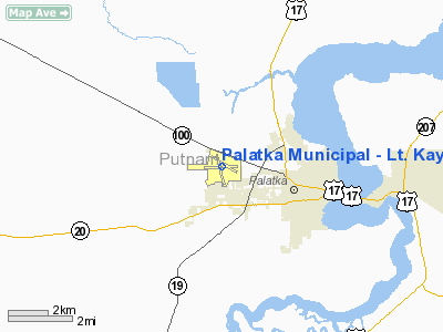
Palatka Municipal Airport (FAA LID: 28J), also known as Lieutenant Kay Larkin Field, is a public-use airport located 2 miles (3.2 km) northwest of the central business district of the city of Palatka in Putnam County, Florida, United States. The airport is publicly owned.
History
Palatka Municipal Airport was originally founded in 1938 with just 214 original acres. On June 1, 1942, the U.S. Navy, under a government lease, acquired the airport from the City of Palatka, and in 1943, acquired additional land in support of naval air training operations, primarily Navy and Marine Corps F4U Corsair fighter training, under the cognizance of the Naval Air Station Jacksonville complex to the north. On August 21, 1942, the airport was officially named Kay Larkin Field for 1st Lieutenant J. K. "Kay" Larkinm, a U.S. Army Air Forces instructor pilot and Palatka native killed during the Second World War. In 1946, the War Assets Administration turned the airport back over to the City of Palatka.
In the early 1960s, it appeared likely that commercial air service would be initiated in the Palatka area. To accommodate this service, a terminal building of approximately 1,400 square feet (130 m) was constructed and dedicated in January of 1963. In September of 1963, South Central Airlines started servicing Palatka and the Central Florida area and continued for approximately two years, discontinuing service in 1965. That terminal building remains in operation today, primarily in support of general aviation operations. Shortly following discontinuance of commercial air service, the City leased operation to outside fixed base operators (FBOs), but resumed complete operation in the early 1980s. In 2010, the city opened a new 4,000 sq ft (370 m). terminal building.
Palatka Municipal Airport currently consists of over 730 acres with three (3) active paved runways, the longest of which is 6,003 feet (1,830 m) in length.
The above content comes from Wikipedia and is published under free licenses – click here to read more.
Location
& QuickFacts
|
FAA Information Effective: |
2007-01-18 |
|
Airport
Identifier: |
28J |
|
Airport
Status: |
Operational |
|
Longitude/Latitude: |
081-41-20.0130W/29-39-31.0260N
-81.688892/29.658618 (Estimated) |
|
Elevation: |
49 ft / 14.94 m (Estimated) |
|
Land: |
640 acres |
|
From
nearest city: |
2 nautical miles NW of Palatka, FL |
|
Location: |
Putnam County, FL |
|
Magnetic Variation: |
05W (2000) |
Owner
& Manager
|
Ownership: |
Publicly owned |
|
Owner: |
City Of Palatka
CTC BOB STURM. |
|
Address: |
201 N. 2nd St
Palatka, FL 32177 |
|
Phone
number: |
386-329-0148 |
|
Manager: |
Allen R. Bush |
|
Address: |
201 N. 2nd St
Palatka, FL 32177 |
|
Phone number: |
386-329-0106 |
Airport
Operations and Facilities
|
Airport Use: |
Open to public |
|
Wind
indicator: |
Yes |
|
Segmented
Circle: |
Yes
WND CONE CIRCLED CONCRETE. |
|
Control
Tower: |
No |
|
Lighting
Schedule: |
DUSK-DAWN
ACTVT MIRL RYS 09/27 & 17/35 - CTAF.
PAPI
LIGHT OPERATE CONTINUOUSLY. |
|
Beacon
Color: |
Clear-Green (lighted land airport) |
|
Landing
fee charge: |
No |
|
Sectional
chart: |
Jacksonville |
|
Region: |
ASO - Southern |
|
Traffic
Pattern Alt: |
1000 ft |
|
Boundary
ARTCC: |
ZJX - Jacksonville |
|
Tie-in
FSS: |
GNV - Gainesville |
|
FSS
on Airport: |
No |
|
FSS
Phone: |
850-377-3291 |
|
FSS
Toll Free: |
1-800-WX-BRIEF |
|
NOTAMs
Facility: |
GNV (NOTAM-d service avaliable) |
|
Federal Agreements: |
NGRY3 |
Airport
Communications
|
CTAF: |
122.800 |
|
Unicom: |
122.800 |
Airport
Services
|
Fuel available: |
100LLA |
|
Airframe Repair: |
MAJOR |
|
Power Plant Repair: |
MINOR |
|
Bottled
Oxygen: |
NONE |
|
Bulk
Oxygen: |
NONE |
|
Runway Information
Runway 09/27
|
Dimension: |
6000 x 100 ft / 1828.8 x 30.5 m |
|
Surface: |
ASPH, Good Condition
GRASS GROWING THROUGH CRACKS. |
|
Weight
Limit: |
Single wheel: 21000 lbs.
Dual wheel: 60000 lbs. |
|
Edge
Lights: |
Medium |
|
|
Runway 09 |
Runway 27 |
|
Longitude: |
081-41-59.9800W |
081-40-52.0400W |
|
Latitude: |
29-39-28.1300N |
29-39-30.9100N |
|
Elevation: |
36.00 ft |
32.00 ft |
|
Alignment: |
87 |
127 |
|
Traffic
Pattern: |
Left |
Left |
|
Markings: |
Non-precision instrument, Good Condition |
Basic, Good Condition |
|
Crossing
Height: |
30.00 ft |
30.00 ft |
|
Displaced
threshold: |
0.00
ft |
450.00 ft |
|
VASI: |
4-light PAPI on left side |
4-light PAPI on left side |
|
Visual
Glide Angle: |
3.00� |
3.00� |
|
Obstruction: |
45 ft trees, 1200.0 ft from runway, 22:1 slope
to clear |
53 ft trees, 1650.0 ft from runway, 27:1 slope
to clear
40:1 TO DSPLCD THLD. |
|
Runway 12/30
|
Dimension: |
3000 x 75 ft / 914.4 x 22.9 m |
|
Surface: |
ASPH, Poor Condition
GRASS GROWING THROUGH CRACKS. |
|
Weight
Limit: |
Single wheel: 10000 lbs. |
|
|
Runway 12 |
Runway 30 |
|
Longitude: |
081-41-30.0000W |
081-41-00.0000W |
|
Latitude: |
29-39-44.0000N |
29-39-30.0000N |
|
Elevation: |
29.00 ft |
33.00 ft |
|
Alignment: |
118 |
127 |
|
Traffic
Pattern: |
Left |
Left |
|
Markings: |
Basic, Poor Condition |
Basic, Fair Condition |
|
Obstruction: |
48 ft trees, 1550.0 ft from runway, 28:1 slope
to clear |
52 ft trees, 2000.0 ft from runway, 24:1 slope
to clear |
|
Runway 17/35
|
Dimension: |
3500 x 75 ft / 1066.8 x 22.9 m |
|
Surface: |
ASPH, Good Condition
GRASS GROWING THROUGH CRACKS. |
|
Weight
Limit: |
Single wheel: 31000 lbs.
Dual wheel: 60000 lbs. |
|
Edge
Lights: |
Medium |
|
|
Runway 17 |
Runway 35 |
|
Longitude: |
081-41-26.0000W |
081-41-16.0000W |
|
Latitude: |
29-39-44.0000N |
29-39-10.0000N |
|
Elevation: |
30.00 ft |
49.00 ft |
|
Traffic
Pattern: |
Left |
Left |
|
Markings: |
Basic, Good Condition |
Numbers only, Fair Condition |
|
Crossing
Height: |
27.00 ft |
35.00 ft |
|
VASI: |
2-light PAPI on left side |
2-light PAPI on left side |
|
Visual
Glide Angle: |
3.00� |
3.45� |
|
Obstruction: |
48 ft trees, 1400.0 ft from runway, 25:1 slope
to clear |
53 ft trees, 1000.0 ft from runway, 15:1 slope
to clear |
|
Radio Navigation
Aids
|
ID |
Type |
Name |
Ch |
Freq |
Var |
Dist |
|
IAK |
NDB |
Palatka |
|
243.00 |
05W |
6.4 nm |
|
GN |
NDB |
Wynds |
|
269.00 |
04W |
25.2 nm |
|
HEG |
NDB |
Herlong |
|
332.00 |
02W |
37.7 nm |
|
DED |
NDB |
Deland/dcmsnd |
|
201.00 |
05W |
41.6 nm |
|
EYA |
NDB |
Eastport |
|
357.00 |
03W |
46.2 nm |
|
JA |
NDB |
Dinns |
|
344.00 |
03W |
48.8 nm |
|
NIP |
TACAN |
Jacksonville |
19X |
|
04W |
34.6 nm |
|
NZC |
TACAN |
Cecil/dcmsnd |
088X |
|
04W |
35.1 nm |
|
NRB |
TACAN |
Mayport |
051X |
|
03W |
46.0 nm |
|
VQQ |
VOR |
Cecil |
|
117.90 |
03W |
34.9 nm |
|
SGJ |
VOR/DME |
St Augustine |
031X |
109.40 |
06W |
25.9 nm |
|
GNV |
VORTAC |
Gators |
109X |
116.20 |
04W |
30.6 nm |
|
OMN |
VORTAC |
Ormond Beach |
073X |
112.60 |
00E |
36.9 nm |
|
OCF |
VORTAC |
Ocala |
084X |
113.70 |
00E |
40.4 nm |
|
CRG |
VORTAC |
Craig |
092X |
114.50 |
03W |
41.9 nm |
|
DAB |
VOT |
Daytona Beach |
|
111.00 |
|
43.8 nm |
Remarks
- PARACHUTE
JUMPING.
- SELF
SERVE AVGAS AVBL 24 HRS WITH CREDIT CARD.
- RY
12/30 CLSD INDEFLY.
- WILDLIFE
ON & INVOF ARPT.
- TWY
C LIGHTS OTS INDEFLY.
- PREFERENTIAL
RY 09 CONDITIONS PERMITTING.
- VFR
OPERNS ONLY.
Based Aircraft
|
Aircraft
based on field: |
77 |
|
Single
Engine Airplanes: |
66 |
|
Multi
Engine Airplanes: |
11 |
Operational Statistics
Time Period: 1998-05-20
- 1999-05-19
|
Aircraft
Operations: |
112/Day |
|
Air Taxi: |
6.9% |
|
General
Aviation Local: |
36.2% |
|
General
Aviation Itinerant: |
54.4% |
|
Military: |
2.5% |
Palatka Municipal - Lieutenant Kay Larkin
Field Airport
Address:
Putnam County, FL
Tel:
386-329-0148,
386-329-0106
Images
and information placed above are from
http://www.airport-data.com/airport/28J/
We
thank them for the data!
| General
Info |
| Country |
United
States |
| State |
FLORIDA
|
| FAA ID |
28J
|
| Time |
UTC-5(-4DT)
|
| Latitude |
29.658619
29� 39' 31.03" N |
| Longitude |
-81.688892
081� 41' 20.01" W |
| Elevation |
49 feet
15 meters |
| Type |
Civil
|
| Magnetic
Variation |
005� W
(08/06) |
| Beacon |
Yes
|
| Operating
Agency |
U.S.CIVIL
AIRPORT WHEREIN PERMIT COVERS USE BY TRANSIT MILITARY AIRCRAFT
|
| Operating
Hours |
SEE REMARKS
FOR OPERATING HOURS OR COMMUNICATIONS FOR POSSIBLE HOURS |
| Daylight
Saving Time |
Second
Sunday in March at 0200 to first Sunday in November at 0200 local
time (Exception Arizona and that portion of Indiana in the Eastern
Time Zone) |
We don't guarantee the information is fresh and accurate. The data may
be wrong or outdated.
For more up-to-date information please refer to other sources.
|
|


