 |
|
Ocala Intl - Jim Taylor Field Airport |
Ocala International Airport
Jim Taylor Field |
| IATA: OCF – ICAO: KOCF – FAA LID: OCF |
| Summary |
| Airport type |
Public |
| Owner |
City of Ocala |
| Serves |
Ocala, Florida |
| Elevation AMSL |
89 ft / 27 m |
| Coordinates |
29°10′21″N 082°13′27″W / 29.1725°N 82.22417°W / 29.1725; -82.22417 |
| Website |
www.OcalaAirport.com |
| Runways |
| Direction |
Length |
Surface |
| ft |
m |
| 18/36 |
7,467 (Soon to be over 8,400 ft) |
2,275 |
Asphalt |
| 8/26 |
3,010 |
917 |
Asphalt |
| Statistics (2005) |
| Aircraft operations |
75,000 |
| Based aircraft |
145 |
| Source: Federal Aviation Administration |
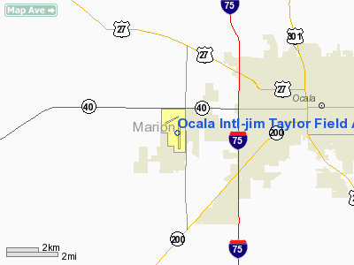
Ocala International Airport (IATA: OCF, ICAO: KOCF, FAA LID: OCF) is a city-owned public-use airport located four nautical miles (7 km) west of the central business district of Ocala, a city in Marion County, Florida, United States. It is also known as Ocala International Airport-Jim Taylor Field, Ocala Regional Airport and/or Jim Taylor Field.
The airport is located approximately 31 miles south of the Gainesville Regional Airport.
Facilities and aircraft
Ocala International Airport covers an area of 1,532 acres (620 ha) at an elevation of 89 feet (27 m) above mean sea level. It has two asphalt paved runways: Runway 18/36 measuring 7,463 by 150 feet (2,275 x 46 m) and Runway 8/26 measuring 3,010 by 50 feet (917 x 15 m).
The Ocala International Airport began in 1968 with one runway served by Eastern Airlines and then Allegheny Commuter Airlines. Scheduled air service was discontinued in the early 1980s, however the original facilities were expanded over the years to include a 3,000 foot crosswind runway, an extension of the main runway out to 6,900 feet, an all weather instrument landing approach, and FAA Part 139 certification. Due to several factors including airline deregulation, current runway length and strength, economic issues related to the operations of competing airports such as Gainesville Regional Airport, Orlando International Airport and Tampa International Airport, the likelihood of scheduled air carrier service returning to Ocala is unlikely.
In 2004, a $1.3 million improvement plan was put into motion that will upgrade apron security systems. The airport is the first within the State of Florida to utilize the polycon pavement surface treatment.
For the 12-month period ending December 31, 2008, the airport had 75,000 aircraft operations, an average of 205 per day: 98% general aviation, 1% air taxi and 1% military. At that time there were 145 aircraft based at this airport: 68% single-engine, 23% multi-engine, 6% jet and 3% helicopter.
In May of 2009 construction began on a control tower. The tower was certified and staffed in the summer of 2010.
The above content comes from Wikipedia and is published under free licenses – click here to read more.
Location
& QuickFacts
|
FAA Information Effective: |
2007-01-18 |
|
Airport
Identifier: |
OCF |
|
Airport
Status: |
Operational |
|
Longitude/Latitude: |
082-13-27.0000W/29-10-21.4000N
-82.224167/29.172611 (Estimated) |
|
Elevation: |
89 ft / 27.13 m (Surveyed) |
|
Land: |
1532 acres |
|
From
nearest city: |
4 nautical miles W of Ocala, FL |
|
Location: |
Marion County, FL |
|
Magnetic Variation: |
04W (2000) |
Owner
& Manager
|
Ownership: |
Publicly owned |
|
Owner: |
City Of Ocala |
|
Address: |
P.o. Box 1270
Ocala, FL 34478-1270 |
|
Phone
number: |
352-629-8248 |
|
Manager: |
Matt Grow |
|
Address: |
3400 Sw 60th Ave
Ocala, FL 34474-1270 |
|
Phone number: |
352-629-8377 |
Airport
Operations and Facilities
|
Airport Use: |
Open to public |
|
Wind
indicator: |
Yes |
|
Segmented
Circle: |
Yes |
|
Control
Tower: |
No |
|
Lighting
Schedule: |
DUSK-DAWN
MIRL RY 18/36 PRESET LOW INTST, TO INCR INTST AND ACTVT
MALSR RY 36 & PAPI RYS 18 & 36 - CTAF. |
|
Beacon
Color: |
Clear-Green (lighted land airport) |
|
Landing
fee charge: |
No |
|
Sectional
chart: |
Jacksonville |
|
Region: |
ASO - Southern |
|
Boundary
ARTCC: |
ZJX - Jacksonville |
|
Responsible
ARTCC: |
ZJX - Jacksonville |
|
Tie-in
FSS: |
GNV - Gainesville |
|
FSS
on Airport: |
No |
|
FSS
Phone: |
850-377-3291 |
|
FSS
Toll Free: |
1-800-WX-BRIEF |
|
NOTAMs
Facility: |
OCF (NOTAM-d service avaliable) |
|
Certification
type/date: |
I L U 11/1984
CLSD TO ACR OPNS WITH MORE THAN 30 PSGR SEATS EXCP 24 HRS
PPR CALL352-239-1366. |
|
Federal Agreements: |
NGY |
Airport
Communications
|
CTAF: |
123.000 |
|
Unicom: |
123.000 |
Airport
Services
|
Fuel available: |
100LLA1+ |
|
Airframe Repair: |
MAJOR |
|
Power Plant Repair: |
MAJOR |
|
Bottled
Oxygen: |
NONE |
|
Bulk
Oxygen: |
HIGH/LOW |
|
Runway Information
Runway 08/26
|
Dimension: |
3010 x 50 ft / 917.4 x 15.2 m |
|
Surface: |
ASPH, Good Condition |
|
Weight
Limit: |
Single wheel: 30000 lbs. |
|
|
Runway 08 |
Runway 26 |
|
Longitude: |
082-13-53.0640W |
082-13-19.6380W |
|
Latitude: |
29-10-45.8280N |
29-10-51.0420N |
|
Elevation: |
88.00 ft |
89.00 ft |
|
Alignment: |
80 |
127 |
|
Traffic
Pattern: |
Left |
Left |
|
Markings: |
Basic, Fair Condition |
Basic, Fair Condition |
|
Obstruction: |
45 ft trees, 1300.0 ft from runway, 250 ft
right of centerline, 24:1 slope to clear |
29 ft pline, 1200.0 ft from runway, 300 ft
right of centerline, 34:1 slope to clear |
|
Runway 18/36
|
Dimension: |
6907 x 150 ft / 2105.3 x 45.7 m |
|
Surface: |
ASPH, Good Condition |
|
Weight
Limit: |
Single wheel: 60000 lbs.
Dual wheel: 125000 lbs.
Dual
tandem wheel: 220000 lbs. |
|
Edge
Lights: |
Medium |
|
|
Runway 18 |
Runway 36 |
|
Longitude: |
082-13-23.0200W |
082-13-22.9290W |
|
Latitude: |
29-10-43.7590N |
29-09-35.3770N |
|
Elevation: |
81.00 ft |
78.00 ft |
|
Alignment: |
127 |
127 |
|
ILS
Type: |
|
ILS |
|
Traffic
Pattern: |
Left |
Left |
|
Markings: |
Non-precision instrument, Poor Condition
RY 18 MARKINGS FADED. |
Precision instrument, Poor Condition
RY 36 MARKINGS FADED. |
|
Crossing
Height: |
52.00 ft |
29.00 ft |
|
VASI: |
4-light PAPI on left side |
4-light PAPI on left side |
|
Visual
Glide Angle: |
3.00� |
3.00� |
|
Approach
lights: |
|
MALSR |
|
Obstruction: |
60 ft trees, 2600.0 ft from runway, 40:1 slope
to clear |
, 50:1 slope to clear |
|
Radio Navigation
Aids
|
ID |
Type |
Name |
Ch |
Freq |
Var |
Dist |
|
GN |
NDB |
Wynds |
|
269.00 |
04W |
30.0 nm |
|
LEE |
NDB |
Leesburg |
|
335.00 |
04W |
30.6 nm |
|
IAK |
NDB |
Palatka |
|
243.00 |
05W |
36.0 nm |
|
OCF |
VORTAC |
Ocala |
084X |
113.70 |
00E |
0.3 nm |
|
GNV |
VORTAC |
Gators |
109X |
116.20 |
04W |
31.3 nm |
Remarks
- RY
36 DESIGNATED CALM WIND RY.
- ALL
ACFT DEPG RY 18 MAINTAIN RY HEADING TO 800 FT AGL OR UNTIL REACHING
END OF RY WHICHEVER OCCURS LATER BEFORE MAKING LEFT TURNS.
- RWY
08/26 CLSD TO ACR AIRCRAFT.
- CUSTOM
SVC UNAVBL.
Based Aircraft
|
Aircraft
based on field: |
145 |
|
Single
Engine Airplanes: |
98 |
|
Multi
Engine Airplanes: |
34 |
|
Jet Engine
Airplanes: |
8 |
|
Helicopters: |
5 |
Operational Statistics
Time Period: 2005-01-01
- 2005-12-31
|
Aircraft
Operations: |
206/Day |
|
Air Taxi: |
1.1% |
|
General
Aviation Local: |
96.8% |
|
General
Aviation Itinerant: |
1.3% |
|
Military: |
0.8% |
Ocala Intl-jim Taylor Field Airport
Address:
Marion County, FL
Tel:
352-629-8248,
352-629-8377
Images
and information placed above are from
http://www.airport-data.com/airport/OCF/
We
thank them for the data!
| General
Info |
| Country |
United
States |
| State |
FLORIDA
|
| FAA ID |
OCF
|
| Latitude |
29-10-21.400N
|
| Longitude |
082-13-27.000W
|
| Elevation |
89 feet
|
| Near City |
OCALA
|
We don't guarantee the information is fresh and accurate. The data may
be wrong or outdated.
For more up-to-date information please refer to other sources.
|
|


