 |
|
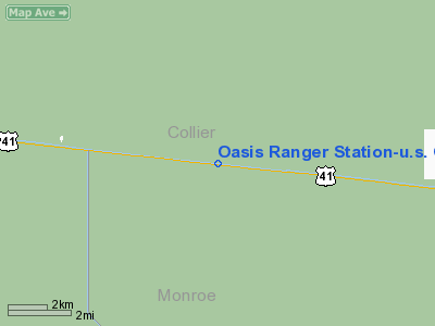
Oasis Ranger Station - U.S.Government Airport |
|
|
Location
& QuickFacts
|
FAA Information Effective: |
2007-01-18 |
|
Airport
Identifier: |
9FL7 |
|
Airport
Status: |
Operational |
|
Longitude/Latitude: |
081-02-04.2530W/25-51-26.3550N
-81.034515/25.857321 (Estimated) |
|
Elevation: |
10 ft / 3.05 m (Estimated) |
|
Land: |
0 acres |
|
From
nearest city: |
19 nautical miles E of Everglades City, FL |
|
Location: |
Collier County, FL |
|
Magnetic Variation: |
02W (1985) |
Owner
& Manager
|
Ownership: |
Publicly owned |
|
Owner: |
Dept Of Interior
NATIONAL PARK SERVICE, BIG CYPRESS NATIONAL PRESERVE. |
|
Address: |
Hcr61 Box 110
Ochopee, FL 33943 |
|
Phone number: |
813-695-4111 |
|
Manager: |
Wallace. Hibbard |
|
Address: |
Hcr61 Box 110
Ochopee, FL 33943 |
|
Phone number: |
813-695-2000 |
Airport
Operations and Facilities
|
Airport Use: |
Private |
|
Wind
indicator: |
Yes |
|
Segmented
Circle: |
No |
|
Control
Tower: |
No |
|
Landing
fee charge: |
No |
|
Sectional
chart: |
Miami |
|
Region: |
ASO - Southern |
|
Boundary
ARTCC: |
ZMA - Miami |
|
Tie-in
FSS: |
MIA - Miami |
|
FSS
on Airport: |
No |
|
FSS
Phone: |
305-233-2600 |
|
FSS
Toll Free: |
1-800-WX-BRIEF |
|
Runway Information
Runway 18/36
|
Dimension: |
2060 x 150 ft / 627.9 x 45.7 m |
|
Surface: |
GRAVEL, |
|
|
Runway 18 |
Runway 36 |
|
Traffic
Pattern: |
Right |
Left |
|
Radio Navigation
Aids
|
ID |
Type |
Name |
Ch |
Freq |
Var |
Dist |
|
APF |
NDB |
Naples |
|
201.00 |
03W |
43.8 nm |
|
FX |
NDB |
Praiz |
|
221.00 |
02W |
44.4 nm |
|
PJN |
NDB |
Plantation |
|
242.00 |
03W |
47.1 nm |
|
HST |
TACAN |
Homestead |
019X |
|
03W |
41.8 nm |
|
CYY |
VOR/DME |
Cypress |
023X |
108.60 |
03W |
43.9 nm |
|
VKZ |
VOR/DME |
Virginia Key |
118X |
117.10 |
04W |
48.0 nm |
|
FLL |
VOR/DME |
Fort Lauderdale |
091X |
114.40 |
00E |
49.4 nm |
|
DHP |
VORTAC |
Dolphin |
086X |
113.90 |
04W |
37.2 nm |
|
MIA |
VOT |
Miami Intl |
|
112.00 |
|
41.1 nm |
Remarks
- 250'
AGL RADIO ANT LCTD 600' NORTHEAST OF LNDG AREA.
- E111:
VFR; PVT USE ONLY; PROPONENT ADZD THAT LARGE TURBOJET ACFT FLY OVER
SITE A 1500' MSL.
Based Aircraft
|
Aircraft
based on field: |
2 |
|
Single
Engine Airplanes: |
1 |
|
Helicopters: |
1 |
Oasis Ranger Station-u.s. Government Airport
Address:
Collier County, FL
Tel:
813-695-4111, 813-695-2000
Images
and information placed above are from
http://www.airport-data.com/airport/9FL7/
We
thank them for the data!
| General
Info |
| Country |
United
States |
| State |
FLORIDA
|
| FAA ID |
9FL7
|
| Latitude |
25-51-26.355N
|
| Longitude |
081-02-04.253W
|
| Elevation |
10 feet
|
| Near City |
EVERGLADES
CITY |
We don't guarantee the information is fresh and accurate. The data may
be wrong or outdated.
For more up-to-date information please refer to other sources.
|
|


