|
|
| Naples Municipal Airport |
 |
 |
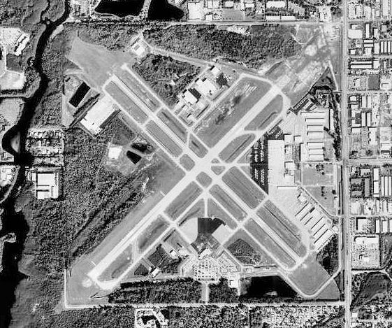
| Aerial photo as of 14 February 1999 |
| IATA: APF – ICAO: KAPF – FAA LID: APF |
| Summary |
| Airport type |
Public |
| Owner |
City of Naples Airport Authority |
| Serves |
Naples, Florida |
| Elevation AMSL |
8 ft / 2 m |
| Coordinates |
26°09′09″N 081°46′31″W / 26.1525°N 81.77528°W / 26.1525; -81.77528 |
| Website |
www.flynaples.com |
| Runways |
| Direction |
Length |
Surface |
| ft |
m |
| 5/23 |
5,290 |
1,612 |
Asphalt |
| 14/32 |
5,000 |
1,524 |
Asphalt |
| SW/NE |
1,850 |
564 |
Turf |
| Statistics (2009) |
| Aircraft operations |
129,731 |
| Based aircraft |
396 |
| Source: Federal Aviation Administration |
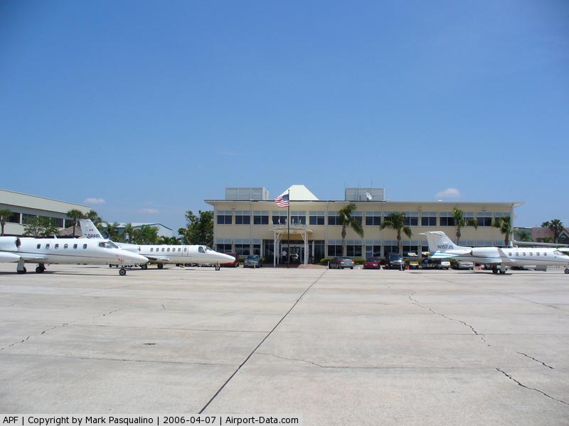
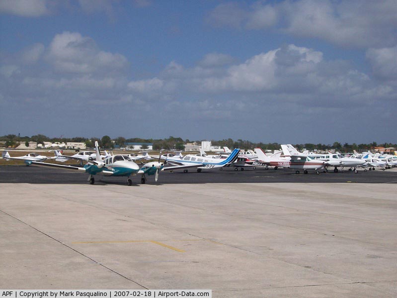
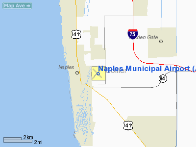
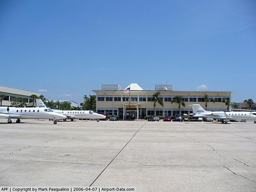
Naples Municipal Airport (IATA: APF, ICAO: KAPF, FAA LID: APF) is a public airport located two nautical miles (3.7 km) northeast of the central business district of Naples, a city in Collier County, Florida, United States. It is owned by the City of Naples Airport Authority. The airport provides space for general aviation, as well as mosquito control and, Med Flight Collier (EMS Helicopters). Facilities and aircraft
Naples Municipal Airport covers an area of 732 acres (296 ha) which contains two asphalt paved runways: 5/23 measuring 5,290 x 150 ft (1,612 x 46 m) and 14/32 measuring 5,000 x 100 ft (1,524 x 30 m). It also has one turf runway designated SW/NE which measures 1,850 x 100 ft (564 x 30 m).
For the 12-month period ending April 30, 2009, the airport had 129,731 aircraft operations, an average of 355 per day: 91% general aviation, 8% air taxi, 1% scheduled commercial and <1% military. At that time there were 396 aircraft based at this airport: 65% single-engine, 22% multi-engine, 9% jet and 4% helicopter.
Airlines
| Airlines |
Destinations |
| Gulf Coast Airways |
Key West |
History
Established in 1942 as Naples Army Airfield by the United States Army Air Forces. Assigned initially to the Southeast Training Center (later Eastern Flying Training Command). Provided basic (level 1) flight training to flight cadets by Embry-Riddle Co; Fairchild PT-19s were the primary trainer used. Along with the flight training, was a sub-base to Buckingham Army Airfield for flexible gunnery training. Inactivated on 1 November 1945, being turned over to the War Assets Administration for conveyance to civil control as a public airport.
Provincetown-Boston Airlines began scheduled service to Miami International Airport in the 1950s, and managed the airport for several years until a municipal airport authority was created in 1969.
Although the airport served more than 100,000 passengers per year through 2000, geographic factors limited its capacity, and the opening of the much larger Southwest Florida International Airport in nearby Fort Myers drew medium-haul traffic away from Naples. Passenger numbers dipped when American Eagle ceased scheduled Miami service in 2001, and dipped even further following the September 11, 2001 attacks Scheduled airline service to Naples ended in 2003 when US Airways Express ceased service to Tampa International Airport.
Accidents and incidents
- On 10 September 1985, a Douglas DC-3 of Collier County Mosquito Control District crashed at East Naples whilst on approach to Naples Municipal Airport following an engine failure. The aircraft was on agricultural duties at the time.
The above content comes from Wikipedia and is published under free licenses – click here to read more.
|
 |
(Click on the photo to enlarge) |
|
 |
(Click on the photo to enlarge) |
|
 |
(Click on the photo to enlarge) |
Location
& QuickFacts
|
FAA Information Effective: |
2007-01-18 |
|
Airport
Identifier: |
APF |
|
Airport
Status: |
Operational |
|
Longitude/Latitude: |
081-46-31.0620W/26-09-09.4330N
-81.775295/26.152620 (Estimated) |
|
Elevation: |
8 ft / 2.44 m (Surveyed) |
|
Land: |
732 acres |
|
From
nearest city: |
2 nautical miles NE of Naples, FL |
|
Location: |
Collier County, FL |
|
Magnetic Variation: |
03W (1995) |
Owner
& Manager
|
Ownership: |
Publicly owned |
|
Owner: |
City Of Naples Apt Auth |
|
Address: |
160 Aviation Dr North
Naples, FL 34104 |
|
Phone
number: |
239-643-0733 |
|
Manager: |
Theodore D. Soliday |
|
Address: |
160 Aviation Dr North
Naples, FL 34104 |
|
Phone number: |
239-643-0733 |
Airport
Operations and Facilities
|
Airport Use: |
Open to public |
|
Wind
indicator: |
Yes |
|
Segmented
Circle: |
Yes |
|
Control
Tower: |
Yes |
|
Lighting
Schedule: |
DUSK-DAWN
WHEN ATCT CLSD ACTVT MIRL RYS 05/23, 14/32, PAPI RYS 14,
32, REIL RYS 05, 14, 32 & ODALS RY 23 - CTAF. |
|
Beacon
Color: |
Clear-Green (lighted land airport) |
|
Landing
fee charge: |
No |
|
Sectional
chart: |
Miami |
|
Region: |
ASO - Southern |
|
Traffic
Pattern Alt: |
1000 ft |
|
Boundary
ARTCC: |
ZMA - Miami |
|
Tie-in
FSS: |
MIA - Miami |
|
FSS
on Airport: |
No |
|
FSS
Phone: |
305-233-2600 |
|
FSS
Toll Free: |
1-800-WX-BRIEF |
|
NOTAMs
Facility: |
APF (NOTAM-d service avaliable) |
|
Certification type/date: |
I A S 01/1983 |
|
Federal Agreements: |
NGY3 |
Airport
Communications
Airport
Services
|
Fuel available: |
100LLA |
|
Airframe Repair: |
MAJOR |
|
Power Plant Repair: |
MAJOR |
|
Bottled
Oxygen: |
HIGH/LOW |
|
Bulk
Oxygen: |
NONE |
|
Runway Information
Runway 05/23
|
Dimension: |
5290 x 150 ft / 1612.4 x 45.7 m |
|
Surface: |
ASPH, Good Condition |
|
Surface
Treatment: |
Saw-cut or plastic Grooved |
|
Weight
Limit: |
Dual wheel: 75000 lbs. |
|
Edge
Lights: |
Medium |
|
|
Runway 05 |
Runway 23 |
|
Longitude: |
081-46-53.0200W |
081-46-12.5300W |
|
Latitude: |
26-08-49.9800N |
26-09-27.5200N |
|
Elevation: |
8.00
ft |
8.00
ft |
|
Alignment: |
44 |
127 |
|
Traffic
Pattern: |
Right |
Left |
|
Markings: |
Non-precision instrument, Fair Condition |
Non-precision instrument, Fair Condition |
|
Crossing
Height: |
30.00 ft |
43.00 ft |
|
Displaced
threshold: |
290.00 ft |
0.00
ft |
|
VASI: |
4-light PAPI on right side |
4-light PAPI on left side |
|
Visual
Glide Angle: |
3.50� |
3.00� |
|
Approach
lights: |
|
ODALS |
|
Runway
End Identifier: |
Yes |
|
|
Obstruction: |
77 ft bldg, 3100.0 ft from runway, 475 ft left
of centerline, 41:1 slope to clear
APCH SLOPE 40:1 DUE TO 77 FT BLDG 2810 FT FROM THE DSPLCD
THLD. |
45 ft tree, 1754.0 ft from runway, 200 ft right
of centerline, 36:1 slope to clear |
|
Decleard
distances: |
Take off run available 5000.00 ft
Take off distance available 5290.00 ft
Actual stop distance available 5000.00 ft
Landing distance available 5000.00 ft |
Take off run available 5000.00 ft
Take off distance available 5000.00 ft
Actual stop distance available 5000.00 ft
Landing distance available 5000.00 ft |
|
Runway 14/32
|
Dimension: |
5000 x 100 ft / 1524.0 x 30.5 m |
|
Surface: |
ASPH, Good Condition |
|
Weight
Limit: |
Dual wheel: 75000 lbs. |
|
Edge
Lights: |
Medium |
|
|
Runway 14 |
Runway 32 |
|
Longitude: |
081-46-48.9100W |
081-46-09.5900W |
|
Latitude: |
26-09-27.4300N |
26-08-52.8800N |
|
Elevation: |
7.00
ft |
8.00
ft |
|
Alignment: |
127 |
127 |
|
Traffic
Pattern: |
Right |
Left |
|
Markings: |
Basic, Good Condition |
Basic, Good Condition |
|
Crossing
Height: |
40.00 ft |
38.00 ft |
|
Displaced
threshold: |
130.00 ft |
450.00 ft |
|
VASI: |
4-light PAPI on left side |
4-light PAPI on left side |
|
Visual
Glide Angle: |
3.50� |
3.00� |
|
Runway
End Identifier: |
Yes |
Yes |
|
Obstruction: |
44 ft , 1300.0 ft from runway, 100 ft right
of centerline, 30:1 slope to clear |
45 ft , 1500.0 ft from runway, 100 ft left
of centerline, 33:1 slope to clear |
|
Decleard
distances: |
Take off run available 5000.00 ft
Take off distance available 5000.00 ft
Actual stop distance available 4550.00 ft
Landing distance available 4420.00 ft |
Take off run available 5000.00 ft
Take off distance available 5000.00 ft
Actual stop distance available 4870.00 ft
Landing distance available 4420.00 ft |
|
Runway SW/NE
|
Dimension: |
1850 x 100 ft / 563.9 x 30.5 m |
|
Surface: |
TURF, |
|
|
Runway NE |
Runway SW |
|
Traffic
Pattern: |
Left |
Left |
|
Radio Navigation
Aids
|
ID |
Type |
Name |
Ch |
Freq |
Var |
Dist |
|
APF |
NDB |
Naples |
|
201.00 |
03W |
0.2 nm |
|
PGD |
VOR |
Punta Gorda |
|
110.20 |
03W |
47.4 nm |
|
CYY |
VOR/DME |
Cypress |
023X |
108.60 |
03W |
0.2 nm |
|
RSW |
VORTAC |
Lee County |
055X |
111.80 |
02W |
22.7 nm |
|
LBV |
VORTAC |
La Belle |
041X |
110.40 |
01E |
45.6 nm |
Remarks
- EXTREMELY
NOISE SENSITIVE AREAS ALL QUADRANTS. ALL TURBOJETS USE CLOSE-IN NOISE
ABATEMENT PROCEDURES.
- CLSD
TO ALL ACFT EXCEEDING 75000 LBS MAXIMUM GROSS WEIGHT DUAL GEAR AS INDICATED
ON ACFT OPERATING CERT ISSUED BY THE MANUFACTURER.
- ANTENNA
TOWER LCTD 1/2 MILE E OF 152 FT AGL.
- USE
CARE WHEN EXITING RY 05 ONTO TWY G. DO NOT TURN ONTO RY 14/32 UNLESS
INSTRUCTED BY ATC.
- USE
OF TURF RY (RY SW/NE) RSTRD TO INDIVIDUALS WHO HAVE REVIEWED & SIGNED
LETTER OF AGREEMENT AVAILABLE AT GEN AVN TRML.
- TWY
C FM C-1 TO THE AER 32 NOT VISIBLE FM THE ATCT.
- STAGE
1 ACFT AND STAGE 2 JET ACFT OPNS PROHIBITED. VOLUNTARY RESTRICTIONS
EXIST FOR STAGE 3 JET ACFT OPNS 2200-0700. VOLUNTARY
RESTRAINT FROM TOUCH AND GO OPNS 2200-0700.
- EXISTED
PRIOR TO 1959.
Based Aircraft
|
Aircraft
based on field: |
421 |
|
Single
Engine Airplanes: |
278 |
|
Multi
Engine Airplanes: |
90 |
|
Jet Engine
Airplanes: |
41 |
|
Helicopters: |
12 |
Major Carriers
Serving This Airport
| Atlantic Southeast Airlines |
100.0% |
Most Popular Destinations
|
Hartsfield - Jackson Atlanta Intl (ATL) |
100.0% |
Most Popular Aircraft
|
N885AS |
9.3% |
| N923EV |
7.9% |
|
N876AS |
7.9% |
| N921EV |
6.6% |
|
N917EV |
6.6% |
| N886AS |
6.0% |
|
N925EV |
6.0% |
| N889AS |
6.0% |
|
N922EV |
5.3% |
| N883AS |
5.3% |
Operational Statistics
Time Period: 2004-10-01
- 2005-09-30
|
Aircraft
Operations: |
448/Day |
|
Commerical: |
2.6% |
|
Air Taxi: |
5.9% |
|
General
Aviation Local: |
31.4% |
|
General
Aviation Itinerant: |
60.0% |
|
Military: |
0.1% |
Naples Municipal Airport
Address:
Collier County, FL
Tel:
239-643-0733
Images
and information placed above are from
http://www.airport-data.com/airport/APF/
We
thank them for the data!
| General
Info |
| Country |
United
States |
| State |
FLORIDA
|
| FAA ID |
APF
|
| Latitude |
26-09-09.967N
|
| Longitude |
081-46-30.457W
|
| Elevation |
8 feet
|
| Near City |
NAPLES
|
We don't guarantee the information is fresh and accurate. The data may
be wrong or outdated.
For more up-to-date information please refer to other sources.
|
|