 |
|
|
|
|
|
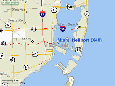
Location
& QuickFacts
|
FAA Information Effective: |
2007-01-18 |
|
Airport
Identifier: |
X48 |
|
Airport
Status: |
Operational |
|
Longitude/Latitude: |
080-10-38.4717W/25-47-09.8818N
-80.177353/25.786078 (Estimated) |
|
Elevation: |
7 ft / 2.13 m (Estimated) |
|
Land: |
4 acres |
|
From
nearest city: |
1 nautical miles E of Miami, FL |
|
Location: |
Dade County, FL |
|
Magnetic Variation: |
03W (1985) |
Owner
& Manager
|
Ownership: |
Publicly owned |
|
Owner: |
City Of Miami
ATTN PROPERTY MANAGEMENT SECTION 305-579-6318. |
|
Address: |
300 Biscayne Way Suite 400-401
Miami, FL 33131 |
|
Phone
number: |
305-374-3737 |
|
Manager: |
Clerance Woods |
|
Address: |
444 Sw 2nd Ave - 3rd Floor
Miami, FL 33130 |
|
Phone number: |
305-416-1400 |
Airport
Operations and Facilities
|
Airport Use: |
Open to public |
|
Wind
indicator: |
Yes |
|
Segmented
Circle: |
No |
|
Control
Tower: |
No |
|
Lighting
Schedule: |
DUSK-DAWN |
|
Landing
fee charge: |
No |
|
Sectional
chart: |
Miami |
|
Region: |
ASO - Southern |
|
Boundary
ARTCC: |
ZMA - Miami |
|
Tie-in
FSS: |
MIA - Miami |
|
FSS
on Airport: |
No |
|
FSS
Phone: |
305-233-2600 |
|
FSS
Toll Free: |
1-800-WX-BRIEF |
|
NOTAMs
Facility: |
MIA (NOTAM-d service avaliable) |
Airport
Communications
Airport
Services
|
Airframe Repair: |
MINOR |
|
Power Plant Repair: |
MINOR |
|
Bottled
Oxygen: |
NONE |
|
Bulk
Oxygen: |
NONE |
|
Runway Information
Helipad H1
|
Dimension: |
80 x 80 ft / 24.4 x 24.4 m |
|
Surface: |
TURF, Poor Condition |
|
|
Runway H1 |
Runway |
|
Traffic
Pattern: |
Left |
Left |
|
Radio Navigation
Aids
|
ID |
Type |
Name |
Ch |
Freq |
Var |
Dist |
|
PJN |
NDB |
Plantation |
|
242.00 |
03W |
20.9 nm |
|
FX |
NDB |
Praiz |
|
221.00 |
02W |
24.9 nm |
|
ZBB |
NDB |
Bimini/dcmsnd |
|
396.00 |
04W |
49.0 nm |
|
HST |
TACAN |
Homestead |
019X |
|
03W |
20.9 nm |
|
VKZ |
VOR/DME |
Virginia Key |
118X |
117.10 |
04W |
2.4 nm |
|
FLL |
VOR/DME |
Fort Lauderdale |
091X |
114.40 |
00E |
17.4 nm |
|
DHP |
VORTAC |
Dolphin |
086X |
113.90 |
04W |
9.3 nm |
|
ZBV |
VORTAC |
Bimini |
114X |
116.70 |
04W |
48.1 nm |
|
MIA |
VOT |
Miami Intl |
|
112.00 |
|
5.5 nm |
Remarks
- HELIPAD
ENCLOSED BY A FOUR FT FENCE.
- EXISTED
PRIOR TO 1959.
Based Aircraft
|
Aircraft
based on field: |
2 |
|
Helicopters: |
2 |
Operational Statistics
Time Period: 1999-08-31
- 2000-08-29
|
Aircraft
Operations: |
97/Week |
|
Air Taxi: |
20.0% |
|
General
Aviation Local: |
50.0% |
|
General
Aviation Itinerant: |
20.0% |
|
Military: |
10.0% |
Miami Heliport
Address:
Dade County, FL
Tel:
305-374-3737,
305-416-1400
Images
and information placed above are from
http://www.airport-data.com/airport/X48/
We
thank them for the data!
| General
Info |
| Country |
United
States |
| State |
FLORIDA
|
| FAA ID |
X48
|
| Latitude |
25-47-09.882N
|
| Longitude |
080-10-38.472W
|
| Elevation |
7 feet
|
| Near City |
MIAMI
|
We don't guarantee the information is fresh and accurate. The data may
be wrong or outdated.
For more up-to-date information please refer to other sources.
|
|


