 |
|
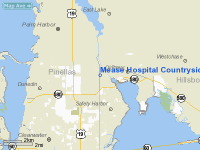
Mease Hospital Countryside Heliport |
Location
& QuickFacts
|
FAA Information Effective: |
2007-01-18 |
|
Airport
Identifier: |
36FL |
|
Airport
Status: |
Operational |
|
Longitude/Latitude: |
082-42-28.3600W/28-02-20.0630N
-82.707878/28.038906 (Estimated) |
|
Elevation: |
32 ft / 9.75 m (Estimated) |
|
Land: |
0 acres |
|
From
nearest city: |
3 nautical miles NW of Safety Harbor, FL |
|
Location: |
Pinellas County, FL |
|
Magnetic Variation: |
02W (1985) |
Owner
& Manager
|
Ownership: |
Privately owned |
|
Owner: |
Mease Health Care |
|
Address: |
601 Main St
Dunedin, FL 34698 |
|
Phone
number: |
727-725-6237 |
|
Manager: |
Don Clark |
|
Address: |
Po Box 1098
Safety Harbor, FL 33572 |
|
Phone number: |
727-235-2372 |
Airport
Operations and Facilities
|
Airport Use: |
Private
MEDICAL |
|
Wind
indicator: |
Yes |
|
Segmented
Circle: |
No |
|
Control
Tower: |
No |
|
Sectional
chart: |
Jacksonville |
|
Region: |
ASO - Southern |
|
Boundary
ARTCC: |
ZJX - Jacksonville |
|
Tie-in
FSS: |
PIE - Saint Petersburg |
|
FSS
Toll Free: |
1-800-WX-BRIEF |
|
Runway Information
Helipad H1
|
Dimension: |
60 x 60 ft / 18.3 x 18.3 m |
|
Surface: |
CONC, |
|
|
Runway H1 |
Runway |
|
Traffic
Pattern: |
Left |
Left |
|
Radio Navigation
Aids
|
ID |
Type |
Name |
Ch |
Freq |
Var |
Dist |
|
AM |
NDB |
Picny |
|
388.00 |
02W |
13.7 nm |
|
TPF |
NDB |
Knight |
|
270.00 |
02W |
15.6 nm |
|
PCM |
NDB |
Plant City |
|
346.00 |
02W |
29.3 nm |
|
RHZ |
NDB |
Zephyrhills |
|
253.00 |
03W |
31.3 nm |
|
MCF |
TACAN |
Macdill |
047X |
|
04W |
14.8 nm |
|
PIE |
VORTAC |
St Petersburg |
111X |
116.40 |
01E |
8.0 nm |
|
LAL |
VORTAC |
Lakeland |
107X |
116.00 |
01E |
37.0 nm |
|
SRQ |
VORTAC |
Sarasota |
099X |
115.20 |
02W |
39.4 nm |
|
TPA |
VOT |
Tampa Intl |
|
111.00 |
|
10.1 nm |
Remarks
- OPS
VFR PRIVATE USE ONLY; APP/DEP CLOCKWISE 060-270 DEGREES; AREA MARKED;
WIND INDICATOR MAINTAINED.
Mease Hospital Countryside Heliport
Address:
Pinellas County, FL
Tel:
727-725-6237,
727-235-2372
Images
and information placed above are from
http://www.airport-data.com/airport/36FL/
We
thank them for the data!
| General
Info |
| Country |
United
States |
| State |
FLORIDA
|
| FAA ID |
36FL
|
| Latitude |
28-02-20.063N
|
| Longitude |
082-42-28.360W
|
| Elevation |
32 feet
|
| Near City |
SAFETY
HARBOR |
We don't guarantee the information is fresh and accurate. The data may
be wrong or outdated.
For more up-to-date information please refer to other sources.
|
|


