|
|
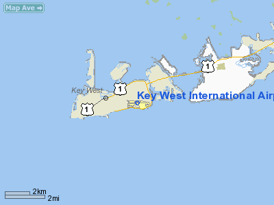
Key West International Airport |
Coordinates: 24°33′22″N 081°45′34″W / 24.55611°N 81.75944°W / 24.55611; -81.75944
| Key West International Airport |
 |
| IATA: EYW – ICAO: KEYW – FAA LID: EYW |
| Summary |
| Airport type |
Public |
| Owner |
Monroe County |
| Serves |
Key West, Florida |
| Elevation AMSL |
3 ft / 1 m |
| Website |
monroecounty-fl.gov/... |
| Runways |
| Direction |
Length |
Surface |
| ft |
m |
| 9/27 |
4,801 |
1,463 |
Asphalt |
| Statistics (2006) |
| Aircraft operations |
94,408 |
| Based aircraft |
43 |
| Source: Federal Aviation Administration |
Key West International Airport (IATA: EYW, ICAO: KEYW, FAA LID: EYW) is a county-owned public airport located two miles (3 km) east of the central business district of Key West, in Monroe County, Florida, United States.
The IATA code starts from the second letter of the name (Key West) because initial "K" is a reserved block; the ICAO code restores the K in the identification as "K" is the first position ICAO code used for airports located in the Continental United States. Flights departing from EYW often have strict weight or baggage restrictions due to the short length of the runway. History
Key West's aviation history begins with a 1913 flight to Cuba by Augustin Parla. In 1928, Pan American Airlines began scheduled flights from Key West. Meacham Field was the primary runway for Key West. It was initially pressed into Army use after the Pearl Harbor bombing, and then later during World War II by the Navy as an adjunct runway to the Trumbo Point Seaplane Base and the main Naval Air Station for fixed-wing and lighter-than-air (i.e., blimp) aircraft on Boca Chica Key. After the war, control of the runway was returned to the city and the civilian facility was eventually called the Key West Municipal Airport. In January 1953, the city gave Monroe County clear title to Meacham Field, allowing the county to apply for CAA grants. It was at this time that the name changed to the Key West International Airport.
Facilities and aircraft
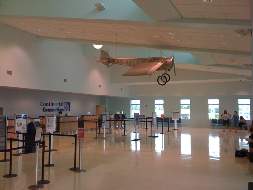 | |
Departing Passenger Terminal at Key West International Airport |
 | |
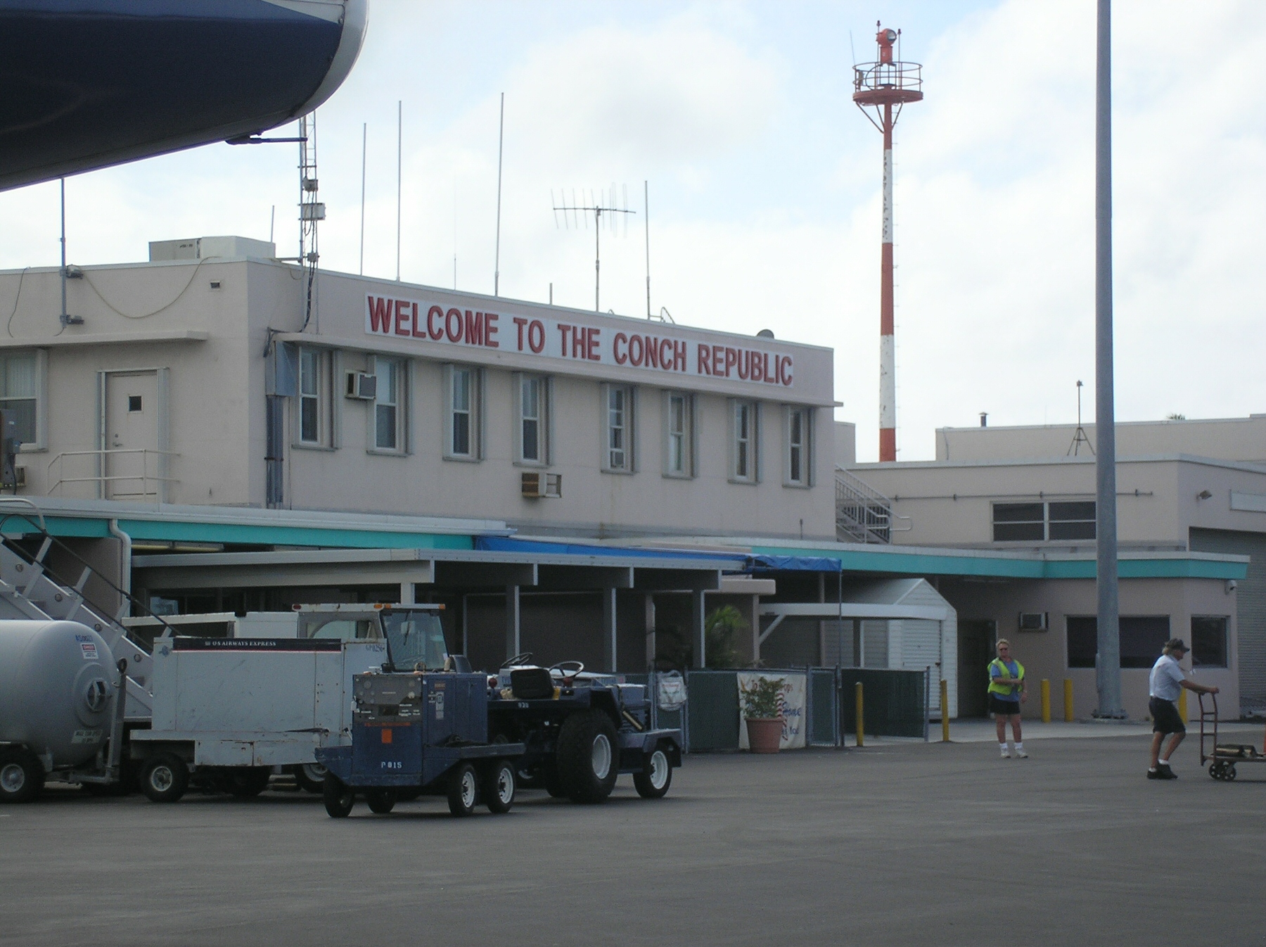
Conch Republic sign at the Key West International Airport |
| |
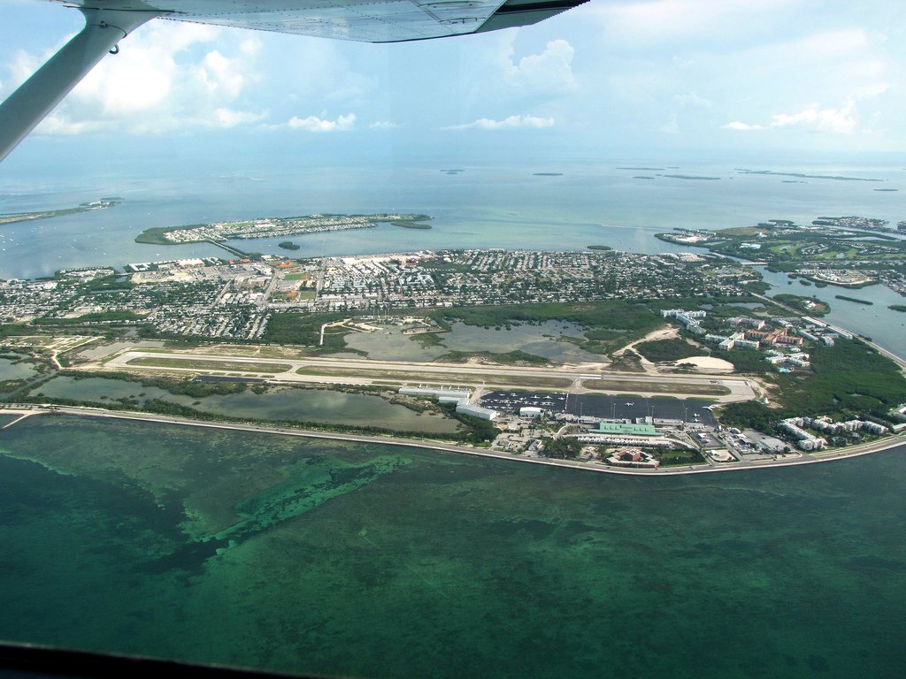
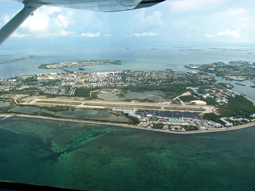
Aerial view of the airport. |
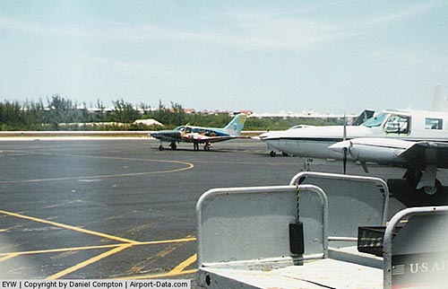
Key West International Airport covers an area of 255 acres (103 ha) which contains one asphalt paved runway (9/27) measuring 4,801 x 100 ft (1,463 x 30 m). For the year 2006, the airport had 94,408 aircraft operations—an average of 258 per day. This included 51% general aviation, 29% air taxi, 14% military and 6% scheduled commercial. There are 43 aircraft based at this airport: 31 single-engine and 21 multi-engine.
The airport has two terminals desighned by Mark Mosko/Dwane Stark of URS (Mr. Mark Mosko also did work on the Baltimore/Washington International Airport). The older one opened in 1957 and now serves arriving passengers. The newer terminal opened in February 2009 and serves departing passengers. With an area of approximately 30,000 square feet (2,800 m), it more than doubled the size of the airport. Parking for 300 vehicles is located at ground level beneath the newer terminal—150 spaces for rental cars and 150 for the public.
Airlines and destinations
Scheduled passenger service
| Airlines |
Destinations |
| AirTran Airways |
Orlando, Tampa [begins March 10] |
| American Eagle operated by Executive Air |
Miami |
| Cape Air |
Fort Myers |
| Continental Connection operated by Gulfstream International Airlines |
Fort Lauderdale, Tampa |
| Delta Air Lines |
Atlanta |
| Delta Connection operated by Atlantic Southeast Airlines |
Atlanta |
| US Airways Express operated by Republic Airlines |
Charlotte [Seasonal; Resumes October 20] |
Air taxi service
| Airlines |
Destinations |
| Yellow Air Taxi |
Naples, Ft. Lauderdale [charters only] |
Accidents and Incidents
- On April 25 1959, a Vickers Viscount of Cubana de Aviación was hijacked on a flight from Varadero to Havana. The aircraft landed at Key West.
- On 19 March 2003, Aerotaxi Flight 882 operated by Douglas DC-3C CU-T1192 was hijacked on a flight from Rafael Cabrera Airport, Nueva Gerona, Cuba to José Martí International Airport, Havana, Cuba. The aircraft landed at Key West International Airport, where the six hijackers were detained.
The above content comes from Wikipedia and is published under free licenses – click here to read more.
|
 |
(Click on the photo to enlarge) |
Location
& QuickFacts
|
FAA Information Effective: |
2007-01-18 |
|
Airport
Identifier: |
EYW |
|
Airport
Status: |
Operational |
|
Longitude/Latitude: |
081-45-34.4000W/24-33-22.0000N
-81.759556/24.556111 (Estimated) |
|
Elevation: |
3 ft / 0.91 m (Surveyed) |
|
Land: |
255 acres |
|
From
nearest city: |
2 nautical miles E of Key West, FL |
|
Location: |
Monroe County, FL |
|
Magnetic Variation: |
04W (2000) |
Owner
& Manager
|
Ownership: |
Publicly owned |
|
Owner: |
Monroe County |
|
Address: |
3491 S Roosevelt Blvd
Key West, FL 33040-5260 |
|
Phone
number: |
305-296-7223 |
|
Manager: |
Peter Horton |
|
Address: |
3491 S Roosevelt Blvd
Key West, FL 33040-5260 |
|
Phone number: |
305-304-0063 |
Airport
Operations and Facilities
|
Airport Use: |
Open to public |
|
Wind
indicator: |
Yes |
|
Segmented
Circle: |
Yes |
|
Control
Tower: |
Yes |
|
Lighting
Schedule: |
DUSK DAWN
ACTVT MIRL RY 09/27, VASI RYS 09 & 27 AND REIL RYS 09
& 27 - CTAF. |
|
Beacon
Color: |
Clear-Green (lighted land airport) |
|
Landing
fee charge: |
No |
|
Sectional
chart: |
Miami |
|
Region: |
ASO - Southern |
|
Boundary
ARTCC: |
ZMA - Miami |
|
Tie-in
FSS: |
MIA - Miami |
|
FSS
on Airport: |
No |
|
FSS
Phone: |
305-233-2600 |
|
FSS
Toll Free: |
1-800-WX-BRIEF |
|
NOTAMs
Facility: |
EYW (NOTAM-d service avaliable) |
|
Certification
type/date: |
I B S 01/2005
PPR FOR UNSKED ACR OPNS WITH MORE THAN 30 PSGR SEATS 2330-0545;
CALL AMGR 305-296-7223. |
|
Federal Agreements: |
NGSY |
Airport
Communications
|
CTAF: |
118.200 |
|
Unicom: |
122.950 |
Airport
Services
|
Fuel available: |
100 A |
|
Airframe Repair: |
MAJOR |
|
Power Plant Repair: |
MAJOR |
|
Bottled
Oxygen: |
NONE |
|
Bulk
Oxygen: |
NONE |
|
Runway Information
Runway 09/27
|
Dimension: |
4801 x 100 ft / 1463.3 x 30.5 m |
|
Surface: |
ASPH, Good Condition |
|
Surface
Treatment: |
Saw-cut or plastic Grooved |
|
Weight
Limit: |
Single wheel: 75000 lbs.
Dual wheel: 125000 lbs.
Dual
tandem wheel: 195000 lbs. |
|
Edge
Lights: |
Medium |
|
|
Runway 09 |
Runway 27 |
|
Longitude: |
081-46-00.3647W |
081-45-08.3659W |
|
Latitude: |
24-33-21.7924N |
24-33-22.2957N |
|
Elevation: |
3.00
ft |
2.00
ft |
|
Alignment: |
89 |
127 |
|
Traffic
Pattern: |
Right |
Left |
|
Markings: |
Non-precision instrument, Good Condition |
Non-precision instrument, Good Condition |
|
Crossing
Height: |
34.00 ft |
34.00 ft |
|
VASI: |
4-box on left side |
4-box on left side |
|
Visual
Glide Angle: |
3.00� |
3.00� |
|
Runway
End Identifier: |
Yes |
Yes |
|
Obstruction: |
14 ft tree, 700.0 ft from runway, 300 ft left
of centerline, 34:1 slope to clear |
2 ft tree, 300.0 ft from runway, 39:1 slope
to clear |
|
Radio Navigation
Aids
|
ID |
Type |
Name |
Ch |
Freq |
Var |
Dist |
|
FIS |
NDB |
Fish Hook |
|
332.00 |
04W |
1.5 nm |
|
MTH |
NDB |
Marathon |
|
260.00 |
04W |
37.5 nm |
|
NQX |
TACAN |
Key West |
078X |
|
02W |
4.5 nm |
|
EYW |
VORTAC |
Key West |
082X |
113.50 |
01E |
2.9 nm |
Remarks
-
< OF
VCNTY THE IN AND ON BIRDS FLOCKS>
- RESTRICTED
AREA R-2916 LCTD 14 NM NE OF ARPT HAS STROBE-LGTD AND MKD BALLOON AND
CABLE TO 14000 FT.
- INTENSIVE
MILITARY JET TFC SOUTH AND EAST OF ARPT; ACFT ENTERING ARPT TRF AREA
FROM SOUTHEAST THRU WEST.
- ENTER
ARPT TRF AREA BLO 2000'; REFER TO MIAMI VFR TERMINAL AREA CHART FOR
SUGGESTED VFR FLYWAY ROUTES.
- EXTREMELY
NOISE SENSITIVE AREA. URGE NO OPNS 2300-0700. USE NBAA CLOSE IN NOISE
ABATEMENT PROCEDURES OTHER TIMES. LOCAL ORDINANCE REQS ENGINE RUNUPS
IN DSGND AREA ON N SIDE COML RAMP FM 2300-0700 & FINES.
- PPR
FOR ACFT EXCEEDING RY WT BEARING CAPACITY; CALL AMGR 305-296-7223.
- DEPARTING
VFR ACFT REQUESTED TO MAINTAIN RY HEADING UNTIL REACHING FIELD BOUNDARY,
THEN EXECUTE TURNS FOR NORTH OR SOUTH DEPARTURE.
Based Aircraft
|
Aircraft
based on field: |
57 |
|
Single
Engine Airplanes: |
38 |
|
Multi
Engine Airplanes: |
16 |
|
Jet Engine
Airplanes: |
3 |
Major Carriers
Serving This Airport
| Atlantic Southeast Airlines |
100.0% |
Most Popular Destinations
|
Hartsfield - Jackson Atlanta Intl (ATL) |
100.0% |
Most Popular Aircraft
|
N730EV |
4.0% |
| N750EV |
3.5% |
|
N758EV |
3.5% |
| N754EV |
3.5% |
|
N889AS |
3.5% |
| N713EV |
3.5% |
|
N723EV |
3.0% |
| N709EV |
3.0% |
|
N705EV |
3.0% |
| N718EV |
3.0% |
Operational Statistics
Time Period: 2005-01-01
- 2005-12-31
|
Aircraft
Operations: |
243/Day |
|
Commerical: |
6.3% |
|
Air Taxi: |
36.5% |
|
General
Aviation Local: |
10.1% |
|
General
Aviation Itinerant: |
39.4% |
|
Military: |
7.8% |
Key West International Airport
Address:
Monroe County, FL
Tel:
305-296-7223,
305-304-0063
Images
and information placed above are from
http://www.airport-data.com/airport/EYW/
We
thank them for the data!
| General
Info |
| Country |
United
States |
| State |
FLORIDA
|
| FAA ID |
EYW
|
| Latitude |
24-33-22.000N
|
| Longitude |
081-45-34.400W
|
| Elevation |
3 feet
|
| Near City |
KEY WEST
|
We don't guarantee the information is fresh and accurate. The data may
be wrong or outdated.
For more up-to-date information please refer to other sources.
|
|