 |
|
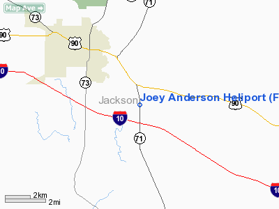
Location
& QuickFacts
|
FAA Information Effective: |
2007-01-18 |
|
Airport
Identifier: |
FL53 |
|
Airport
Status: |
Operational |
|
Longitude/Latitude: |
085-11-05.7300W/30-44-04.6900N
-85.184925/30.734636 (Estimated) |
|
Elevation: |
114 ft / 34.75 m (Estimated) |
|
Land: |
0 acres |
|
From
nearest city: |
3 nautical miles NE of Marianna, FL |
|
Location: |
Jackson County, FL |
|
Magnetic Variation: |
02W (2000) |
Owner
& Manager
|
Ownership: |
Privately owned |
|
Owner: |
Anderson Columbia Conracting Inc |
|
Address: |
2316 Hwy 71
Marianna, FL 32448 |
|
Phone
number: |
850-526-4440 |
|
Manager: |
Wesley C. Gager |
|
Address: |
P.o. Box 714
Crystal River, FL 34423-0714 |
|
Phone number: |
352-563-8322 |
Airport
Operations and Facilities
|
Airport Use: |
Private |
|
Segmented
Circle: |
No |
|
Control
Tower: |
No |
|
Lighting
Schedule: |
PHONE REQ
FOR FLOOD LIGHTS CALL 850-526-4440. |
|
Sectional
chart: |
New Orleans |
|
Region: |
ASO - Southern |
|
Boundary
ARTCC: |
ZJX - Jacksonville |
|
Tie-in
FSS: |
GNV - Gainesville |
|
FSS
Phone: |
850-377-3291 |
|
FSS
Toll Free: |
1-800-WX-BRIEF |
|
Runway Information
Helipad H1
|
Dimension: |
24
x 24 ft / 7.3 x 7.3 m |
|
Surface: |
CONC, |
|
|
Runway H1 |
Runway |
|
Traffic
Pattern: |
Left |
Left |
|
Radio Navigation
Aids
|
ID |
Type |
Name |
Ch |
Freq |
Var |
Dist |
|
SMY |
NDB |
Soyya |
|
329.00 |
02W |
8.5 nm |
|
BKK |
NDB |
Tri County |
|
275.00 |
02W |
22.6 nm |
|
LYZ |
NDB |
Willis |
|
359.00 |
01W |
36.9 nm |
|
OZ |
NDB |
Ruckr |
|
212.00 |
00E |
43.9 nm |
|
HYE |
NDB |
Hanchey |
|
221.00 |
00E |
44.9 nm |
|
IWJ |
NDB |
Blaak |
|
344.00 |
03W |
47.3 nm |
|
LOR |
NDB |
Lowe |
|
269.00 |
03W |
47.3 nm |
|
TL |
NDB |
Wakul |
|
379.00 |
01W |
49.3 nm |
|
PAM |
TACAN |
Tyndall |
124X |
|
00W |
44.5 nm |
|
FYL |
VOR |
Tri County |
|
108.40 |
08W |
22.8 nm |
|
HEY |
VOR |
Hanchey |
|
110.60 |
02E |
45.4 nm |
|
OZR |
VOR/DME |
Cairns |
049X |
111.20 |
02E |
42.5 nm |
|
MAI |
VORTAC |
Marianna |
087X |
114.00 |
00E |
4.4 nm |
|
RRS |
VORTAC |
Wiregrass |
053X |
111.60 |
02E |
35.4 nm |
|
PFN |
VORTAC |
Panama City |
090X |
114.30 |
00W |
40.4 nm |
|
SZW |
VORTAC |
Seminole |
122X |
117.50 |
02E |
43.3 nm |
|
TLH |
VOT |
Tallahassee Muni |
|
111.00 |
|
47.4 nm |
Remarks
- 250
FT TOWER 150 FT WSW & 250 FT TOWER 350 FT SE OF HELIPAD.
- SEE
AIRSPACE CASE 99-ASO-3133-NRA.
Joey Anderson Heliport
Address:
Jackson County, FL
Tel:
850-526-4440,
352-563-8322
Images
and information placed above are from
http://www.airport-data.com/airport/FL53/
We
thank them for the data!
| General
Info |
| Country |
United
States |
| State |
FLORIDA
|
| FAA ID |
FL53
|
| Latitude |
30-44-04.690N
|
| Longitude |
085-11-05.730W
|
| Elevation |
114 feet
|
| Near City |
MARIANNA
|
We don't guarantee the information is fresh and accurate. The data may
be wrong or outdated.
For more up-to-date information please refer to other sources.
|
|


