|
|
|
 |
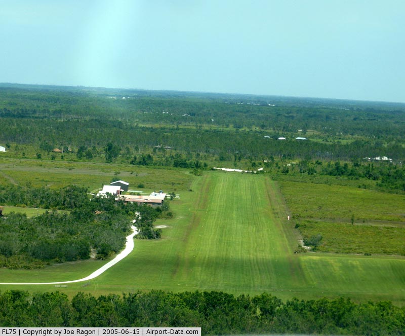
(Click on the photo to enlarge) |
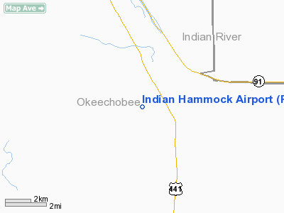
Location
& QuickFacts
|
FAA Information Effective: |
2007-01-18 |
|
Airport
Identifier: |
FL75 |
|
Airport
Status: |
Operational |
|
Longitude/Latitude: |
080-49-59.2180W/27-32-31.1330N
-80.833116/27.541981 (Estimated) |
|
Elevation: |
65 ft / 19.81 m (Estimated) |
|
Land: |
0 acres |
|
From
nearest city: |
2 nautical miles NW of Fort Drum, FL |
|
Location: |
Okeechobee County, FL |
|
Magnetic Variation: |
03W (1985) |
Owner
& Manager
|
Ownership: |
Privately owned |
|
Owner: |
Indian Hammock H&r Club Inc
INDIAN HAMMOCK HUNT & RIDING CLUB INC. |
|
Address: |
32801 Us Hwy 441 North #400
Okeechobee, FL 33472 |
|
Phone
number: |
813-763-9401 |
|
Manager: |
Wesley R. Holder |
|
Address: |
32801 Us Hwy 441 North #183
Okeechobee, FL 34972 |
|
Phone number: |
813-763-7676 |
Airport
Operations and Facilities
|
Airport Use: |
Private |
|
Wind
indicator: |
Yes |
|
Segmented
Circle: |
No |
|
Control
Tower: |
No |
|
Lighting
Schedule: |
RDO-CTL
ACTVT LIRL RY 11/29 - 122.8. |
|
Landing
fee charge: |
No |
|
Sectional
chart: |
Miami |
|
Region: |
ASO - Southern |
|
Boundary
ARTCC: |
ZMA - Miami |
|
Tie-in
FSS: |
PIE - Saint Petersburg |
|
FSS
Toll Free: |
1-800-WX-BRIEF |
|
Runway Information
Runway 11/29
|
Dimension: |
3000 x 100 ft / 914.4 x 30.5 m |
|
Surface: |
TURF, Good Condition |
|
Edge
Lights: |
Low |
|
|
Runway 11 |
Runway 29 |
|
Traffic
Pattern: |
Right |
Left |
|
Displaced
threshold: |
300.00 ft |
10.00
ft |
|
Radio Navigation
Aids
|
ID |
Type |
Name |
Ch |
Freq |
Var |
Dist |
|
VEP |
NDB |
Vero Beach |
|
392.00 |
04W |
23.2 nm |
|
FPR |
NDB |
Fort Pierce |
|
275.00 |
04W |
24.7 nm |
|
SQT |
NDB |
Satellite |
|
257.00 |
03W |
34.2 nm |
|
UTX |
NDB |
United |
|
405.00 |
03W |
46.4 nm |
|
COI |
NDB |
Merritt Island |
|
247.00 |
05W |
48.6 nm |
|
COF |
TACAN |
Patrick |
097X |
|
04W |
43.4 nm |
|
MLB |
VOR/DME |
Melbourne |
037X |
110.00 |
02W |
35.5 nm |
|
VRB |
VORTAC |
Vero Beach |
120X |
117.30 |
04W |
20.1 nm |
|
PHK |
VORTAC |
Pahokee |
101X |
115.40 |
00E |
46.3 nm |
|
VRB |
VOT |
Vero Beach |
|
111.00 |
|
23.2 nm |
Remarks
- 330
FT TWR 1 MILE NE OF ARPT.
- PVT
VFR USE; ALL TFC PATTERNS ESTAB SOUTH OF RWY AND RWY CENTERLINE EXTENDED.
Based Aircraft
|
Aircraft
based on field: |
8 |
|
Single
Engine Airplanes: |
7 |
|
Multi
Engine Airplanes: |
1 |
Indian Hammock Airport
Address:
Okeechobee County, FL
Tel:
813-763-9401,
813-763-7676
Images
and information placed above are from
http://www.airport-data.com/airport/FL75/
We
thank them for the data!
| General
Info |
| Country |
United
States |
| State |
FLORIDA
|
| FAA ID |
FL75
|
| Latitude |
27-32-31.133N
|
| Longitude |
080-49-59.218W
|
| Elevation |
65 feet
|
| Near City |
FORT DRUM
|
We don't guarantee the information is fresh and accurate. The data may
be wrong or outdated.
For more up-to-date information please refer to other sources.
|
|