 |
|
|
|
|
|
Location
& QuickFacts
|
FAA Information Effective: |
2007-01-18 |
|
Airport
Identifier: |
46FL |
|
Airport
Status: |
Operational |
|
Longitude/Latitude: |
080-49-19.1940W/28-37-45.9850N
-80.821998/28.629440 (Estimated) |
|
Elevation: |
10 ft / 3.05 m (Estimated) |
|
Land: |
0 acres |
|
From
nearest city: |
0 nautical miles N of Titusville, FL |
|
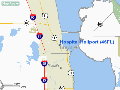
Location: |
Brevard County, FL |
|
Magnetic Variation: |
03W (1985) |
Owner
& Manager
|
Ownership: |
Privately owned |
|
Owner: |
Parrish Medical Center |
|
Address: |
951 N. Washington Ave
Titusville, FL 32796 |
|
Phone
number: |
321-268-6111
EXT 8711. |
|
Manager: |
Robert Connor |
|
Address: |
951 N. Washington Ave
Titusville, FL 32796 |
|
Phone number: |
321-268-6333 |
Airport
Operations and Facilities
|
Airport Use: |
Private
MEDICAL. |
|
Wind
indicator: |
Yes |
|
Segmented
Circle: |
No |
|
Control
Tower: |
No |
|
Lighting
Schedule: |
PHONE REQ
FOR HELIPAD LGTS, PHONE 305-268-6111. |
|
Landing
fee charge: |
No |
|
Sectional
chart: |
Jacksonville |
|
Region: |
ASO - Southern |
|
Boundary
ARTCC: |
ZMA - Miami |
|
Tie-in
FSS: |
PIE - Saint Petersburg |
|
FSS
on Airport: |
No |
|
FSS
Toll Free: |
1-800-WX-BRIEF |
|
Runway Information
Helipad H1
|
Dimension: |
32 x 32 ft / 9.8 x 9.8 m |
|
Surface: |
TURF, |
|
|
Runway H1 |
Runway |
|
Traffic
Pattern: |
Left |
Left |
|
Radio Navigation
Aids
|
ID |
Type |
Name |
Ch |
Freq |
Var |
Dist |
|
GGL |
NDB |
Geiger Lake |
|
375.00 |
05W |
2.2 nm |
|
COI |
NDB |
Merritt Island |
|
247.00 |
05W |
18.7 nm |
|
SFB |
NDB |
Sanford |
|
408.00 |
05W |
24.1 nm |
|
EVB |
NDB |
New Smyrna Beach |
|
417.00 |
04W |
26.3 nm |
|
SQT |
NDB |
Satellite |
|
257.00 |
03W |
32.5 nm |
|
DED |
NDB |
Deland/dcmsnd |
|
201.00 |
05W |
35.5 nm |
|
ISM |
NDB |
Kissimmee |
|
329.00 |
05W |
38.3 nm |
|
TTS |
TACAN |
Kennedy Space Center |
059Y |
|
00E |
6.7 nm |
|
COF |
TACAN |
Patrick |
097X |
|
04W |
26.0 nm |
|
MLB |
VOR/DME |
Melbourne |
037X |
110.00 |
02W |
33.0 nm |
|
ORL |
VORTAC |
Orlando |
059X |
112.20 |
00E |
27.6 nm |
|
OMN |
VORTAC |
Ormond Beach |
073X |
112.60 |
00E |
43.3 nm |
|
DAB |
VOT |
Daytona Beach |
|
111.00 |
|
35.4 nm |
Remarks
- VFR;
PRIVATE USE; ROUTINE TRAFFIC SHOULD REMAIN EAST OF HWAY US1 UNTIL CLEAR
OF DUNN AIRPARK TRAFFIC PATTERN.
Hospital Heliport
Address:
Brevard County, FL
Tel:
321-268-6111,
321-268-6333
Images
and information placed above are from
http://www.airport-data.com/airport/46FL/
We
thank them for the data!
| General
Info |
| Country |
United
States |
| State |
FLORIDA
|
| FAA ID |
46FL
|
| Latitude |
28-37-45.985N
|
| Longitude |
080-49-19.194W
|
| Elevation |
10 feet
|
| Near City |
TITUSVILLE
|
We don't guarantee the information is fresh and accurate. The data may
be wrong or outdated.
For more up-to-date information please refer to other sources.
|
|


