 |
|
Coordinates: 30°16′40″N 081°48′21″W / 30.27778°N 81.80583°W / 30.27778; -81.80583
| Herlong Airport |
| IATA: none – ICAO: KHEG – FAA LID: HEG |
| Summary |
| Airport type |
Public |
| Owner |
Jacksonville Aviation Authority |
| Serves |
Jacksonville, Florida |
| Location |
www.jaa.aero/... |
| Elevation AMSL |
87 ft / 27 m |
| Runways |
| Direction |
Length |
Surface |
| ft |
m |
| 7/25 |
4,000 |
1,219 |
Asphalt |
| 11/29 |
3,500 |
1,067 |
Asphalt |
| Statistics (1999) |
| Aircraft operations |
80,700 |
| Based aircraft |
162 |
| Source: Federal Aviation Administration |
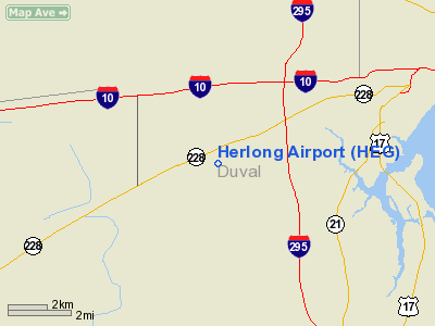
Herlong Airport (ICAO: KHEG, FAA LID: HEG) is a public airport located eight miles (13 km) southwest of the central business district of Jacksonville, a city in Duval County, Florida, United States. Although most U.S. airports use the same three-letter location identifier for the FAA and IATA, Herlong Airport is assigned HEG by the FAA but has no designation from the IATA.
The Jacksonville Aviation Authority (JAA) is the owner of all four public airports in Jacksonville and serves as the Fixed Base Operator (FBO) at Herlong. The airport was originally built during World War II to facilitate pilot training for the Navy and Air Force. After the war, the property was given to the city, and subsequently the JAA.
In recognition of the improvements and excellent operations, Herlong Airport was named the Florida Department of Transportation's General Aviation Airport of the Year in 2001.
Facilities and aircraft
Herlong Airport covers an area of 1,484 acres (601 ha) which contains two asphalt paved runways: 7/25 measuring 4,000 x 100 ft (1,219 x 30 m) and 11/29 measuring 3,500 x 100 ft (1,067 x 30 m).
For the 12-month period ending October 20, 1999, the airport had 80,700 aircraft operations, an average of 221 per day: 97% general aviation and 3% military. There are 162 aircraft based at this airport: 70% single-engine, 9% multi-engine, 10% ultralight, 8% glider and 2% helicopter.
The above content comes from Wikipedia and is published under free licenses – click here to read more.
Location
& QuickFacts
|
FAA Information Effective: |
2007-01-18 |
|
Airport
Identifier: |
HEG |
|
Airport
Status: |
Operational |
|
Longitude/Latitude: |
081-48-21.4100W/30-16-40.0400N
-81.805947/30.277789 (Estimated) |
|
Elevation: |
87 ft / 26.52 m (Estimated) |
|
Land: |
1484 acres |
|
From
nearest city: |
8 nautical miles SW of Jacksonville, FL |
|
Location: |
Duval County, FL |
|
Magnetic Variation: |
03W (1985) |
Owner
& Manager
|
Ownership: |
Publicly owned |
|
Owner: |
Jacksonville Airport Auth |
|
Address: |
P.o. Box 18018
Jacksonville, FL 32229-0018 |
|
Phone
number: |
904-573-1613 |
|
Manager: |
Aimee Clancy |
|
Address: |
9300 Normandy Blvd Bldg 4
Jacksonville, FL 32221 |
|
Phone number: |
904-783-2805
FBO (904) 783-2805. |
Airport
Operations and Facilities
|
Airport Use: |
Open to public |
|
Wind
indicator: |
Yes |
|
Segmented
Circle: |
Yes |
|
Control
Tower: |
No |
|
Lighting
Schedule: |
DUSK-DAWN
ACTVT MIRL RY 07/25 & 11/29 - CTAF. |
|
Beacon
Color: |
Clear-Green (lighted land airport) |
|
Landing
fee charge: |
No |
|
Sectional
chart: |
Jacksonville |
|
Region: |
ASO - Southern |
|
Boundary
ARTCC: |
ZJX - Jacksonville |
|
Tie-in
FSS: |
GNV - Gainesville |
|
FSS
on Airport: |
No |
|
FSS
Phone: |
850-377-3291 |
|
FSS
Toll Free: |
1-800-WX-BRIEF |
|
NOTAMs
Facility: |
GNV (NOTAM-d service avaliable) |
|
Federal Agreements: |
NGRY |
Airport
Communications
|
CTAF: |
123.000 |
|
Unicom: |
123.000 |
Airport
Services
|
Fuel available: |
100LLA |
|
Airframe Repair: |
MAJOR |
|
Power Plant Repair: |
MAJOR |
|
Bottled
Oxygen: |
NONE |
|
Bulk
Oxygen: |
NONE |
|
Runway Information
Runway 07/25
|
Dimension: |
4000 x 100 ft / 1219.2 x 30.5 m |
|
Surface: |
ASPH, Good Condition |
|
Weight
Limit: |
Single wheel: 30000 lbs. |
|
Edge
Lights: |
Medium |
|
|
Runway 07 |
Runway 25 |
|
Longitude: |
081-48-53.6600W |
081-48-12.4000W |
|
Latitude: |
30-16-34.9100N |
30-16-51.8400N |
|
Elevation: |
74.00 ft |
80.00 ft |
|
Alignment: |
65 |
127 |
|
Traffic
Pattern: |
Left |
Left |
|
Markings: |
Non-precision instrument, Good Condition |
Non-precision instrument, Good Condition |
|
Crossing
Height: |
34.00 ft |
34.00 ft |
|
VASI: |
2-box on left side |
2-box on left side |
|
Visual
Glide Angle: |
3.00� |
3.00� |
|
Obstruction: |
42 ft trees, 1656.0 ft from runway, 34:1 slope
to clear |
44 ft trees, 1970.0 ft from runway, 40:1 slope
to clear |
|
Runway 11/29
|
Dimension: |
3500 x 100 ft / 1066.8 x 30.5 m |
|
Surface: |
ASPH, Good Condition |
|
Weight
Limit: |
Single wheel: 30000 lbs. |
|
Edge
Lights: |
Medium |
|
|
Runway 11 |
Runway 29 |
|
Longitude: |
081-48-26.9700W |
081-47-49.2800W |
|
Latitude: |
30-16-42.0800N |
30-16-30.3800N |
|
Elevation: |
87.00 ft |
84.00 ft |
|
Traffic
Pattern: |
Left |
Left |
|
Markings: |
Basic, Good Condition |
Basic, Good Condition |
|
Obstruction: |
46 ft trees, 1766.0 ft from runway, 34:1 slope
to clear |
41 ft trees, 1619.0 ft from runway, 34:1 slope
to clear |
|
Radio Navigation
Aids
|
ID |
Type |
Name |
Ch |
Freq |
Var |
Dist |
|
HEG |
NDB |
Herlong |
|
332.00 |
02W |
0.2 nm |
|
JA |
NDB |
Dinns |
|
344.00 |
03W |
11.3 nm |
|
EYA |
NDB |
Eastport |
|
357.00 |
03W |
13.4 nm |
|
IAK |
NDB |
Palatka |
|
243.00 |
05W |
37.6 nm |
|
LCQ |
NDB |
Lake City |
|
204.00 |
03W |
40.5 nm |
|
GN |
NDB |
Wynds |
|
269.00 |
04W |
41.2 nm |
|
NZC |
TACAN |
Cecil/dcmsnd |
088X |
|
04W |
4.8 nm |
|
NIP |
TACAN |
Jacksonville |
19X |
|
04W |
7.3 nm |
|
NRB |
TACAN |
Mayport |
051X |
|
03W |
21.0 nm |
|
VQQ |
VOR |
Cecil |
|
117.90 |
03W |
5.9 nm |
|
SGJ |
VOR/DME |
St Augustine |
031X |
109.40 |
06W |
31.4 nm |
|
CRG |
VORTAC |
Craig |
092X |
114.50 |
03W |
15.8 nm |
|
TAY |
VORTAC |
Taylor |
076X |
112.90 |
03W |
41.1 nm |
|
GNV |
VORTAC |
Gators |
109X |
116.20 |
04W |
42.8 nm |
|
JAX |
VOT |
Jacksonville Intl |
|
111.00 |
|
14.3 nm |
Remarks
- ULTRALIGHT
& GLIDER ACTIVITY ON & INVOF ARPT.
- GCO
AVBL ON FRE 121.725 THRU JAX CLEARANCE DELIVERY AND GNV AFSS.
- VFR
OPERATIONS ONLY.
Based Aircraft
|
Aircraft
based on field: |
162 |
|
Single
Engine Airplanes: |
114 |
|
Multi
Engine Airplanes: |
15 |
|
Helicopters: |
3 |
|
Gliders: |
13 |
|
Ultralights: |
17 |
Operational Statistics
Time Period: 1998-10-21
- 1999-10-20
|
Aircraft
Operations: |
222/Day |
|
General
Aviation Local: |
53.3% |
|
General
Aviation Itinerant: |
43.4% |
|
Military: |
3.3% |
Herlong Airport
Address:
Duval County, FL
Tel:
904-573-1613,
904-783-2805
Images
and information placed above are from
http://www.airport-data.com/airport/HEG/
We
thank them for the data!
| General
Info |
| Country |
United
States |
| State |
FLORIDA
|
| FAA ID |
HEG
|
| Latitude |
30-16-40.040N
|
| Longitude |
081-48-21.410W
|
| Elevation |
87 feet
|
| Near City |
JACKSONVILLE
|
We don't guarantee the information is fresh and accurate. The data may
be wrong or outdated.
For more up-to-date information please refer to other sources.
|
|


