 |
|
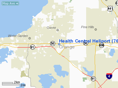
Location
& QuickFacts
|
FAA Information Effective: |
2007-01-18 |
|
Airport
Identifier: |
76FL |
|
Airport
Status: |
Operational |
|
Longitude/Latitude: |
081-31-41.0000W/28-33-02.0000N
-81.528056/28.550556 (Estimated) |
|
Elevation: |
128 ft / 39.01 m (Estimated) |
|
Land: |
0 acres |
|
From
nearest city: |
1 nautical miles SE of Ocoee, FL |
|
Location: |
Orange County, FL |
|
Magnetic Variation: |
04W (1995) |
Owner
& Manager
|
Ownership: |
Privately owned |
|
Owner: |
Health Central |
|
Address: |
10000 West Colonial Drive
Ocoee, FL 34761 |
|
Phone
number: |
407-296-1710 |
|
Manager: |
Health Central |
|
Address: |
10000 West Colonial Drive
Ocoee, FL 34761 |
|
Phone number: |
407-296-1710 |
Airport
Operations and Facilities
|
Airport Use: |
Private
MEDICAL USE. |
|
Wind
indicator: |
Yes |
|
Segmented
Circle: |
No |
|
Control
Tower: |
No |
|
Sectional
chart: |
Jacksonville |
|
Region: |
ASO - Southern |
|
Boundary
ARTCC: |
ZJX - Jacksonville |
|
Tie-in
FSS: |
PIE - Saint Petersburg |
|
FSS
on Airport: |
No |
|
FSS
Toll Free: |
1-800-WX-BRIEF |
|
Runway Information
Helipad H1
|
Dimension: |
42 x 42 ft / 12.8 x 12.8 m |
|
Surface: |
CONC, |
|
|
Runway H1 |
Runway |
|
Traffic
Pattern: |
Left |
Left |
|
Radio Navigation
Aids
|
ID |
Type |
Name |
Ch |
Freq |
Var |
Dist |
|
ISM |
NDB |
Kissimmee |
|
329.00 |
05W |
16.5 nm |
|
SFB |
NDB |
Sanford |
|
408.00 |
05W |
20.6 nm |
|
LEE |
NDB |
Leesburg |
|
335.00 |
04W |
21.8 nm |
|
DED |
NDB |
Deland/dcmsnd |
|
201.00 |
05W |
33.8 nm |
|
GGL |
NDB |
Geiger Lake |
|
375.00 |
05W |
37.7 nm |
|
RHZ |
NDB |
Zephyrhills |
|
253.00 |
03W |
38.5 nm |
|
EVB |
NDB |
New Smyrna Beach |
|
417.00 |
04W |
43.3 nm |
|
COI |
NDB |
Merritt Island |
|
247.00 |
05W |
46.1 nm |
|
PCM |
NDB |
Plant City |
|
346.00 |
02W |
46.8 nm |
|
TTS |
TACAN |
Kennedy Space Center |
059Y |
|
00E |
44.2 nm |
|
ORL |
VORTAC |
Orlando |
059X |
112.20 |
00E |
10.2 nm |
|
LAL |
VORTAC |
Lakeland |
107X |
116.00 |
01E |
42.6 nm |
|
DAB |
VOT |
Daytona Beach |
|
111.00 |
|
45.3 nm |
Remarks
- PRVDD
PVT/VFR USE; APCH/DEP ROUTE CONDUCTED 040 CLKWS 120 USING HELIPAD AS
CENTER OF COMPASS ROSE; MARKING PER AC 150-5390.2A; WIND INDICATOR IS
MAINTAINED.
Based Aircraft
|
Aircraft
based on field: |
2 |
|
Helicopters: |
2 |
Health Central Heliport
Address:
Orange County, FL
Tel:
407-296-1710
Images
and information placed above are from
http://www.airport-data.com/airport/76FL/
We
thank them for the data!
| General
Info |
| Country |
United
States |
| State |
FLORIDA
|
| FAA ID |
76FL
|
| Latitude |
28-33-02.000N
|
| Longitude |
081-31-41.000W
|
| Elevation |
128 feet
|
| Near City |
OCOEE
|
We don't guarantee the information is fresh and accurate. The data may
be wrong or outdated.
For more up-to-date information please refer to other sources.
|
|


