 |
|
Fort Walton Beach Airport |
Coordinates: 30°24′23″N 086°49′45″W / 30.40639°N 86.82917°W / 30.40639; -86.82917
| Fort Walton Beach Airport |
| IATA: none – ICAO: none – FAA LID: 1J9 |
| Summary |
| Airport type |
Public |
| Owner |
John S. Williams |
| Location |
Navarre, Florida |
| Elevation AMSL |
22 ft / 7 m |
| Runways |
| Direction |
Length |
Surface |
| ft |
m |
| 18/36 |
2,100 |
640 |
Turf |
| Statistics (2002) |
| Aircraft operations |
8,030 |
| Source: Federal Aviation Administration |
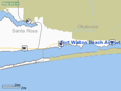
Fort Walton Beach Airport (FAA LID: 1J9) is a public-use airport located two miles (3 km) east of the central business district of Navarre, in Santa Rosa County, Florida, United States. It is privately owned by John S. Williams.
Facilities and aircraft
Fort Walton Beach Airport covers an area of 15 acres (6 ha) and contains one runway designated 18/36 with a turf surface measuring 2,100 x 65 ft (640 x 20 m). For the 12-month period ending May 23, 2002, the airport had 8,030 general aviation aircraft operations, an average of 22 per day.
The above content comes from Wikipedia and is published under free licenses – click here to read more.
Location
& QuickFacts
|
FAA Information Effective: |
2007-01-18 |
|
Airport
Identifier: |
1J9 |
|
Airport
Status: |
Operational |
|
Longitude/Latitude: |
086-49-44.8510W/30-24-22.7160N
-86.829125/30.406310 (Estimated) |
|
Elevation: |
22 ft / 6.71 m (Surveyed) |
|
Land: |
15 acres |
|
From
nearest city: |
2 nautical miles E of Navarre, FL |
|
Location: |
Santa Rosa County, FL |
|
Magnetic Variation: |
01E (1985) |
Owner
& Manager
|
Ownership: |
Privately owned |
|
Owner: |
John S. Williams |
|
Address: |
P.o. Box 1075
Fort Walton, FL 32549 |
|
Phone
number: |
850-244-1313 |
|
Manager: |
Mark Williams |
|
Address: |
Po Box 1075
Ft Walton Beach, FL 32549 |
|
Phone number: |
850-244-1313 |
Airport
Operations and Facilities
|
Airport Use: |
Open to public |
|
Wind
indicator: |
Yes |
|
Segmented
Circle: |
No |
|
Control
Tower: |
No |
|
Landing
fee charge: |
No |
|
Sectional
chart: |
New Orleans |
|
Region: |
ASO - Southern |
|
Boundary
ARTCC: |
ZJX - Jacksonville |
|
Tie-in
FSS: |
GNV - Gainesville |
|
FSS
on Airport: |
No |
|
FSS
Phone: |
850-377-3291 |
|
FSS
Toll Free: |
1-800-WX-BRIEF |
|
NOTAMs
Facility: |
GNV (NOTAM-d service avaliable) |
Airport
Communications
|
CTAF: |
122.700 |
|
Unicom: |
122.700 |
Airport
Services
|
Airframe Repair: |
NONE |
|
Power Plant Repair: |
NONE |
|
Bottled
Oxygen: |
NONE |
|
Bulk
Oxygen: |
NONE |
|
Runway Information
Runway 18/36
|
Dimension: |
2100 x 65 ft / 640.1 x 19.8 m |
|
Surface: |
TURF, Poor Condition
RWY 18/36 BARE SPOTS SOFT & SANDY SOUTH OF RWYS MID POINT. |
|
|
Runway 18 |
Runway 36 |
|
Traffic
Pattern: |
Left |
Left |
|
Obstruction: |
15 ft road, 120.0 ft from runway, 5:1 slope
to clear |
, 50:1 slope to clear
BRUSH IN PRIMARY SFC & TRANSITION ZONES FY 36 +/- 100
FT FROM CNTRLN.
ACFT PARKED 80 FT FROM CNTRLN. |
|
Radio Navigation
Aids
|
ID |
Type |
Name |
Ch |
Freq |
Var |
Dist |
|
PKZ |
NDB |
Pickens |
|
326.00 |
01E |
18.2 nm |
|
DTS |
NDB |
Destin |
|
254.00 |
01W |
18.4 nm |
|
ESU |
NDB |
Summerdale |
|
204.00 |
01E |
46.8 nm |
|
HRT |
TACAN |
Hurlburt |
045X |
|
00E |
7.3 nm |
|
NGS |
TACAN |
Santa Rosa |
063X |
|
01E |
13.7 nm |
|
DWG |
TACAN |
Warrington |
002X |
|
00E |
16.5 nm |
|
NSE |
TACAN |
Whiting |
070X |
|
01E |
21.5 nm |
|
NPA |
TACAN |
Pensacola |
119X |
|
01E |
25.4 nm |
|
NUN |
VOR |
Saufley |
|
108.80 |
01E |
26.6 nm |
|
CEW |
VORTAC |
Crestview |
106X |
115.90 |
03E |
26.4 nm |
Remarks
- RY
18/36 SLOPES TO 3 FT ELEVATION AT SOUTH END.
- BANNER
TOWING.
- NO
HEL OPNS.
- RY
18/36 MARKED WITH WHITE CONES.
- EXISTED
PRIOR TO 1959.
Based Aircraft
|
Aircraft
based on field: |
6 |
|
Single
Engine Airplanes: |
6 |
Operational Statistics
Time Period: 2001-05-24
- 2002-05-23
|
Aircraft
Operations: |
155/Week |
|
General
Aviation Local: |
90.7% |
|
General
Aviation Itinerant: |
9.3% |
Fort Walton Beach Airport
Address:
Santa Rosa County, FL
Tel:
850-244-1313
Images
and information placed above are from
http://www.airport-data.com/airport/1J9/
We
thank them for the data!
| General
Info |
| Country |
United
States |
| State |
FLORIDA
|
| FAA ID |
1J9
|
| Latitude |
30-24-22.716N
|
| Longitude |
086-49-44.851W
|
| Elevation |
22 feet
|
| Near City |
NAVARRE
|
We don't guarantee the information is fresh and accurate. The data may
be wrong or outdated.
For more up-to-date information please refer to other sources.
|
|


