 |
|
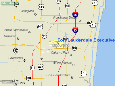
Fort Lauderdale Executive Airport |
Coordinates: 26°11′50″N 080°10′15″W / 26.19722°N 80.17083°W / 26.19722; -80.17083
| Fort Lauderdale Executive Airport |
| IATA: FXE – ICAO: KFXE – FAA LID: FXE |
| Summary |
| Airport type |
Public |
| Owner |
City of Fort Lauderdale |
| Location |
Fort Lauderdale, Florida |
| Elevation AMSL |
13 ft / 4 m |
| Website |
ci.FtLaud.fl.us/FXE/ |
| Runways |
| Direction |
Length |
Surface |
| ft |
m |
| 8/26 |
6,001 |
1,829 |
Asphalt |
| 13/31 |
4,000 |
1,219 |
Asphalt |
| Statistics (2001) |
| Aircraft operations |
261,163 |
| Based aircraft |
708 |
| Source: Federal Aviation Administration |
Fort Lauderdale Executive Airport (IATA: FXE, ICAO: KFXE, FAA LID: FXE) is a general aviation airport located within the city limits of Fort Lauderdale, in Broward County, Florida, United States, five miles (8 km) north of downtown Fort Lauderdale. It is a division of the Community and Economic Development Department of the City of Fort Lauderdale.
The airport was built in 1941 to train Naval Aviators during World War II, and named West Prospect Satellite Field. In 1947, the federal government deeded the airport to Fort Lauderdale for use as a public airport.
The airport serves over 250,000 aircraft operations per year, making it the eighth busiest General Aviation center in the United States. The airport is designated as general aviation reliever facility for the Fort Lauderdale-Hollywood International Airport by the FAA. The airport is a port of entry with a full service Customs facility. The airport also operates a 24 ARFF facility that meets the requirements of index B, although the airport is not certificated under FAR Part 139. ARFF services are provided by Fort Lauderdale Fire-Rescue
The airport is home to two rare Florida native species of animal, the Gopher Tortoise and the Florida Burrowing Owl. Facilities and aircraft
Fort Lauderdale Executive Airport covers an area of 1,050 acres (425 ha) which contains two asphalt paved runways: 8/26 measuring 6,001 x 100 ft (1,829 x 30 m) and 13/31 measuring 4,000 x 100 ft (1,219 x 30 m).
For the 12-month period ending December 31, 2001, the airport had 261,163 aircraft operations, an average of 715 per day: 94% general aviation, 6% air taxi and <1% military. There are 708 aircraft based at this airport: 52% single-engine, 26% multi-engine, 16% jet and 5% helicopter.
Accidents and incidents
- On 12 June 1979, Douglas DC-3D N427W of Bradley Aviation crashed shortly after take-off when take-off was attempted at too low an airspeed. Both crew were killed. The pilot did not have a rating to fly the DC-3 and the aircraft did not have a certificate of airworthiness.
- On 20 February 2004 a Learjet 25B owned by Skylinks Jets overran runway 8 by about 1,750 feet (530 m) feet. The aircraft touched down midway along the runway. A complete loss of brakes and a failed emergency drag-chute resulted in the aircraft overrunning the runway, crashing through the airport perimeter fence, across a four-lane highway and coming to a rest at a warehouse structure. The cause of the accident was the pilot-in-commands mis-calculation of fuel needed and a failure of the flight crew to deploy the emergency drag-chute and main-gear brakes upon landing.
- On 13 June 2005, Douglas R4D-8 N3906J of Air Pony Express suffered an engine failure shortly after take-off on an international cargo flight to Marsh Harbour Airport, Marsh Harbour, Bahamas. The aircraft was written off when it was put down on a road in the Coral Ridge Isles neighbourhood, hitting trees and a building and subsequently catching fire. The engine that failed had had maintenance work performed immediately before the accident flight.
- Preliminary reports indicate that a Cessna 421 crashed shortly after take off from the airport around 11:20 a.m., April 17, 2009. Local authorities stated the aircraft crashed into a vacant home located about two miles from the airport. The aircraft was en route to Fernandina Beach, Florida near Jacksonville and was due to arrive at 13:00. The Federal Aviation Administration indicated that one person was on board the aircraft. Sebring Air Charter of Tamarac, Florida is listed on FAA records as the owner of the aircraft. The cause of the crash is currently under investigation.
The above content comes from Wikipedia and is published under free licenses – click here to read more.
Location
& QuickFacts
|
FAA Information Effective: |
2007-01-18 |
|
Airport
Identifier: |
FXE |
|
Airport
Status: |
Operational |
|
Longitude/Latitude: |
080-10-14.5426W/26-11-50.2057N
-80.170706/26.197279 (Estimated) |
|
Elevation: |
13 ft / 3.96 m (Surveyed) |
|
Land: |
1050 acres |
|
From
nearest city: |
5 nautical miles N of Fort Lauderdale, FL |
|
Location: |
Broward County, FL |
|
Magnetic Variation: |
03W (1985) |
Owner
& Manager
|
Ownership: |
Publicly owned |
|
Owner: |
City Of Fort Lauderdale |
|
Address: |
6000 Nw 21st Ave Suite 200
Fort Lauderdale, FL 33309 |
|
Phone
number: |
954-828-4966 |
|
Manager: |
Clara Bennett |
|
Address: |
6000 Nw 21st Ave Suite 200
Ft Lauderdale, FL 33309 |
|
Phone number: |
954-828-4966 |
Airport
Operations and Facilities
|
Airport Use: |
Open to public |
|
Wind
indicator: |
Yes |
|
Segmented
Circle: |
Yes |
|
Control
Tower: |
Yes |
|
Lighting
Schedule: |
DUSK-DAWN |
|
Beacon
Color: |
Clear-Green (lighted land airport) |
|
Landing
fee charge: |
No |
|
Sectional
chart: |
Miami |
|
Region: |
ASO - Southern |
|
Traffic
Pattern Alt: |
1000 ft |
|
Boundary
ARTCC: |
ZMA - Miami |
|
Tie-in
FSS: |
MIA - Miami |
|
FSS
on Airport: |
No |
|
FSS
Phone: |
305-233-2600 |
|
FSS
Toll Free: |
1-800-WX-BRIEF |
|
NOTAMs
Facility: |
FXE (NOTAM-d service avaliable) |
|
Federal Agreements: |
NGRY |
Airport
Communications
Airport
Services
|
Fuel available: |
100LLA |
|
Airframe Repair: |
MAJOR |
|
Power Plant Repair: |
MAJOR |
|
Bottled
Oxygen: |
HIGH |
|
Bulk
Oxygen: |
HIGH |
|
Runway Information
Runway 08/26
|
Dimension: |
6001 x 100 ft / 1829.1 x 30.5 m |
|
Surface: |
ASPH, Good Condition |
|
Surface
Treatment: |
Saw-cut or plastic Grooved |
|
Weight
Limit: |
Single wheel: 30000 lbs.
Dual wheel: 60000 lbs. |
|
Edge
Lights: |
High |
|
|
Runway 08 |
Runway 26 |
|
Longitude: |
080-10-51.1140W |
080-09-45.6240W |
|
Latitude: |
26-11-51.2701N |
26-11-57.7027N |
|
Elevation: |
12.00
ft |
12.00
ft |
|
Alignment: |
84 |
127 |
|
ILS
Type: |
ILS |
|
|
Traffic
Pattern: |
Left |
Left |
|
Markings: |
Precision instrument, Good Condition |
Precision instrument, Good Condition |
|
Crossing
Height: |
44.00 ft |
28.00 ft |
|
VASI: |
4-light PAPI on left side |
4-light PAPI on left side |
|
Visual
Glide Angle: |
3.00� |
3.25� |
|
Approach
lights: |
MALSR |
|
|
Runway
End Identifier: |
|
Yes |
|
Obstruction: |
, 50:1 slope to clear |
50 ft trees, 1900.0 ft from runway, 500 ft
left of centerline, 34:1 slope to clear |
|
Runway 13/31
|
Dimension: |
4000 x 100 ft / 1219.2 x 30.5 m |
|
Surface: |
ASPH, Good Condition |
|
Weight
Limit: |
Single wheel: 30000 lbs.
Dual wheel: 60000 lbs. |
|
Edge
Lights: |
Medium |
|
|
Runway 13 |
Runway 31 |
|
Longitude: |
080-10-25.9187W |
080-09-51.6963W |
|
Latitude: |
26-11-56.1911N |
26-11-31.3709N |
|
Elevation: |
12.00
ft |
12.00
ft |
|
Alignment: |
127 |
127 |
|
Traffic
Pattern: |
Left |
Left |
|
Markings: |
Precision instrument, Good Condition |
Precision instrument, Good Condition |
|
Crossing
Height: |
40.00 ft |
48.00 ft |
|
VASI: |
2-light PAPI on left side |
2-light PAPI on left side |
|
Visual
Glide Angle: |
3.25� |
3.25� |
|
Runway
End Identifier: |
Yes |
Yes |
|
Obstruction: |
17 ft trees, 776.0 ft from runway, 33:1 slope
to clear |
15 ft road, 710.0 ft from runway, 34:1 slope
to clear |
|
Radio Navigation
Aids
|
ID |
Type |
Name |
Ch |
Freq |
Var |
Dist |
|
PJN |
NDB |
Plantation |
|
242.00 |
03W |
4.7 nm |
|
FX |
NDB |
Praiz |
|
221.00 |
02W |
6.9 nm |
|
PB |
NDB |
Rubin |
|
356.00 |
03W |
29.6 nm |
|
UTX |
NDB |
United |
|
405.00 |
03W |
43.7 nm |
|
HST |
TACAN |
Homestead |
019X |
|
03W |
44.0 nm |
|
FLL |
VOR/DME |
Fort Lauderdale |
091X |
114.40 |
00E |
7.4 nm |
|
VKZ |
VOR/DME |
Virginia Key |
118X |
117.10 |
04W |
26.8 nm |
|
DHP |
VORTAC |
Dolphin |
086X |
113.90 |
04W |
25.8 nm |
|
PBI |
VORTAC |
Palm Beach |
104X |
115.70 |
03W |
29.4 nm |
|
PHK |
VORTAC |
Pahokee |
101X |
115.40 |
00E |
45.0 nm |
|
MIA |
VOT |
Miami Intl |
|
112.00 |
|
24.9 nm |
|
PBI |
VOT |
Palm Beach |
|
109.00 |
|
29.7 nm |
Remarks
- VOLUNTARY
RESTRICTION OF JET ACFT ON RY 13/31. REQ QUIET ONE DEP FOR RY 08 EASTBOUND
2200-0700. ALL
RYS USE NBAA STANDARD NOISE ABATEMENT DEPS.
- WHEN
REPORTED CEILING & VIS MINS ARE BLO 800 FT OR TWO MILES; TWY 'A'
WILL BE CLSD.
- REQUEST
PROGRESSIVE TAXI IF UNFAMILIAR.
- PORTIONS
OF RY 31 RUN-UP AREA(WEST OF TWY 'B')ARE NOT VISIBLE FROM THE ATCT.
- FLOCKS
OF BIRDS ON & INVOF ARPT.
- ALL
RYS NOISE SENSITIVE & MONITORED 24 HRS.
- JET
RUNUPS PROHIBITED 1900-0700
- ALL
ACFT OPERATORS AVOID OVERFLIGHTS OF RESIDENTIAL AREA ONE-HALF MILE SW
OF ATCT.
- RY
26 NIGHTTIME PREFERENTIAL USE RY.
- TAXILANE
'C'(SW OF TWY 'B') IS A NON-CONTROLLED OPERATIONAL AREA.
- TWY
'A' IS RSTRD TO ACFT WEIGHING UP TO 12500 LBS.
Based Aircraft
|
Aircraft
based on field: |
708 |
|
Single
Engine Airplanes: |
369 |
|
Multi
Engine Airplanes: |
187 |
|
Jet Engine
Airplanes: |
115 |
|
Helicopters: |
37 |
Operational Statistics
Time Period: 2001-01-01
- 2001-12-31
|
Aircraft
Operations: |
716/Day |
|
Air Taxi: |
5.6% |
|
General
Aviation Local: |
24.4% |
|
General
Aviation Itinerant: |
70.0% |
|
Military: |
0.0% |
Fort Lauderdale Executive Airport
Address:
Broward County, FL
Tel:
954-828-4966
Images
and information placed above are from
http://www.airport-data.com/airport/FXE/
We
thank them for the data!
| General
Info |
| Country |
United
States |
| State |
FLORIDA
|
| FAA ID |
FXE
|
| Latitude |
26-11-50.208N
|
| Longitude |
080-10-14.550W
|
| Elevation |
14 feet
|
| Near City |
FORT LAUDERDALE
|
We don't guarantee the information is fresh and accurate. The data may
be wrong or outdated.
For more up-to-date information please refer to other sources.
|
|


