 |
|
|
|
|
|
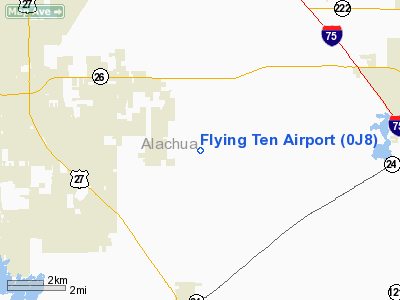
Location
& QuickFacts
|
FAA Information Effective: |
2007-01-18 |
|
Airport
Identifier: |
0J8 |
|
Airport
Status: |
Operational |
|
Longitude/Latitude: |
082-30-31.3930W/29-37-04.8800N
-82.508720/29.618022 (Estimated) |
|
Elevation: |
85 ft / 25.91 m (Estimated) |
|
Land: |
55 acres |
|
From
nearest city: |
5 nautical miles N of Archer, FL |
|
Location: |
Alachua County, FL |
|
Magnetic Variation: |
02W (1985) |
Owner
& Manager
|
Ownership: |
Privately owned |
|
Owner: |
Flying Ten, Inc. |
|
Address: |
7 Airport Lane
Archer, FL 32618 |
|
Phone
number: |
352-495-2559 |
|
Manager: |
Frank Ogborn |
|
Address: |
3906 Sw 154th St
Archer, FL 32618 |
|
Phone number: |
352-495-2559 |
Airport
Operations and Facilities
|
Airport Use: |
Open to public |
|
Wind
indicator: |
Yes |
|
Segmented
Circle: |
No |
|
Control
Tower: |
No |
|
Lighting
Schedule: |
PHONE REQ
FOR RY 18/36 LIRL CALL 352-495-2559 OR 352-495-1190 AFTER
HRS. |
|
Landing
fee charge: |
No |
|
Sectional
chart: |
Jacksonville |
|
Region: |
ASO - Southern |
|
Boundary
ARTCC: |
ZJX - Jacksonville |
|
Tie-in
FSS: |
GNV - Gainesville |
|
FSS
on Airport: |
No |
|
FSS
Phone: |
850-377-3291 |
|
FSS
Toll Free: |
1-800-WX-BRIEF |
|
NOTAMs
Facility: |
GNV (NOTAM-d service avaliable) |
Airport
Communications
Airport
Services
|
Fuel available: |
100LL |
|
Bottled
Oxygen: |
NONE |
|
Bulk
Oxygen: |
NONE |
|
Runway Information
Runway 18/36
|
Dimension: |
3200 x 170 ft / 975.4 x 51.8 m |
|
Surface: |
TURF, Fair Condition |
|
Edge
Lights: |
Non-standard lighting system
RY 18/36 NSTD LIRL: NSTD SPACING OF RY LGTS & LGTS ARE OF VERY
LOW INTST. |
|
|
Runway 18 |
Runway 36 |
|
Traffic
Pattern: |
Left |
Left |
|
Obstruction: |
60 ft trees, 1500.0 ft from runway, 25:1 slope
to clear
35 FT TREES 95 FT E & W OF RY 18/36 CNTRLN ENTIRE LENGTH
OF RY. 4 FT FENCE 90 FT W OF RY CNTRLN ENTIRE LENGTH OF RY. |
15 ft road, 300.0 ft from runway, 20:1 slope
to clear |
|
Radio Navigation
Aids
|
ID |
Type |
Name |
Ch |
Freq |
Var |
Dist |
|
GN |
NDB |
Wynds |
|
269.00 |
04W |
17.9 nm |
|
LCQ |
NDB |
Lake City |
|
204.00 |
03W |
34.3 nm |
|
IAK |
NDB |
Palatka |
|
243.00 |
05W |
36.5 nm |
|
NZC |
TACAN |
Cecil/dcmsnd |
088X |
|
04W |
49.1 nm |
|
VQQ |
VOR |
Cecil |
|
117.90 |
03W |
48.1 nm |
|
GNV |
VORTAC |
Gators |
109X |
116.20 |
04W |
13.1 nm |
|
CTY |
VORTAC |
Cross City |
057X |
112.00 |
02W |
28.2 nm |
|
OCF |
VORTAC |
Ocala |
084X |
113.70 |
00E |
30.3 nm |
Remarks
- PUBLIC
USE, VFR OPERATIONS ONLY.
Based Aircraft
|
Aircraft
based on field: |
23 |
|
Single
Engine Airplanes: |
20 |
|
Helicopters: |
2 |
|
Ultralights: |
1 |
Operational Statistics
Time Period: 1998-10-22
- 1999-10-21
|
Aircraft
Operations: |
83/Day |
|
General
Aviation Local: |
66.7% |
|
General
Aviation Itinerant: |
33.3% |
Flying Ten Airport
Address:
Alachua County, FL
Tel:
352-495-2559
Images
and information placed above are from
http://www.airport-data.com/airport/0J8/
We
thank them for the data!
| General
Info |
| Country |
United
States |
| State |
FLORIDA
|
| FAA ID |
0J8
|
| Latitude |
29-37-04.880N
|
| Longitude |
082-30-31.393W
|
| Elevation |
85 feet
|
| Near City |
ARCHER
|
We don't guarantee the information is fresh and accurate. The data may
be wrong or outdated.
For more up-to-date information please refer to other sources.
|
|


