 |
|
|
|
|
|
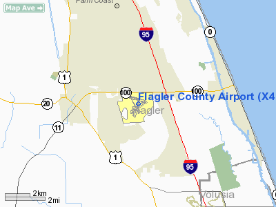
Location
& QuickFacts
|
FAA Information Effective: |
2007-01-18 |
|
Airport
Identifier: |
X47 |
|
Airport
Status: |
Operational |
|
Longitude/Latitude: |
081-12-22.8000W/29-28-02.6000N
-81.206333/29.467389 (Estimated) |
|
Elevation: |
33 ft / 10.06 m (Estimated) |
|
Land: |
1145 acres |
|
From
nearest city: |
3 nautical miles E of Bunnell, FL |
|
Location: |
Flagler County, FL |
|
Magnetic Variation: |
03W (1985) |
Owner
& Manager
|
Ownership: |
Publicly owned |
|
Owner: |
Flagler County |
|
Address: |
1200 E. Moody Blvd #1
Bunnell, FL 32110 |
|
Phone
number: |
386-437-0401 |
|
Manager: |
Jack E. Thompson |
|
Address: |
201 Airport Rd
Palm Coast, FL 32164 |
|
Phone number: |
386-437-0401
386-437-7477. |
Airport
Operations and Facilities
|
Airport Use: |
Open to public |
|
Wind
indicator: |
Yes |
|
Segmented
Circle: |
Yes |
|
Control
Tower: |
No |
|
Lighting
Schedule: |
DUSK-DAWN |
|
Beacon
Color: |
Clear-Green (lighted land airport) |
|
Landing
fee charge: |
No |
|
Sectional
chart: |
Jacksonville |
|
Region: |
ASO - Southern |
|
Traffic
Pattern Alt: |
1000 ft |
|
Boundary
ARTCC: |
ZJX - Jacksonville |
|
Tie-in
FSS: |
GNV - Gainesville |
|
FSS
on Airport: |
No |
|
FSS
Phone: |
850-377-3291 |
|
FSS
Toll Free: |
1-800-WX-BRIEF |
|
NOTAMs
Facility: |
GNV (NOTAM-d service avaliable) |
|
Federal Agreements: |
NGRY3 |
Airport
Communications
|
CTAF: |
123.000 |
|
Unicom: |
123.000 |
Airport
Services
|
Fuel available: |
100LLA
FOR A FUEL AFTER HRS CALL 386-437-0401 24 HRS IN ADVANCE. |
|
Airframe Repair: |
MAJOR |
|
Power Plant Repair: |
MAJOR |
|
Bottled
Oxygen: |
NONE |
|
Bulk
Oxygen: |
NONE |
|
Runway Information
Runway 06/24
|
Dimension: |
5000 x 100 ft / 1524.0 x 30.5 m |
|
Surface: |
ASPH, Good Condition |
|
Weight
Limit: |
Single wheel: 60000 lbs. |
|
Edge
Lights: |
Medium |
|
|
Runway 06 |
Runway 24 |
|
Longitude: |
081-12-43.9557W |
081-11-57.9033W |
|
Latitude: |
29-27-38.6627N |
29-28-07.3956N |
|
Elevation: |
29.00 ft |
31.00 ft |
|
Alignment: |
55 |
127 |
|
Traffic
Pattern: |
Left |
Left |
|
Markings: |
Non-precision instrument, Poor Condition
RY 06/24 MARKINGS FADED. |
Non-precision instrument, Poor Condition |
|
Crossing
Height: |
40.00 ft |
40.00 ft |
|
VASI: |
2-light PAPI on left side |
2-light PAPI on left side |
|
Visual
Glide Angle: |
3.00� |
3.00� |
|
Obstruction: |
60 ft , 510.0 ft from runway, 240 ft left of
centerline, 5:1 slope to clear
APCH SLOPE 8:1 TO EOR. |
2 ft , 210.0 ft from runway, 5:1 slope to clear
APCH SLOPE 20:1 TO EOR. |
|
Runway 11/29
|
Dimension: |
4999 x 100 ft / 1523.7 x 30.5 m |
|
Surface: |
ASPH, Good Condition |
|
Weight
Limit: |
Single wheel: 60000 lbs. |
|
Edge
Lights: |
Medium |
|
|
Runway 11 |
Runway 29 |
|
Longitude: |
081-12-51.9821W |
081-11-57.5145W |
|
Latitude: |
29-28-18.7760N |
29-28-05.4565N |
|
Elevation: |
30.00 ft |
31.00 ft |
|
Alignment: |
106 |
127 |
|
Traffic
Pattern: |
Left |
Left |
|
Markings: |
Non-precision instrument, Poor Condition
RY 11/29 MARKINGS FADED. |
Non-precision instrument, Poor Condition |
|
Crossing
Height: |
40.00 ft |
40.00 ft |
|
VASI: |
2-light PAPI on left side |
2-light PAPI on left side |
|
Visual
Glide Angle: |
3.00� |
3.00� |
|
Obstruction: |
41 ft trees, 1600.0 ft from runway, 34:1 slope
to clear |
3 ft , 200.0 ft from runway
APCH SLOPE 20:1 TO EOR. |
|
Runway 18W/36W
|
Dimension: |
3000 x 500 ft / 914.4 x 152.4 m |
|
Surface: |
WATER, |
|
|
Runway 18W |
Runway 36W |
|
Elevation: |
22.00
ft |
22.00
ft |
|
Traffic
Pattern: |
Left |
Left |
|
Obstruction: |
40 ft trees, 800.0 ft from runway, 20:1 slope
to clear |
40 ft trees, 800.0 ft from runway, 20:1 slope
to clear |
|
Helipad H1
|
Dimension: |
36 x 36 ft / 11.0 x 11.0 m |
|
Surface: |
CONC-GRVL, |
|
|
Runway H1 |
Runway |
|
Traffic
Pattern: |
Left |
Left |
|
Radio Navigation
Aids
|
ID |
Type |
Name |
Ch |
Freq |
Var |
Dist |
|
DED |
NDB |
Deland/dcmsnd |
|
201.00 |
05W |
24.3 nm |
|
EVB |
NDB |
New Smyrna Beach |
|
417.00 |
04W |
28.5 nm |
|
IAK |
NDB |
Palatka |
|
243.00 |
05W |
33.6 nm |
|
SFB |
NDB |
Sanford |
|
408.00 |
05W |
41.1 nm |
|
SGJ |
VOR/DME |
St Augustine |
031X |
109.40 |
06W |
30.1 nm |
|
OMN |
VORTAC |
Ormond Beach |
073X |
112.60 |
00E |
11.0 nm |
|
DAB |
VOT |
Daytona Beach |
|
111.00 |
|
18.9 nm |
Remarks
- NOISE
ABATEMENT PROCEDURES IN EFFECT, CTC ARPT MGR FOR DETAILS AT (386) 437-0401.
- TGL
AND STOP AND GO LDGS PROHIBITED EXCEPT BY PRIOR PERMISSION FRM ARPT
MGR 386-437-0401.
- NOISE
SENSITIVE AREA NORTHWEST QUADRANT.
- CAUTION:
OCNL ULTRALIGHT AND GYRO-COPTER ACTIVITY CENTER AND SOUTH OF ARPT.
- TWY
D SOUTH OF TWY E CLSD INDEFLY.
- TWY
C SOUTH OF RY 06/24 CLSD INDEFLY.
- ALL
ACFT MUST COME TO FULL STOP AND USE ARPT TAXI PATTERN.
- FOR
SEAPLANE REFUELING AT LAKE CALL 386-437-0401 24 HRS IN ADVANCE.
- EXISTED
PRIOR TO 1959.
Based Aircraft
|
Aircraft
based on field: |
72 |
|
Single
Engine Airplanes: |
60 |
|
Multi
Engine Airplanes: |
7 |
|
Jet Engine
Airplanes: |
3 |
|
Helicopters: |
2 |
Operational Statistics
Time Period: 2001-05-08
- 2002-05-07
|
Aircraft
Operations: |
521/Day |
|
General
Aviation Local: |
50.0% |
|
General
Aviation Itinerant: |
50.0% |
|
Military: |
0.0% |
Flagler County Airport
Address:
Flagler County, FL
Tel:
386-437-0401,
386-437-7477
Images
and information placed above are from
http://www.airport-data.com/airport/X47/
We
thank them for the data!
| General
Info |
| Country |
United
States |
| State |
FLORIDA
|
| FAA ID |
X47
|
| Latitude |
29-28-02.600N
|
| Longitude |
081-12-22.800W
|
| Elevation |
33 feet
|
| Near City |
BUNNELL
|
We don't guarantee the information is fresh and accurate. The data may
be wrong or outdated.
For more up-to-date information please refer to other sources.
|
|


