|
|
Eglin Air Force Base Airport |
Northwest Florida Regional Airport
Eglin Air Force Base |
 |
| USGS aerial photo as of 15 February 1999 |
| IATA: VPS – ICAO: KVPS – FAA LID: VPS |
| Summary |
| Airport type |
Public / Military |
| Owner/Operator |
United States Air Force |
| Serves |
Fort Walton Beach, Destin |
| Location |
Valparaiso, Florida |
| Elevation AMSL |
87 ft / 27 m |
| Coordinates |
30°29′00″N 086°31′31″W / 30.4833333°N 86.52528°W / 30.4833333; -86.52528 |
| Website |
www.FlyVPS.com |
| Runways |
| Direction |
Length |
Surface |
| ft |
m |
| 12/30 |
12,005 |
3,659 |
Asphalt |
| 1/19 |
10,012 |
3,052 |
Asphalt |
| Statistics (2006) |
| Aircraft operations |
126,060 |
| Source: Federal Aviation Administration |
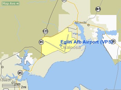
Northwest Florida Regional Airport (IATA: VPS, ICAO: KVPS, FAA LID: VPS) is an airport located within Eglin Air Force Base, near Valparaiso and Fort Walton Beach in Okaloosa County, Florida, United States. No private aircraft are permitted to leave out of or arrive at Northwest Florida Regional, so Destin-Fort Walton Beach Airport is used for non-commercial operations. The airport was formerly known as Okaloosa Regional Airport until its name was changed in September 2008.
Northwest Florida Regional Airport is served by eight airlines providing non-stop service to Dallas, Houston, Memphis, Atlanta, and Charlotte. In 2007 the total passengers that flew out of Northwest Florida Regional was over 800,000. There is a demand for more flights to and from Northwest Florida Regional Airport. As a result, the airport is expanding its terminal by adding 2 gates. Airport officials hope to break ground in 2010. History
1957: The Okaloosa County Air Terminal opened on Eglin Air Force Base in building 89 with 3 personnel (Airport Manager, Security and Admin Support. Southern Airways was the only air carrier. Passengers would enter the base through the TAC gate on the east side of the base in Valparaiso, thus the airport code of VPS was born.
1968: Southern Airways began flying four DC-9 aircraft daily out of VPS. Air New Orleans began operations with service to New Orleans.
March 13, 1975: The Okaloosa Air Terminal located on State Road 85 opened its doors. The 32,000 sq ft (3,000 m) facility was constructed at a cost of $1.7 million. Financing for the entire facility was through federal, state, and local money. Federal grants totaled $472,000, state $80,000, Okaloosa County bond sale $1.1 million, and Southern Airways $190,000. First year enplaned passengers totaled 97,000 with Southern Airways as the sole airline with 12 departing flights daily.
November 2004: The current Northwest Florida Regional Airport opened its doors following a major expansion program including additional public parking and aircraft parking apron, a second parallel taxiway, landscaping and a new 110,000 sq ft (10,000 m) passenger terminal.
January 2008: Broke ground on the Consolidated Rental Car Service Facility to be located on 22 acres (89,000 m) east of the airport. This facility will have offices for all 5 rental car companies as well as rental car service facilities with hydraulic lifts, automated car washes, gas pumps and vacuum islands and a consolidated fuel farm for both aviation and unleaded gasoline. A cargo facility and new offices for airport maintenance will also be built to the east of the terminal and are included in the project.
May 2009: Opened Consolidated Rental Car Service Facility on new 22 acre leasehold just east of the main terminal. This $14M project came in on time and under budget and was funded entirely with rental car user fees.
Facilities and aircraft
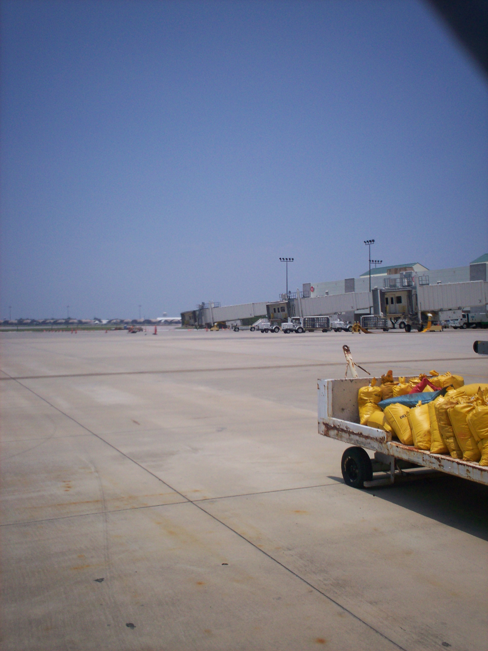
 | |
Gates at the Northwest Florida Regional Airport. |
Northwest Florida Regional Airport and Eglin AFB share two runways: 12/30 with a 12,005 x 300 ft (3,659 x 91 m) asphalt/concrete surface and 1/19 with a 10,012 x 300 ft (3,052 x 91 m) asphalt pavement. For the 12-month period ending March 31, 2006, the airport had 126,060 aircraft operations, an average of 345 per day: 71% military, 19% scheduled commercial, 8% general aviation and 2% air taxi.
The airport has a 110,000ft² airport passenger terminal building with three second-level gates with passenger jet ways and three ground-level commuter gates with regional jet boarding bridges
Airlines and destinations
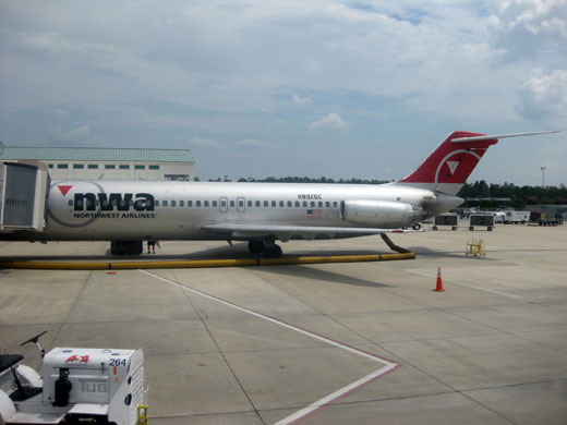 | |
Northwest Airlines parked at Northwest Florida Regional Airport |
| Airlines |
Destinations |
| American Eagle |
Dallas/Fort Worth |
| Continental Express operated by ExpressJet Airlines |
Houston-Intercontinental |
| Delta Air Lines |
Atlanta [seasonal] |
| Delta Connection operated by Atlantic Southeast Airlines |
Atlanta, Memphis |
| Delta Connection operated by Comair |
Atlanta |
| Delta Connection operated by Pinnacle Airlines |
Memphis |
| US Airways Express operated by Air Wisconsin |
Charlotte |
| US Airways Express operated by PSA Airlines |
Charlotte |
The above content comes from Wikipedia and is published under free licenses – click here to read more.
Location
& QuickFacts
|
FAA Information Effective: |
2007-01-18 |
|
Airport
Identifier: |
VPS |
|
Airport
Status: |
Operational |
|
Longitude/Latitude: |
086-31-31.2000W/30-29-00.0000N
-86.525333/30.483333 (Estimated) |
|
Elevation: |
87 ft / 26.52 m (Surveyed) |
|
Land: |
0 acres |
|
From
nearest city: |
1 nautical miles SW of Valparaiso, FL |
|
Location: |
Okaloosa County, FL |
|
Magnetic Variation: |
00E (1985) |
Owner
& Manager
|
Ownership: |
Air Force owned |
|
Owner: |
Usaf
JOINT-USE FACILITY. USAF OWNS MAJORITY OF AIRFIELD INCLUDING
RUNWAYS AND TAXIWAYS. THE OKALOOSA COUNTY BOARD OF COUNTY
COMMISIONERS IS THE CERTIFICATE HOLDER(AIRPORT OPERATING
CERTIFICATE) AND OWNS/OPERATES AN AIR CARRIER RAMP AND TWO
STUB TAXIWAYS. |
|
Address: |
Dept Of The Af Hdqrts Afmc
Eglin Afb, FL 32542 |
|
Manager: |
Jerry L. Sealy, A.a.e.
JOINT-USE FACILITY. MANAGER OF CIVILIAN PORTION OF AIRPORT
ONLY.
USAF OWNS AND OPERATES THE RUNWAYS AND OTHER
FACILITIES. |
|
Address: |
1701 State Road 85n
Eglin Afb, FL 32542 |
|
Phone
number: |
850-651-7160
USAF BASE OPERATIONS (850) 882-5313 OKALOOSA REGIONAL AIRPORT
OPS (850) 651-7160 |
Airport
Operations and Facilities
|
Airport Use: |
Private
RSTRD TO MIL ACFT AND CIVIL ACR ONLY. |
|
Wind
indicator: |
Yes |
|
Segmented
Circle: |
No |
|
Control
Tower: |
Yes |
|
Lighting
Schedule: |
DUSK-DAWN |
|
Beacon
Color: |
Clear-Green (lighted land airport) |
|
Landing
fee charge: |
No |
|
Sectional
chart: |
New Orleans |
|
Region: |
ASO - Southern |
|
Boundary
ARTCC: |
ZJX - Jacksonville |
|
Tie-in
FSS: |
GNV - Gainesville |
|
FSS
on Airport: |
No |
|
FSS
Phone: |
850-377-3291 |
|
FSS
Toll Free: |
1-800-WX-BRIEF |
|
NOTAMs
Facility: |
VPS (NOTAM-d service avaliable) |
|
Certification type/date: |
I C S 05/1973 |
|
Federal Agreements: |
NGY |
Airport
Services
|
Fuel available: |
100 |
|
Airframe Repair: |
NONE |
|
Power Plant Repair: |
NONE |
|
Bottled
Oxygen: |
NONE |
|
Bulk
Oxygen: |
NONE |
|
Runway Information
Runway 01/19
|
Dimension: |
10012 x 300 ft / 3051.7 x 91.4 m |
|
Surface: |
ASPH,
FIRST 1000 FT OF RY 12/30 IS CONC ON BOTH ENDS. |
|
Pavement
Class: |
76 /F/B/W/T |
|
Weight
Limit: |
Single wheel: 150000 lbs.
Dual wheel: 200000 lbs.
Dual tandem wheel: 500000 lbs.
Dual dual tandem wheel: 800000 lbs. |
|
Edge
Lights: |
High |
|
|
Runway 01 |
Runway 19 |
|
Longitude: |
086-31-04.8220W |
086-30-40.8210W |
|
Latitude: |
30-28-22.7140N |
30-29-59.7120N |
|
Elevation: |
51.00 ft |
61.00 ft |
|
ILS
Type: |
|
ILS/DME |
|
Traffic
Pattern: |
Left |
Left |
|
Markings: |
Precision instrument, Fair Condition |
Precision instrument, Fair Condition |
|
Arresting: |
BAK12 |
BAK12 |
|
VASI: |
4-light PAPI on left side |
4-light PAPI on left side |
|
Visual
Glide Angle: |
3.00� |
2.50� |
|
RVR
Equipment: |
touchdown |
touchdown |
|
Approach
lights: |
ALSF1 |
ALSF1
RWY 19 NSTD ALSF-1 LEN 1500'. |
|
Runway
End Identifier: |
No |
No |
|
Centerline
Lights: |
No |
No |
|
Touchdown
Lights: |
No |
No |
|
Runway 12/30
|
Dimension: |
12005 x 300 ft / 3659.1 x 91.4 m |
|
Surface: |
ASPH-CONC,
FIRST 1000 FT OF RY 12/30 IS CONC ON BOTH ENDS. |
|
Pavement
Class: |
25 /R/C/W/T |
|
Weight
Limit: |
Single wheel: 150000 lbs.
Dual wheel: 200000 lbs.
Dual tandem wheel: 500000 lbs.
Dual dual tandem wheel: 800000 lbs. |
|
Edge
Lights: |
High |
|
|
Runway 12 |
Runway 30 |
|
Longitude: |
086-33-07.8250W |
086-31-08.8220W |
|
Latitude: |
30-29-19.7120N |
30-28-20.7140N |
|
Elevation: |
85.00 ft |
51.00 ft |
|
ILS
Type: |
|
ILS |
|
Traffic
Pattern: |
Left |
Left |
|
Markings: |
Precision instrument, Fair Condition |
Precision instrument, Fair Condition |
|
Arresting: |
BAK12 |
BAK12 |
|
VASI: |
4-light PAPI on left side |
4-light PAPI on left side |
|
Visual
Glide Angle: |
3.00� |
2.50� |
|
RVR
Equipment: |
touchdown |
touchdown |
|
Approach
lights: |
ALSF1 |
ALSF1 |
|
Runway
End Identifier: |
No |
No |
|
Centerline
Lights: |
No |
No |
|
Touchdown
Lights: |
No |
No |
|
Radio Navigation
Aids
|
ID |
Type |
Name |
Ch |
Freq |
Var |
Dist |
|
DTS |
NDB |
Destin |
|
254.00 |
01W |
5.4 nm |
|
PKZ |
NDB |
Pickens |
|
326.00 |
01E |
33.9 nm |
|
JUY |
NDB |
Judd |
|
264.00 |
02W |
49.9 nm |
|
DWG |
TACAN |
Warrington |
002X |
|
00E |
0.4 nm |
|
HRT |
TACAN |
Hurlburt |
045X |
|
00E |
9.2 nm |
|
NGS |
TACAN |
Santa Rosa |
063X |
|
01E |
22.8 nm |
|
NSE |
TACAN |
Whiting |
070X |
|
01E |
29.3 nm |
|
NPA |
TACAN |
Pensacola |
119X |
|
01E |
41.7 nm |
|
NUN |
VOR |
Saufley |
|
108.80 |
01E |
42.0 nm |
|
CEW |
VORTAC |
Crestview |
106X |
115.90 |
03E |
22.1 nm |
|
PFN |
VORTAC |
Panama City |
090X |
114.30 |
00W |
46.6 nm |
Remarks
- RY
DSTC MRKRS ON BOTH RYS.
- CAUTION:
HI VOLUME OF NAVY T-34 AND B-06 TRNG ACFT NEAR CEW VORTAC.
- CAUTION:
UNCTL VEH ON MOVEMENT AREA.
- CAUTION:
RWY 19 AT TWY M LATERAL PONDING DUR WET RWY COND, POTENTIAL HYDROPLANING.
- REGIONAL
WX BRIEFINGS; CLSD WKNDS AND HOLS.
- BEARING
STRENGTH RWY 01/19: ST150; SBTT600; TT500; TD T800; TRT600
- A-GEAR:
8 PT TIE-DOWNS ON ALL BAK-12B; BAK-12B RUNOUT 1200'. BAK-9(B) APCH END
RWY 12-30 DISCONNECTED ON LDG RWY, AVBL 20 MIN PN. BAK-12B APCH END
RWY RWY 01-19 DISCONNECTED ON LDG RWY, AVBL 20 MIN PN.
- JASU:
(MD-3) 4(MC-1) (MC-1A) 2(MA-2)
- FLUID:
ADI-LTD; SP PRESAIR LHOX LOX
- OIL:
O-128-132-133-148-156; SOAP/JOAP - NOT AVBL WEKEND AND HOL.
- RSTD:
PPR MIN 24 HR. CTC BASE OPS DSN 872-5313/5406, C850-882-5313/5406. PPR
24 HR. PPR ARR/DEP TIMES ARE STRICTLY ENFORCED. TRAN ACFT ARR LATE EXP
MIN 2 HR DELAY. TRAN AIRCREWS RPT LATE FOR SKED DEP EXP MIN 2 HR DELAY.
- RSTD:
ALL AMC OR ACFT WITH DV CODE 7 OR ABV CTC BASE OPS 20 MN PRIOR TO LANDING.
- CAUTION:
OBST (HGR) 211' LCTD APRX FIRST 1000' E OF ACPH END RWY 01. DUR VFR
POSSIBLE CONFLICTING TFC. VFR ARR/DEP CTC ELGLIN APP FOR CLNC TO ENTER
EGLIN CORREIDOR SE OF CRESTVIEW.
UNLGTD OBST ON AFLD.
- CAUTION:
HI MID-AIR POTENTIAL, EXER EXTREME VIGILANCE. DESTIN -FT WALTON BEACH
(KDTS) IS AN UNCTL ARPT LCTD 6 NM SE OF EGLIN AFB.
- TWY
PARL TO RY 12/30 MAY BE MISTAKEN FOR RY.
- CAUTION:
ACFT FLYING WITHIN 2NM OF KDTS AT OR BLW 1000' MANY NOT BE MNT EGLIN
APP FREQ. SPECIAL
AIR TRAFFIC RULES-PART 93, SEE REGULATORY NTC.
- TFC
PAT: OVERHEAD TFC RWY 19 NML PROH.
-
CSTMS/AG/IMG: LTD SVC, NO RESIDENT CSTMS AGENT. AVBL
FOR BASE ASGN ACFT AND THEIR DEPLOYMENTS ONLY. 24 HR ADVANCE NOTICE
RQR. ALL OTHER ACFT MUST CLEAR CSTMS PRIOR TO ARR T EGLIN AFB.
- MISC:
EXP EXTV FLT PLAN FILING/DEP, REFUEL AND MAINT DELAYS DUR PEAK MSN PERIODS/WKEND.
THE FIRST 1000' RWY 12 AND THE FIRST 1000' RWY 30 ARE CONCRETE. THE
MIDDLE PORTION, 10,000' OF RWY 12-30, IS ASPHALTIC CONCRETE. DEP ACFT
ASGN A HDG TO FLY, SHALL INITIATE THEIR TURN WITHIN 1 NM OF DEP END
RWY.
- MISC:
STD USAF RSRS APPLIED.
- MISC:
COMSEC DOCUMENTS NOT AVBL FOR ISSUE. TRAN FLIGHT CREW CLASSIFIED STOR
AVBL IN BASE OPS TO SECRET AND BLW.
- TRAN
ALERT: OPR 1400-2200Z++. TRAN ACFT NOT ALLOWED WHEN TRAN ALERT NOT AVBL.
TRAN ACFT MUST USE FLW-ME TO PARK. PROGRESSIVE TAXI NOT AVBL. NO TRAN
ACFT CAN ARR/DEP PRIOR TO 1400Z++ AND MUST ARR/DEP NLT 2200Z++.
- TRAN
ALERT: ARR/DEP OT EXTREMELY LTD AND REQUIRES STRICT 24 HR ADVANCED APVL.
TO ARRANGE OVERTIME SUPPORT, CTC THE CONTRACT MANAGEMENT OFFICE DSN
872-2305, AFTER HRS C850-240-3057. WKEND AND HOL MAINT CAPABILITY EXTREMELY
LTD AND MAY BE POSTPNED TIL NEXT DUTY DAY. FLEET
SVC NOT AVBL.
- HEAVY
TFC 10 NM NORTH OF ARPT INVOF CRESTVIEW/BOB SIKES ARPT.
- RSTD:
TRAN ALERT WILL NOT SUPPORT LCL, ROUND ROBINS, OR OUT AND BACK FLT BY
TRAN ACFT.
- CAUTION:
HI VOLUME OF GA ACFT INVOF ARPT. LCL HI-DENSITY TFC AREAS & RSTD
AIRSPACE - SPECIAL RULES APPLY.
- RWY
19 NSTD OVERRUN 750 X 300, RWY 01 NSTD OVERRUN 500 X 300.
- LARGE
MIGRATORY BIRDS PRESENT YEAR ROUND ON & INVOF ARPT.
- FUEL:
J8, J8+ 100
- ARPT
CLSD TO ALL ACFT EXCP MIL & AUZD ACRS.
- MILITARY.
Based Aircraft
|
Aircraft
based on field: |
14 |
|
Single
Engine Airplanes: |
14 |
Major Carriers
Serving This Airport
| Atlantic Southeast Airlines |
31.5% |
| American Eagle Airlines Inc. |
22.0% |
| Expressjet Airlines Inc. |
18.9% |
| Northwest Airlines Inc. |
16.2% |
| Delta Air Lines Inc. |
11.4% |
Most Popular Destinations
|
Hartsfield - Jackson Atlanta Intl (ATL) |
42.9% |
|
Dallas/fort Worth Intl (DFW) |
22.0% |
|
George Bush Intercontinental/houston (IAH) |
18.9% |
| Memphis Intl (MEM) |
16.2% |
Most Popular Aircraft
|
N761EV |
0.9% |
| N744EV |
0.8% |
|
N17521 |
0.8% |
| N16520 |
0.8% |
|
N740EV |
0.8% |
| N8938E |
0.8% |
|
N681AE |
0.7% |
| N709EV |
0.7% |
|
N613NW |
0.7% |
| N692AE |
0.7% |
Operational Statistics
Time Period: 2005-04-01
- 2006-03-31
|
Aircraft
Operations: |
346/Day |
|
Commerical: |
18.5% |
|
Air Taxi: |
2.0% |
|
General
Aviation Local: |
0.2% |
|
General
Aviation Itinerant: |
7.9% |
|
Military: |
71.4% |
Eglin
Air Force Base
Airport
Address:
Okaloosa County, FL
Tel:
850-651-7160
Images
and information placed above are from
http://www.airport-data.com/airport/VPS/
We
thank them for the data!
| General
Info |
| Country |
United
States |
| State |
FLORIDA
|
| FAA ID |
VPS
|
| Latitude |
30-28-59.700N
|
| Longitude |
086-31-31.440W
|
| Elevation |
87 feet
|
| Near City |
VALPARAISO
|
We don't guarantee the information is fresh and accurate. The data may
be wrong or outdated.
For more up-to-date information please refer to other sources.
|
|