|
 |
|
||||
|
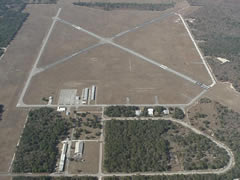
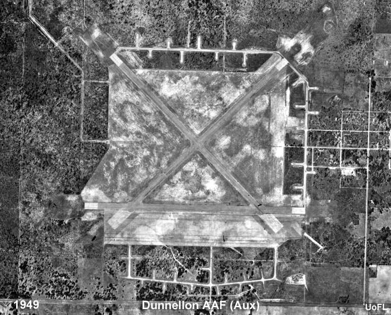
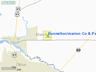
Dunnellon/Marion County Airport and Park of Commerce (FAA LID: X35) is a public use airport located four nautical miles (7 km) east of the central business district of Dunnellon, in Marion County, Florida, United States. The airport is owned by Dunnellon Airport Authority. It is also known as the Dunnellon/Marion County Airport, Dunnellon Airport and Marion County Airport. Originally set on 500 acres (2 km²), the airport encompasses 1,706 acres (6.9 km²) of land. One runway was closed in the 1990s, reducing the airport to its current two. With new security fencing, electrical gates, a snack bar and additional T-hangars, the airport is not projected to require major expansion through 2020. The facility is located 38 miles south of Gainesville Regional Airport. Services available include 24-hour fuel, major airframe powerplant servicing. During 2006, the airport averaged 41 flights per day. HistoryThe airport was opened in August 1942, by the United States Army Air Forces. Known as Dunnellon Army Air Base it was assigned to the I Troop Carrier Command as a training Airfield. The 10th Troop Carrier Group used the airfield to train C-47 Skytrain troop carrier groups between 13 February-30 November 1943. The 27th and 436th Troop Carrier Squadrons of the 10th Troop Carrier Group flying C-47 Skytrains were assigned to the base in 1943. Also, the 317th and 318th Troop Carrier Commando Units were assigned to the base during 1944. Troop Carrier units continued to train at Dunnellon throughout the war receiving training as C-47 pilots and crewmen of the British-design Airspeed Horsa glider. Graduates saw duty in North Africa, Europe, and the China-Burma-India Theater in this capacity. In August 1943, control of Dunnellon was reassigned to the Air University Army Air Forces School of Applied Tactics (AAFSAT) tactical combat simulation school in Central and Northern Florida. Headquartered at Orlando Army Air Base, the school's mission was to develop tactics and techniques of aerial warfare and to establish technical and tactical proficiency requirements for combat units to effectively engage and defeat enemy air forces. This was done with a wide variety of aircraft, including heavy strategic bombers; tactical fighters; medium and light bombers; reconnaissance and dive bombers, based at different airfields of the school. Initially under AAFSAT, Night Fighter training was performed with 420th Night Fighter Squadron (481st Night Fighter Operational Training Group) moving in on 20 August; remaining until being assigned to AAFSAT's California facility at Hammer Field on 18 January 1944. Control was deeded to Marion County following the end of the war, with the facility being renamed the Dunnellon/Marion County Airport & Park of Commerce. Facilities and aircraftDunnellon/Marion Co. & Park of Commerce Airport covers an area of 1,706 acres (690 ha) at an elevation of 65 feet (20 m) above mean sea level. It has two asphalt paved runways: 5/23 is 4,941 by 100 feet (1,506 x 30 m) and 9/27 is 4,702 by 60 feet (1,433 x 18 m). For the 12-month period ending April 21, 2008, the airport had 15,000 general aviation aircraft operations, an average of 41 per day. At that time there were 52 aircraft based at this airport: 80.8% single-engine, 9.6% multi-engine and 9.6% ultralight. The above content comes from Wikipedia and is published under free licenses – click here to read more.
Runway InformationRunway 05/23
Runway 09/27
Radio Navigation Aids
Remarks
Based Aircraft
Operational StatisticsTime Period: 2001-05-07 - 2002-05-06
Dunnellon/marion Co & Park Of Commerce Airport Address: Marion County, FL Tel: 352-620-3340 Images
and information placed above are from We thank them for the data!
We don't guarantee the information is fresh and accurate. The data may
be wrong or outdated.
|
||||||||||||||||||||||||||||||||||||||||||||||||||||||||||||||||||||||||||||||||||||||||||||||||||||||||||||||||||||||||||||||||||||||||||||||||||||||||||||||||||||||||||||||||||||||||||||||||||||||||||||||||||||||||||||||||||||||||||||||||||||||||||||||||||||||||||||||||||||||||||||||||||||||||||||||||||||||||||||||||||||||||||||||||||||

 |
|
Copyright 2004-2024 © by Airports-Worldwide.com, Vyshenskoho st. 36, Lviv 79010, Ukraine Legal Disclaimer |