 |
|
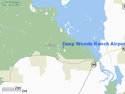
Location
& QuickFacts
|
FAA Information Effective: |
2007-01-18 |
|
Airport
Identifier: |
FD86 |
|
Airport
Status: |
Operational |
|
Longitude/Latitude: |
081-26-49.2430W/29-01-48.9430N
-81.447012/29.030262 (Estimated) |
|
Elevation: |
45 ft / 13.72 m (Estimated) |
|
Land: |
10 acres |
|
From
nearest city: |
10 nautical miles NE of Deland, FL |
|
Location: |
Lake County, FL |
|
Magnetic Variation: |
03W (1985) |
Owner
& Manager
|
Ownership: |
Privately owned |
|
Owner: |
John W.h. Schmale |
|
Address: |
P.o. Box 549
Deland, FL 32721-0549 |
|
Phone
number: |
904-669-2221 |
|
Manager: |
John K. Schmale |
|
Address: |
46800 Deep Woods Road
Paisley, FL 32767 |
|
Phone number: |
904-669-4240 |
Airport
Operations and Facilities
|
Airport Use: |
Private |
|
Wind
indicator: |
Yes |
|
Segmented
Circle: |
No |
|
Control
Tower: |
No |
|
Sectional
chart: |
Jacksonville |
|
Region: |
ASO - Southern |
|
Boundary
ARTCC: |
ZJX - Jacksonville |
|
Tie-in
FSS: |
PIE - Saint Petersburg |
|
FSS
on Airport: |
No |
|
FSS
Toll Free: |
1-800-WX-BRIEF |
|
Runway Information
Runway 05/23
|
Dimension: |
2800 x 100 ft / 853.4 x 30.5 m |
|
Surface: |
TURF, |
|
|
Runway 05 |
Runway 23 |
|
Traffic
Pattern: |
Left |
Left |
|
Displaced
threshold: |
800.00 ft |
730.00 ft |
|
Obstruction: |
50 ft trees, 600.0 ft from runway |
|
|
Radio Navigation
Aids
|
ID |
Type |
Name |
Ch |
Freq |
Var |
Dist |
|
DED |
NDB |
Deland/dcmsnd |
|
201.00 |
05W |
9.3 nm |
|
SFB |
NDB |
Sanford |
|
408.00 |
05W |
18.2 nm |
|
LEE |
NDB |
Leesburg |
|
335.00 |
04W |
22.8 nm |
|
EVB |
NDB |
New Smyrna Beach |
|
417.00 |
04W |
26.6 nm |
|
IAK |
NDB |
Palatka |
|
243.00 |
05W |
42.0 nm |
|
GGL |
NDB |
Geiger Lake |
|
375.00 |
05W |
42.4 nm |
|
ISM |
NDB |
Kissimmee |
|
329.00 |
05W |
44.5 nm |
|
TTS |
TACAN |
Kennedy Space Center |
059Y |
|
00E |
46.4 nm |
|
OMN |
VORTAC |
Ormond Beach |
073X |
112.60 |
00E |
24.0 nm |
|
ORL |
VORTAC |
Orlando |
059X |
112.20 |
00E |
29.9 nm |
|
OCF |
VORTAC |
Ocala |
084X |
113.70 |
00E |
41.9 nm |
|
DAB |
VOT |
Daytona Beach |
|
111.00 |
|
22.5 nm |
Remarks
- PROVIDED
VFR/PVT USE; RWY 05 THR DSPLCD & MARKED TO PROVIDE 20:1 APCH CLNC
OVER TREES SW.
Based Aircraft
|
Aircraft
based on field: |
1 |
|
Single
Engine Airplanes: |
1 |
Deep Woods Ranch Airport
Address:
Lake County, FL
Tel:
904-669-2221,
904-669-4240
Images
and information placed above are from
http://www.airport-data.com/airport/FD86/
We
thank them for the data!
| General
Info |
| Country |
United
States |
| State |
FLORIDA
|
| FAA ID |
FD86
|
| Latitude |
29-01-48.943N
|
| Longitude |
081-26-49.243W
|
| Elevation |
45 feet
|
| Near City |
DELAND
|
We don't guarantee the information is fresh and accurate. The data may
be wrong or outdated.
For more up-to-date information please refer to other sources.
|
|


