|
 |
|
||||
|
Coordinates: 29°10′48″N 081°03′29″W / 29.18°N 81.05806°W
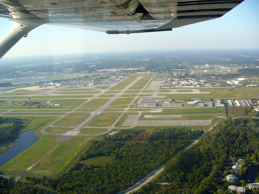
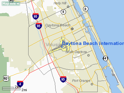
Daytona Beach International Airport (IATA: DAB, ICAO: KDAB, FAA LID: DAB) is a public county-owned airport located three miles (5 km) southwest of the central business district of Daytona Beach, adjacent to the Daytona International Speedway, in Volusia County, Florida, United States. The airport has 3 runways, a six-gate domestic terminal, and an international terminal. Daytona Beach serves as the headquarters of Embry-Riddle Aeronautical University. It is considered to be much more convenient for nearby residents than nearby larger airports such as Orlando International Airport and Jacksonville International Airport. HistoryThe BeachBefore airplanes landed on the beach, automobile races were held regularly. The beach provided a smooth, hard, and relatively clean surface to use for anything with wheels and speed. Pilots soon caught on and used the beach as a runway. Hangars were built later, and even aircraft service was provided on beach. This former airport is one of only two beach airports that were successful. The other, Old Orchard Beach, was located in Maine and was the starting point for at least five transatlantic flights during the 1920s and 1930s.
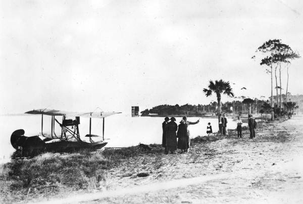
The first flight on the beach occurred in 1906 by Charles K. Hamilton, using Israel Ludlow's glider. The glider was pulled by an automobile and actually took place in Ormond. He went as high as 150 feet (46 m) on his first try, and 250 feet (76 m) on the second, before crashing into a flagpole and surviving with only a bruised knee. Numerous flights followed, including John A. D. McCurdy, the United States's 5th licensed pilot, in 1911, Phillips Page in 1912, and Ruth Law in 1913. Phillips Page has been credited for taking the first aerial photographs in Florida, while flying around the Hotel Clarendon in Daytona Beach. Many other pilots took to the skies above Daytona Beach before it was closed during the winter of 1929-30. Bethune Point
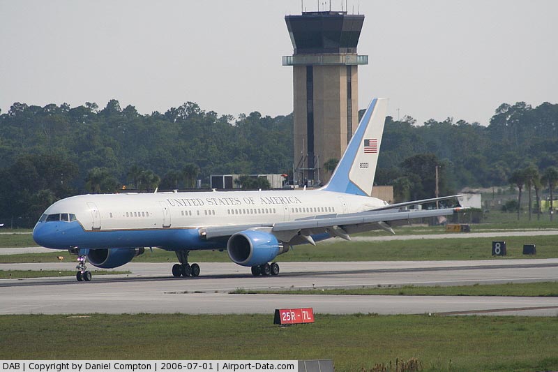
All flights were moved to the new location at Bethune Point, right on the Halifax River. Eastern Air Transport was the first commercial service out of Daytona Beach. The airline was certified to fly mail to Tampa and Orlando. However, the first flight crashed just after takeoff, due to a mechanical failure. The pilot was uninjured, and the mail was collected and sent out on a different flight. Florida State Airways, Inc was an airline that formed in early 1930 in Daytona Beach. The airline provided service for passengers to other Florida cities and to the Bahamas, using Ryan aircraft. In January 1930, Vice President of Operations, Bill Lindley, piloted a flight to Palm Beach. While on the descent, he never pulled out of the dive and went into Lake Worth at full throttle. The combination of Lindley's death and the depression soon caused most aviation activity in Daytona Beach to stop. Municipal AirportIn late 1930, a 740-acre (299 ha) piece of land turned into the current airport, located just a few hundred feet from the main drag of International Speedway Blvd. The first name it was given was Sholtz Field, after the then Governor of Florida, who was from Daytona Beach. The airport began with two runways, both gravel. One runway was 1,800 feet (550 m) long, the other was 2,100 feet (640 m) long. Before too long the name was changed to Daytona Beach Municipal Airport. Eastern Air Lines began passenger service out of Daytona Beach, flying Kingbirds and Condors. But after only a few years, Eastern did not re-bid, after the airmail changes of 1934. In 1935, National Airlines won a bid on the cross-state route from Daytona Beach to St. Petersburg. In 1936, the airport was closed for repairs. National rerouted its flights to Jacksonville but Eastern became upset and called it an act of "buccaneers". National Airlines was nicknamed the "Buccaneer Route". ExpansionIn the late 1930s, four 4000 by 150 feet (46 m) runways were built, all paved. This expansion allowed DC-2 and DC-3 aircraft to land at Daytona Beach. At the time, the terminal was located on the south side of the airport. For a short while in 1940, a zoo-keeper was hired to maintain the airport. When World War II broke out, the US Navy took over and used the airport for training, establishing it as Naval Air Station Daytona Beach. All runways were widened to 200 feet (61 m) and the east-west runway was extended to 5,500 feet (1,700 m). New buildings were constructed, some of which were later used by Embry-Riddle University after their move from Miami in 1965. At the end of the war, ownership was given back to the city of Daytona Beach in 1946. A permanent airline passenger terminal was completed in 1958, along with a control tower. During the 1960s, the east-west runway was extended to 7,500', facilitating operations for Eastern's Boeing 720 jets. This and the north-south runway were became 150' wide, the two diagonal runways were closed, and a 3100' x 75' flight training runway was built parallel to the main runway, on the south side of the field. In 1969, Volusia County took over management and renamed the premises Daytona Beach Regional Airport. In the following decades Embry-Riddle considerably developed its campus on the northeast side of the field. By the mid-1980s, a midfield control tower had been completed, and the airport was served by airlines that included Eastern, Delta and Continental. During the short period of time in the 1980's and 1990's while American Airlines maintained a hub operation in Raleigh/Durham, American Airlines provided 2-3 daily flights using mainline aircraft to Raleigh Durham International Airport. American discontinued service to Daytona Beach in 1994. In 1992, a newer, larger two-level terminal was opened to the public. The previous terminal was converted to an international arrivals facility. These new buildings, along with extension of two runways to 10,500' and 6001', justified a name change to Daytona Beach International Airport. The only scheduled direct flights out of the country from the airport were provided by Vintage Props and Jets using small, turbo-prop aircraft.. On July 18, 2008, Vintage Props and Jets temporarily ceased operations and filed for Chapter 11 bankruptcy protection. International charters using wide-bodied jets of numerous airlines are periodically conducted. In the past, Daytona Beach has seen service from present day airlines such as American Airlines, LTU International, Continental Airlines, US Airways, United Airlines, and AirTran Airways. These airlines have all pulled out of Daytona Beach. However on February 1, 2008, Daytona Beach saw US Airways resume service to Charlotte regularly using regional aircraft as big as the Embraer 175 and as small as the Canadair Regional Jet 200. Continental Airlines served Daytona Beach mainly through its hub at Newark Liberty International Airport near Newark, New Jersey using the ERJ-145 and the Boeing 737 on a seasonal basis. Continental Airlines discontinued all service to the area in September of 2008. In the past decade, Daytona Beach has also seen daily service to Washington-Dulles International Airport near Washington, DC, Baltimore/Washington International Thurgood Marshall Airport near Baltimore, Maryland, Chicago-O'Hare International Airport near Chicago, Illinois and LaGuardia Airport in New York City. Current ServiceCurrently, Daytona Beach International Airport is served by two carriers, Delta Air Lines with service to Atlanta and US Airways with service to Charlotte. Both airlines provide service to Daytona Beach with a mix of mainline jets such as the Boeing 757-232 operated by Delta (normally seen during race weeks or when the MD-88 isn't available), the Boeing 737 operated by US Airways, and the MD-88 and regional jets. Delta Air Lines is the only airline to use mainline aircraft in Daytona Beach year round, though the frequencies do have a seasonal fluctuation. US Airways regularly uses regional jet aircraft though mainline jets are frequently used during race weeks for the Daytona 500 and sometimes for the Coke Zero 400. Facilities and aircraftDaytona Beach International Airport covers an area of 1,800 acres (728 ha) which contains three asphalt paved runways: 7L/25R measuring 10,500 x 150 ft. (3,200 x 46 m), 7R/25L at 3,195 x 100 ft. (974 x 30 m) and 16/34 which is 6,001 x 150 ft. (1,829 x 46 m). For the 12-month period ending June 30, 2009, the airport had 339,036 aircraft operations, an average of 929 per day: 98% general aviation, 1% scheduled commercial, 1% air taxi and <1% military. There are 225 aircraft based at this airport: 72% single engine, 18% multi-engine, 10% jet aircraft and <1% helicopters. Fixed Base Operators
Aviation Schools
Airlines and destinationsScheduled passenger service
Air taxi service
The above content comes from Wikipedia and is published under free licenses – click here to read more.
Runway InformationRunway 07L/25R
Runway 07R/25L
Runway 16/34
Radio Navigation Aids
Remarks
Based Aircraft
Major Carriers Serving This Airport
Most Popular Destinations
Most Popular Aircraft
Operational StatisticsTime Period: 2005-08-01 - 2006-07-31
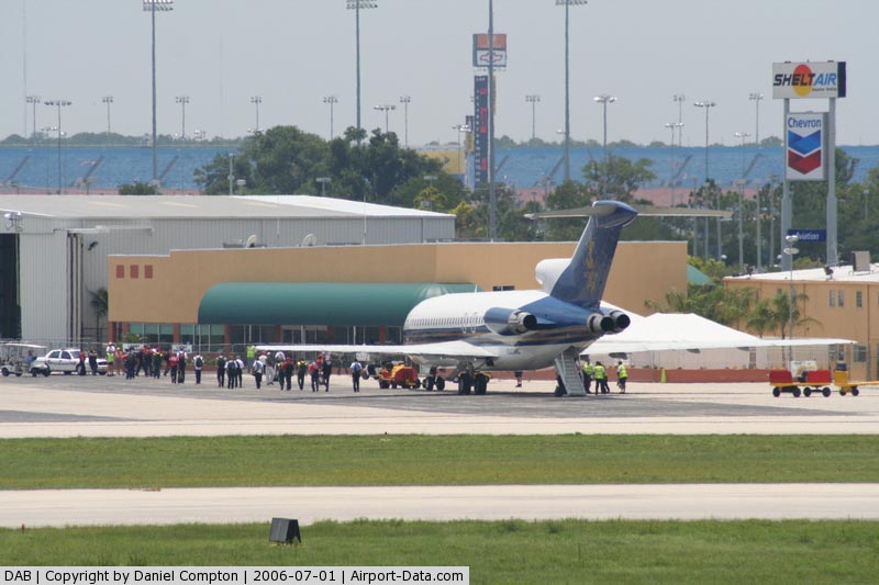
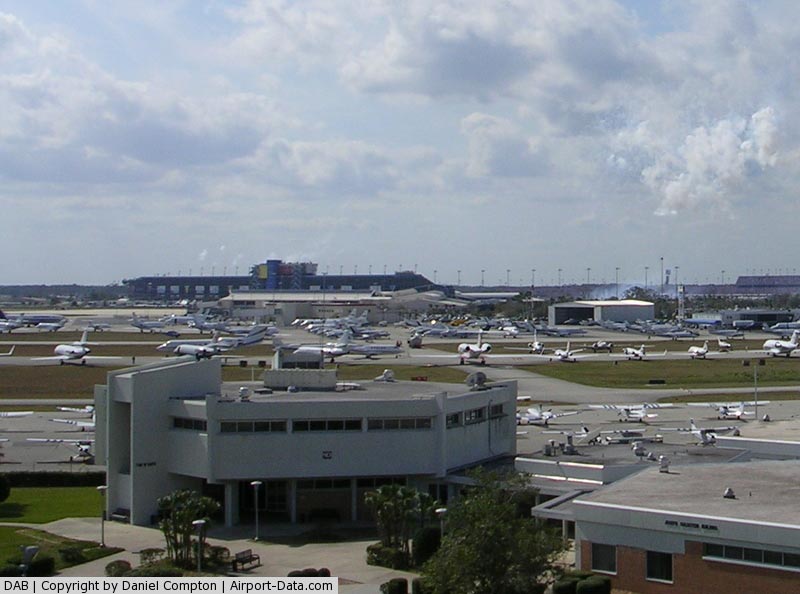
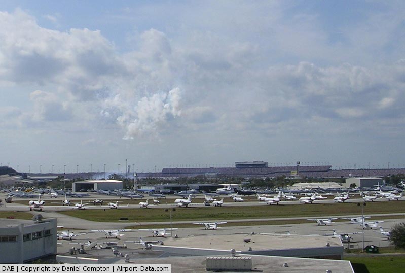
Daytona Beach International Airport Address: Volusia County, FL Tel: 386-248-8030 Images
and information placed above are from We thank them for the data!
We don't guarantee the information is fresh and accurate. The data may
be wrong or outdated.
|
|||||||||||||||||||||||||||||||||||||||||||||||||||||||||||||||||||||||||||||||||||||||||||||||||||||||||||||||||||||||||||||||||||||||||||||||||||||||||||||||||||||||||||||||||||||||||||||||||||||||||||||||||||||||||||||||||||||||||||||||||||||||||||||||||||||||||||||||||||||||||||||||||||||||||||||||||||||||||||||||||||||||||||||||||||||||||||||||||||||||||||||||||||||||||||||||||||||||||||||||||||||||||||||||||||||||||||||||||||||||||||||||||||||||||||||||||||||||||||||||||||||||||||||||||||||||||||||||||||||||||||||||||||||||||||||

 |
|
Copyright 2004-2024 © by Airports-Worldwide.com, Vyshenskoho st. 36, Lviv 79010, Ukraine Legal Disclaimer |