 |
|
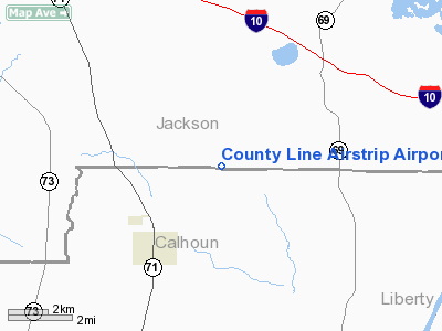
County Line Airstrip Airport |
Location
& QuickFacts
|
FAA
Information Effective: |
2007-01-18 |
|
Airport
Identifier: |
5FD3 |
|
Airport
Status: |
Operational |
|
Longitude/Latitude: |
085-05-28.7200W/30-36-30.6980N
-85.091311/30.608527 (Estimated) |
|
Elevation: |
150 ft / 45.72 m (Estimated) |
|
Land: |
0 acres |
|
From
nearest city: |
2 nautical miles NW of Altha, FL |
|
Location: |
Calhoun County, FL |
|
Magnetic Variation: |
01W (1985) |
Owner
& Manager
|
Ownership: |
Privately
owned |
|
Owner: |
James H. Mc Croan |
|
Address: |
Rt 2 Box 40-b
Altha, FL 32421 |
|
Phone
number: |
904-762-8146 |
|
Manager: |
James H. Mc Croan |
|
Address: |
Rt 1 Box 40-b
Altha, FL 32421 |
|
Phone number: |
904-762-8311 |
Airport Operations and Facilities
|
Airport
Use: |
Private |
|
Wind
indicator: |
Yes
WINDSOCK ON 40' TWR WEST SIDE MID-FIELD. |
|
Segmented Circle: |
No |
|
Control Tower: |
No |
|
Sectional chart: |
New Orleans |
|
Region: |
ASO - Southern |
|
Boundary ARTCC: |
ZJX - Jacksonville |
|
Tie-in FSS: |
GNV - Gainesville |
|
FSS Phone: |
850-377-3291 |
|
FSS Toll Free: |
1-800-WX-BRIEF |
Airport Services
|
Fuel
available: |
100LLMOGAS |
|
Runway Information
Runway 18/36
|
Dimension: |
2100
x 50 ft / 640.1 x 15.2 m |
|
Surface: |
ASPH-TURF,
NORTH 1000' ASPH & SOUTH 1100' TURF. |
|
|
Runway 18 |
Runway 36 |
|
Traffic
Pattern: |
Left |
Left |
|
Displaced
threshold: |
100.00 ft
DSPLCD THR MKD WITH ROW OF 3 MARKERS BOTH SIDES OF THE RY. |
0.00 ft |
|
Radio Navigation
Aids
|
ID |
Type |
Name |
Ch |
Freq |
Var |
Dist |
|
SMY |
NDB |
Soyya |
|
329.00 |
02W |
17.3 nm |
|
BKK |
NDB |
Tri County |
|
275.00 |
02W |
30.1 nm |
|
LYZ |
NDB |
Willis |
|
359.00 |
01W |
36.5 nm |
|
TL |
NDB |
Wakul |
|
379.00 |
01W |
41.6 nm |
|
PAM |
TACAN |
Tyndall |
124X |
|
00W |
40.7 nm |
|
FYL |
VOR |
Tri County |
|
108.40 |
08W |
30.2 nm |
|
MAI |
VORTAC |
Marianna |
087X |
114.00 |
00E |
10.8 nm |
|
SZW |
VORTAC |
Seminole |
122X |
117.50 |
02E |
37.3 nm |
|
PFN |
VORTAC |
Panama City |
090X |
114.30 |
00W |
38.6 nm |
|
RRS |
VORTAC |
Wiregrass |
053X |
111.60 |
02E |
44.2 nm |
|
TLH |
VOT |
Tallahassee Muni |
|
111.00 |
|
40.1 nm |
Remarks
Based Aircraft
|
Aircraft
based on field: |
2 |
|
Single
Engine Airplanes: |
2 |
County Line Airstrip Airport
Address:
Calhoun County, FL
Tel:
904-762-8146,
904-762-8311
Images
and information placed above are from
http://www.airport-data.com/airport/5FD3/
We
thank them for the data!
| General
Info |
| Country |
United
States |
| State |
FLORIDA
|
| FAA ID |
5FD3 |
| Latitude |
30-36-30.698N
|
| Longitude |
085-05-28.720W
|
| Elevation |
150 feet
|
| Near City |
ALTHA
|
We don't guarantee the information is fresh and accurate. The data may
be wrong or outdated.
For more up-to-date information please refer to other sources.
|
|


