 |
|
|
|
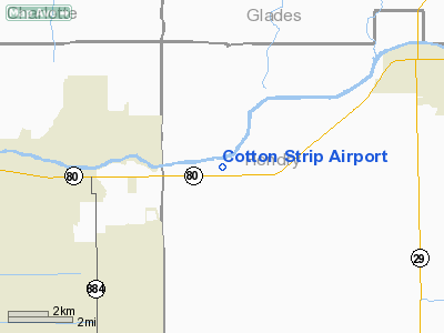
Location
& QuickFacts
|
FAA
Information Effective: |
2007-01-18 |
|
Airport
Identifier: |
17FA |
|
Airport
Status: |
Operational |
|
Longitude/Latitude: |
081-32-07.2810W/26-42-48.2440N
-81.535356/26.713401 (Estimated) |
|
Elevation: |
18 ft / 5.49 m (Estimated) |
|
Land: |
0 acres |
|
From
nearest city: |
6 nautical miles SW of La Belle, FL |
|
Location: |
Hendry County, FL |
|
Magnetic Variation: |
02W (1985) |
Owner
& Manager
|
Ownership: |
Privately owned |
|
Owner: |
Michael Shults |
|
Address: |
6090 State Rd 80 West
Alva, FL 33920 |
|
Phone
number: |
863-612-1388 |
|
Manager: |
Michael Shults |
|
Address: |
6090 State Rd 80 West
Alva, FL 33920 |
|
Phone number: |
863-612-1388 |
Airport
Operations and Facilities
|
Airport Use: |
Private |
|
Wind indicator: |
Yes |
|
Segmented Circle: |
No |
|
Control Tower: |
No |
|
Landing fee charge: |
No
TIE DOWN CHARGE |
|
Sectional chart: |
Miami |
|
Region: |
ASO - Southern |
|
Boundary ARTCC: |
ZMA - Miami |
|
Tie-in FSS: |
MIA - Miami |
|
FSS on Airport: |
No |
|
FSS Phone: |
305-233-2600 |
|
FSS Toll Free: |
1-800-WX-BRIEF |
Airport
Services
|
Airframe
Repair: |
MINOR |
|
Power
Plant Repair: |
MINOR |
|
Runway Information
Runway 03W/21W
|
Dimension: |
5000 x 400 ft / 1524.0 x 121.9 m |
|
Surface: |
WATER, |
|
|
Runway 03W |
Runway 21W |
|
Traffic
Pattern: |
Left |
Left |
|
Runway 09W/27W
|
Dimension: |
6000 x 400 ft / 1828.8 x 121.9 m |
|
Surface: |
WATER, |
|
|
Runway 09W |
Runway 27W |
|
Traffic
Pattern: |
Left |
Left |
|
Runway 18/36
|
Dimension: |
2359 x 100 ft / 719.0 x 30.5 m |
|
Surface: |
TURF, |
|
|
Runway 18 |
Runway 36 |
|
Traffic
Pattern: |
Left |
Left |
|
Radio Navigation
Aids
|
ID |
Type |
Name |
Ch |
Freq |
Var |
Dist |
|
APF |
NDB |
Naples |
|
201.00 |
03W |
35.9 nm |
|
PGD |
VOR |
Punta Gorda |
|
110.20 |
03W |
27.3 nm |
|
CYY |
VOR/DME |
Cypress |
023X |
108.60 |
03W |
36.1 nm |
|
LBV |
VORTAC |
La Belle |
041X |
110.40 |
01E |
10.4 nm |
|
RSW |
VORTAC |
Lee County |
055X |
111.80 |
02W |
17.0 nm |
|
PHK |
VORTAC |
Pahokee |
101X |
115.40 |
00E |
45.5 nm |
Remarks
Cotton Strip Airport
Address:
Hendry County, FL
Tel:
863-612-1388
Images
and information placed above are from
http://www.airport-data.com/airport/17FA/
We
thank them for the data!
| General
Info |
| Country |
United
States |
| State |
FLORIDA
|
| FAA ID |
17FA
|
| Latitude |
26-42-48.244N
|
| Longitude |
081-32-07.281W
|
| Elevation |
18 feet
|
| Near City |
LA BELLE
|
We don't guarantee the information is fresh and accurate. The data may
be wrong or outdated.
For more up-to-date information please refer to other sources.
|
|


