 |
|
|
|
|
|
Location
& QuickFacts
|
FAA Information Effective: |
2007-01-18 |
|
Airport
Identifier: |
A51 |
|
Airport
Status: |
Operational |
|
Longitude/Latitude: |
085-17-20.7050W/29-45-30.7570N
-85.289085/29.758544 (Estimated) |
|
Elevation: |
13 ft / 3.96 m (Estimated) |
|
Land: |
21 acres |
|
From
nearest city: |
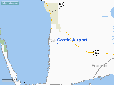
2 nautical miles S of Port St Joe, FL |
|
Location: |
Gulf County, FL |
|
Magnetic Variation: |
00W (1985) |
Owner
& Manager
|
Ownership: |
Privately owned |
|
Owner: |
Leonard C Costin |
|
Address: |
2724 Apalachee Pkwy
Tallahassee, FL 32301 |
|
Phone number: |
850-877-7189 |
|
Manager: |
Leonard C Costin
FBO |
|
Address: |
2724 Apalachee Pkwy
Tallahassee, FL 32301 |
|
Phone number: |
850-877-7189 |
Airport
Operations and Facilities
|
Airport Use: |
Open to public |
|
Wind
indicator: |
Yes |
|
Segmented
Circle: |
No |
|
Control
Tower: |
No |
|
Landing
fee charge: |
Yes |
|
Sectional
chart: |
New Orleans |
|
Region: |
ASO - Southern |
|
Boundary
ARTCC: |
ZJX - Jacksonville |
|
Tie-in
FSS: |
GNV - Gainesville |
|
FSS
on Airport: |
No |
|
FSS
Phone: |
850-377-3291 |
|
FSS
Toll Free: |
1-800-WX-BRIEF |
|
NOTAMs
Facility: |
GNV (NOTAM-d service avaliable) |
Airport
Communications
Airport
Services
|
Fuel available: |
100LL |
|
Airframe Repair: |
MAJOR |
|
Power Plant Repair: |
MAJOR |
|
Runway Information
Runway 18/36
|
Dimension: |
4230 x 65 ft / 1289.3 x 19.8 m |
|
Surface: |
TURF, Good Condition
SOUTH 1000 FT ROUGH, SOFT & SANDY. |
|
|
Runway 18 |
Runway 36 |
|
Traffic
Pattern: |
Left |
Left |
|
Displaced
threshold: |
660.00 ft |
1000.00 ft |
|
Obstruction: |
48 ft trees, 100.0 ft from runway, 2:1 slope
to clear
APCH RATIO 20:1 TO DSPLCD THLD. |
45 ft trees, 900.0 ft from runway, 20:1 slope
to clear
APCH RATIO 42:1 TO DSPLCD THLD. |
|
Radio Navigation
Aids
|
ID |
Type |
Name |
Ch |
Freq |
Var |
Dist |
|
AAF |
NDB |
Apalachicola |
|
349.00 |
02W |
13.8 nm |
|
PAM |
TACAN |
Tyndall |
124X |
|
00W |
24.0 nm |
|
PFN |
VORTAC |
Panama City |
090X |
114.30 |
00W |
34.3 nm |
Remarks
- 550'
RADIO TWR LCTD 1 1/2 MILES NORTH OF ARPT.
- NO
TOUCH & GO LNDGS.
- WATER-FILLED
DITCH WEST OF RY.
- 15-40
FT TREELINE WEST OF RY IN PRIMARY SFC AND TRANSITION SFC.
- VFR
USE ONLY.
Based Aircraft
|
Aircraft
based on field: |
8 |
|
Single
Engine Airplanes: |
8 |
Operational Statistics
Time Period: 2000-08-01
- 2001-07-31
|
Aircraft
Operations: |
241/Week |
|
General
Aviation Local: |
42.0% |
|
General
Aviation Itinerant: |
58.0% |
Costin Airport
Address:
Gulf County, FL
Tel:
850-877-7189
Images
and information placed above are from
http://www.airport-data.com/airport/A51/
We
thank them for the data!
| General
Info |
| Country |
United
States |
| State |
FLORIDA
|
| FAA ID |
A51
|
| Latitude |
29-45-30.757N
|
| Longitude |
085-17-20.705W
|
| Elevation |
13 feet
|
| Near City |
PORT ST
JOE |
We don't guarantee the information is fresh and accurate. The data may
be wrong or outdated.
For more up-to-date information please refer to other sources.
|
|


