 |
|
|
|
|
|
Location
& QuickFacts
|
FAA
Information Effective: |
2007-01-18 |
|
Airport
Identifier: |
83J |
|
Airport
Status: |
Operational |
|
Longitude/Latitude: |
087-23-07.1082W/30-31-54.8047N
-87.385308/30.531890 (Estimated) |
|
Elevation: |
110 ft / 33.53 m (Estimated) |
|
Land: |
32 acres |
|
From
nearest city: |
10 nautical miles NW of Pensacola, FL |
|
Location: |
Escambia County, FL |
|
Magnetic Variation: |
01E (1985) |
Owner
& Manager
|
Ownership: |
Privately owned |
|
Owner: |
Coastal L.c.v. |
|
Address: |
6001 W 9 Mile Rd
Pensacola, FL 32526 |
|
Phone
number: |
850-944-1284 |
|
Manager: |
Anthony E. Fiorentino |
|
Address: |
6001 W. 9 Mile Rd
Pensacola, FL 32526 |
|
Phone number: |
850-944-1284 |
Airport
Operations and Facilities
|
Airport
Use: |
Open to public |
|
Wind
indicator: |
Yes |
|
Segmented
Circle: |
Yes |
|
Control
Tower: |
No |
|
Landing
fee charge: |
No |
|
Sectional
chart: |
New Orleans |
|
Region: |
ASO - Southern |
|
Traffic
Pattern Alt: |
900 ft |
|
Boundary
ARTCC: |
ZJX - Jacksonville |
|
Tie-in
FSS: |
GNV - Gainesville |
|
FSS
on Airport: |
No |
|
FSS
Phone: |
850-377-3291 |
|
FSS
Toll Free: |
1-800-WX-BRIEF |
|
NOTAMs
Facility: |
GNV (NOTAM-d service avaliable) |
Airport
Communications
|
CTAF: |
122.800 |
|
Unicom: |
122.800 |
Airport
Services
|
Bottled
Oxygen: |
NONE |
|
Bulk
Oxygen: |
NONE |
|
Runway Information
Runway 18/36
|
Dimension: |
2526 x 230 ft / 769.9 x 70.1 m |
|
Surface: |
TURF, Good Condition |
|
|
Runway 18 |
Runway 36 |
|
Traffic
Pattern: |
Right |
Left |
|
Displaced
threshold: |
500.00 ft |
360.00 ft |
|
Obstruction: |
4 ft fence
RY 18 APCH RATIO 25:1 DUE TO 58 FT TREES 1090 FT FROM RY END. |
4 ft fence, 0.0 ft from runway
RY 36 APCH RATIO 25:1 DUE TO 25 FT TREES 125 FT FROM RY END. |
|
Radio Navigation
Aids
|
ID |
Type |
Name |
Ch |
Freq |
Var |
Dist |
|
PKZ |
NDB |
Pickens |
|
326.00 |
01E |
12.1 nm |
|
ESU |
NDB |
Summerdale |
|
204.00 |
01E |
17.7 nm |
|
DTS |
NDB |
Destin |
|
254.00 |
01W |
47.8 nm |
|
MO |
NDB |
Wisle |
|
248.00 |
02E |
49.4 nm |
|
NPA |
TACAN |
Pensacola |
119X |
|
01E |
11.0 nm |
|
NSE |
TACAN |
Whiting |
070X |
|
01E |
22.2 nm |
|
NGS |
TACAN |
Santa Rosa |
063X |
|
01E |
23.7 nm |
|
HRT |
TACAN |
Hurlburt |
045X |
|
00E |
36.5 nm |
|
DWG |
TACAN |
Warrington |
002X |
|
00E |
44.9 nm |
|
NUN |
VOR |
Saufley |
|
108.80 |
01E |
4.4 nm |
|
BFM |
VORTAC |
Brookley |
075X |
112.80 |
04E |
35.0 nm |
|
CEW |
VORTAC |
Crestview |
106X |
115.90 |
03E |
40.6 nm |
Remarks
- EXTSV
MILITARY HELI OPNS ADJ ARPT NE.
- TREES
IN TRANSITIION SFC EAST OF RY.
- GLIDER
ACTIVITY ON & INVOF ARPT.
- ARPT
RECORDS TO 1960, EXACT DATE OF ESTABMT UNKN.
Based Aircraft
|
Aircraft
based on field: |
42 |
|
Single
Engine Airplanes: |
19 |
|
Gliders: |
12 |
|
Ultralights: |
11 |
Operational Statistics
Time Period: 1999-09-02 - 2000-08-31
|
Aircraft
Operations: |
145/Week |
|
General
Aviation Local: |
93.1% |
|
General
Aviation Itinerant: |
6.9% |
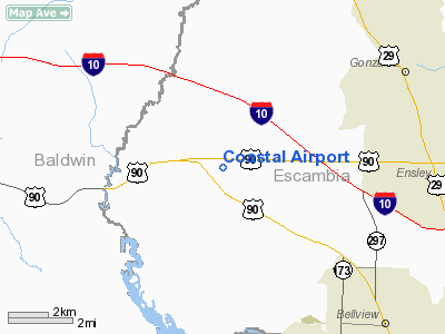
Coastal Airport
Address:
Escambia County, FL
Tel:
850-944-1284
Images
and information placed above are from
http://www.airport-data.com/airport/83J/
We
thank them for the data!
| General
Info |
| Country |
United
States |
| State |
FLORIDA
|
| FAA ID |
83J
|
| Latitude |
30-31-54.805N
|
| Longitude |
087-23-07.108W
|
| Elevation |
110 feet
|
| Near City |
PENSACOLA
|
We don't guarantee the information is fresh and accurate. The data may
be wrong or outdated.
For more up-to-date information please refer to other sources.
|
|


