 |
|
City Of Fort Lauderdale Heliport |
|
|
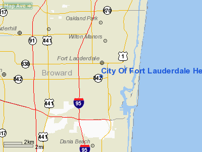
Location
& QuickFacts
|
FAA
Information Effective: |
2007-01-18 |
|
Airport
Identifier: |
30FD |
|
Airport
Status: |
Operational |
|
Longitude/Latitude: |
080-08-39.1620W/26-07-26.3100N
-80.144212/26.123975 (Estimated) |
|
Elevation: |
6 ft / 1.83 m (Estimated) |
|
Land: |
0 acres |
|
From
nearest city: |
0 nautical miles N of Fort Lauderdale, FL |
|
Location: |
Broward County, FL |
|
Magnetic Variation: |
03W (1985) |
Owner
& Manager
|
Ownership: |
Publicly owned |
|
Owner: |
City Of Fort Lauderdale |
|
Address: |
1401 W Commercial Blvd Ste 200
Fort Lauderdale, FL 33309 |
|
Phone
number: |
954-761-5002 |
|
Manager: |
William H. Crouch Jr |
|
Address: |
1401 W Commercial Blvd Ste 200
Fort Lauderdale, FL 33309 |
|
Phone number: |
954-938-4966 |
Airport
Operations and Facilities
|
Airport
Use: |
Private |
|
Wind
indicator: |
Yes |
|
Segmented
Circle: |
No |
|
Control
Tower: |
No |
|
Lighting
Schedule: |
RDO-CTL
ACTVT ROTG BCN - UNICOM. |
|
Beacon Color: |
Clear-Green-Yellow (heliport) |
|
Sectional chart: |
Miami |
|
Region: |
ASO - Southern |
|
Boundary ARTCC: |
ZMA - Miami |
|
Tie-in FSS: |
MIA - Miami |
|
FSS on Airport: |
No |
|
FSS Phone: |
305-233-2600 |
|
FSS Toll Free: |
1-800-WX-BRIEF |
Airport
Communications
|
Runway Information
Helipad H1
|
Dimension: |
44 x 44 ft / 13.4 x 13.4 m |
|
Surface: |
ASPH-CONC, |
|
|
Runway H1 |
Runway |
|
Traffic
Pattern: |
Left |
Left |
|
Radio Navigation
Aids
|
ID |
Type |
Name |
Ch |
Freq |
Var |
Dist |
|
PJN |
NDB |
Plantation |
|
242.00 |
03W |
4.1 nm |
|
FX |
NDB |
Praiz |
|
221.00 |
02W |
9.1 nm |
|
PB |
NDB |
Rubin |
|
356.00 |
03W |
34.1 nm |
|
UTX |
NDB |
United |
|
405.00 |
03W |
48.3 nm |
|
HST |
TACAN |
Homestead |
019X |
|
03W |
40.2 nm |
|
FLL |
VOR/DME |
Fort Lauderdale |
091X |
114.40 |
00E |
3.0 nm |
|
VKZ |
VOR/DME |
Virginia Key |
118X |
117.10 |
04W |
22.4 nm |
|
DHP |
VORTAC |
Dolphin |
086X |
113.90 |
04W |
22.4 nm |
|
PBI |
VORTAC |
Palm Beach |
104X |
115.70 |
03W |
33.6 nm |
|
PHK |
VORTAC |
Pahokee |
101X |
115.40 |
00E |
49.3 nm |
|
MIA |
VOT |
Miami Intl |
|
112.00 |
|
21.1 nm |
|
PBI |
VOT |
Palm Beach |
|
109.00 |
|
33.9 nm |
Remarks
- NUMEROUS
CRANES INVOF HELIPAD.
- MAXIMUM
ROTOR DIAMETER 44 FT.
- PRVDD
OPNS ARE CONDUCTED IN VFR WX CONDS; LANDING FOR PVT USE ONLY; APCH/DEP
FROM 160-230; AREA IS MARKED; WIND INDICATOR IS MAINTAINED; MAX TAILWIND
COMPONENT OF 5 MPH IS USED; LOA WITH FT LAUDERDALE/HOLLYWOOD INT'L ARPT.
City Of Fort Lauderdale Heliport
Address:
Broward County, FL
Tel:
954-761-5002,
954-938-4966
Images
and information placed above are from
http://www.airport-data.com/airport/30FD/
We
thank them for the data!
| General
Info |
| Country |
United
States |
| State |
FLORIDA
|
| FAA ID |
30FD
|
| Latitude |
26-07-26.310N
|
| Longitude |
080-08-39.162W
|
| Elevation |
6 feet
|
| Near City |
FORT LAUDERDALE
|
We don't guarantee the information is fresh and accurate. The data may
be wrong or outdated.
For more up-to-date information please refer to other sources.
|
|


