 |
|
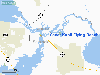
Cedar Knoll Flying Ranch Airport |
Location
& QuickFacts
|
FAA
Information Effective: |
2006-09-28 |
|
Airport
Identifier: |
01FL |
|
Longitude/Latitude: |
081-09-33.2200W/28-46-54.9700N
-81.159228/28.781936 (Estimated) |
|
Elevation: |
19 ft / 5.79 m (Estimated) |
|
Land: |
135 acres |
|
From
nearest city: |
6 nautical miles E of Geneva, FL |
|
Location: |
Seminole County, FL |
|
Magnetic Variation: |
04W (1995) |
Owner
& Manager
|
Ownership: |
Privately owned |
|
Owner: |
Bill Lowery |
|
Address: |
3000 W Osceola Rd
Geneva, FL 32732 |
|
Phone
number: |
407-349-2183 |
|
Manager: |
Bill Lowery |
|
Address: |
3000 W Osceola Rd
Geneva, FL 32732 |
|
Phone number: |
407-349-2183 |
Airport
Operations and Facilities
|
Airport
Use: |
Private |
|
Wind
indicator: |
Yes |
|
Segmented
Circle: |
Yes |
|
Control
Tower: |
No |
|
Attendance
Schedule: |
IREG |
|
Sectional
chart: |
Jacksonville |
|
Region: |
ASO - Southern |
|
Boundary
ARTCC: |
ZJX - Jacksonville |
|
Tie-in
FSS: |
PIE - Saint Petersburg |
|
FSS
on Airport: |
No |
|
FSS
Toll Free: |
1-800-WX-BRIEF |
|
Runway Information
Runway 18/36
|
Dimension: |
3000 x 50 ft / 914.4 x 15.2 m |
|
Surface: |
TURF, |
|
Edge
Lights: |
Medium |
|
|
Runway 18 |
Runway 36 |
|
Traffic
Pattern: |
Left |
Right |
|
Displaced
threshold: |
0.00
ft |
800.00 ft |
|
Radio Navigation
Aids
|
ID |
Type |
Name |
Ch |
Freq |
Var |
Dist |
|
SFB |
NDB |
Sanford |
|
408.00 |
05W |
4.4 nm |
|
DED |
NDB |
Deland/dcmsnd |
|
201.00 |
05W |
18.2 nm |
|
EVB |
NDB |
New Smyrna Beach |
|
417.00 |
04W |
20.0 nm |
|
GGL |
NDB |
Geiger Lake |
|
375.00 |
05W |
21.3 nm |
|
ISM |
NDB |
Kissimmee |
|
329.00 |
05W |
33.0 nm |
|
LEE |
NDB |
Leesburg |
|
335.00 |
04W |
34.2 nm |
|
COI |
NDB |
Merritt Island |
|
247.00 |
05W |
36.3 nm |
|
SQT |
NDB |
Satellite |
|
257.00 |
03W |
47.6 nm |
|
TTS |
TACAN |
Kennedy Space Center |
059Y |
|
00E |
26.2 nm |
|
COF |
TACAN |
Patrick |
097X |
|
04W |
43.7 nm |
|
MLB |
VOR/DME |
Melbourne |
037X |
110.00 |
02W |
49.2 nm |
|
ORL |
VORTAC |
Orlando |
059X |
112.20 |
00E |
17.1 nm |
|
OMN |
VORTAC |
Ormond Beach |
073X |
112.60 |
00E |
31.4 nm |
|
DAB |
VOT |
Daytona Beach |
|
111.00 |
|
24.6 nm |
Remarks
- VFR;
PVT USE; ALL TFC PATTERNS TO THE EAST; MAINTAIN LOA WITH CENTRAL FLORIDA
REGIONAL ARPT ATCT; OPNS DO NOT CONFLICT WITH OPNS AT ALLIGATOR DRIND
SPB.
Based Aircraft
|
Aircraft
based on field: |
1 |
|
Single
Engine Airplanes: |
1 |
Cedar Knoll Flying Ranch Airport
Address:
Seminole County, FL
Tel:
407-349-2183
Images
and information placed above are from
http://www.airport-data.com/airport/01FL/
We
thank them for the data!
| General
Info |
| Country |
United
States |
| State |
FLORIDA
|
| FAA ID |
01FL
|
| Latitude |
28-46-54.970N
|
| Longitude |
081-09-33.220W
|
| Elevation |
19 feet
|
| Near City |
GENEVA
|
We don't guarantee the information is fresh and accurate. The data may
be wrong or outdated.
For more up-to-date information please refer to other sources.
|
|


