 |
|
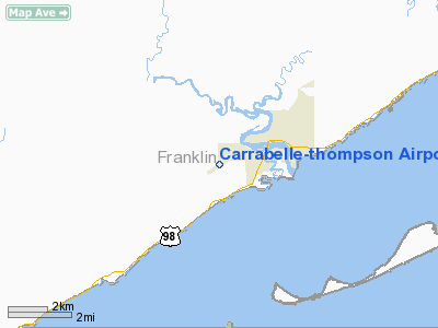
Carrabelle-Thompson Airport |
|
|
Location
& QuickFacts
|
FAA
Information Effective: |
2006-09-28 |
|
Airport
Identifier: |
X13 |
|
Longitude/Latitude: |
084-42-03.7407W/29-50-31.8950N
-84.701039/29.842193 (Estimated) |
|
Elevation: |
20 ft / 6.10 m (Estimated) |
|
Land: |
202 acres |
|
From
nearest city: |
3 nautical miles W of Carrabelle, FL |
|
Location: |
Franklin County, FL |
|
Magnetic Variation: |
01W (1985) |
Owner
& Manager
|
Ownership: |
Publicly owned |
|
Owner: |
City Of Carabelle |
|
Address: |
Po Box 569
Carrabelle, FL 32322 |
|
Phone number: |
850-697-2727
REBECCA JACKSON, CITY CLERK. |
|
Manager: |
Rebecca Jackson, City Clerk |
|
Address: |
Po Drawer 569
Carrabelle, FL 32322 |
|
Phone number: |
850-697-3618
FBO: BARRY WOODS 850-697-3635. |
Airport
Operations and Facilities
|
Airport
Use: |
Open to public |
|
Wind
indicator: |
Yes |
|
Segmented
Circle: |
No |
|
Control
Tower: |
No |
|
Attendance
Schedule: |
UNATNDD |
|
Lighting
Schedule: |
DUSK-DAWN
ACTVT MIRL RY 05/23 AND PAPI RYS 05 & 23 - CTAF. |
|
Beacon
Color: |
Clear-Green (lighted land airport)
ROTG BCN OTS INDEFLY. |
|
Landing
fee charge: |
No |
|
Sectional
chart: |
Jacksonville |
|
Region: |
ASO - Southern |
|
Boundary
ARTCC: |
ZJX - Jacksonville |
|
Tie-in
FSS: |
GNV - Gainesville |
|
FSS
on Airport: |
No |
|
FSS
Phone: |
850-377-3291 |
|
FSS
Toll Free: |
1-800-WX-BRIEF |
|
NOTAMs
Facility: |
GNV (NOTAM-d service avaliable) |
Airport
Communications
Airport
Services
|
Airframe
Repair: |
NONE |
|
Power
Plant Repair: |
NONE |
|
Bottled
Oxygen: |
NONE |
|
Bulk
Oxygen: |
NONE |
|
Runway Information
Runway 05/23
|
Dimension: |
4000 x 75 ft / 1219.2 x 22.9 m
150 FT WIDE; CNTR 75 FT OVERLAYED; 37 FT PAVED SHOULDERS. |
|
Surface: |
ASPH, Good Condition |
|
Weight
Limit: |
Single wheel: 12500 lbs. |
|
Edge
Lights: |
Medium
MIRL OTS INDEFLY. |
|
|
Runway 05 |
Runway 23 |
|
Traffic
Pattern: |
Left |
Left |
|
Markings: |
Basic, Good Condition |
Basic, Good Condition |
|
Crossing
Height: |
40.00 ft |
40.00 ft |
|
VASI: |
2-light PAPI on left side
RY 05 PAPI OTS INDEFLY. |
2-light PAPI on left side
RY 23 PAPI OTS INDEFLY. |
|
Visual
Glide Angle: |
2.30� |
2.30� |
|
Obstruction: |
51 ft trees, 1900.0 ft from runway, 33:1 slope
to clear |
31 ft trees, 828.0 ft from runway, 20:1 slope
to clear
12 FT TREE 100 FT FROM END OF RY 50 FT RIGHT OF CNTRLN. |
|
Radio Navigation
Aids
|
ID |
Type |
Name |
Ch |
Freq |
Var |
Dist |
|
AAF |
NDB |
Apalachicola |
|
349.00 |
02W |
18.5 nm |
|
TL |
NDB |
Wakul |
|
379.00 |
01W |
34.1 nm |
|
PAM |
TACAN |
Tyndall |
124X |
|
00W |
47.5 nm |
|
SZW |
VORTAC |
Seminole |
122X |
117.50 |
02E |
46.2 nm |
|
TLH |
VOT |
Tallahassee Muni |
|
111.00 |
|
38.0 nm |
Remarks
- LGTS
ON SEVERAL TWYS OTS INDEFLY.
- EXISTED
PRIOR TO 1959.
Operational Statistics
|
Aircraft
Operations: |
11/Week |
|
General
Aviation Itinerant: |
95.4% |
|
Military: |
4.6% |
Carrabelle-thompson Airport
Address:
Franklin County, FL
Tel:
850-697-2727, 850-697-3618
Images
and information placed above are from
http://www.airport-data.com/airport/X13/
We
thank them for the data!
| General
Info |
| Country |
United
States |
| State |
FLORIDA
|
| FAA ID |
X13
|
| Latitude |
29-50-31.895N
|
| Longitude |
084-42-03.741W
|
| Elevation |
20 feet
|
| Near City |
CARRABELLE
|
We don't guarantee the information is fresh and accurate. The data may
be wrong or outdated.
For more up-to-date information please refer to other sources.
|
|


