 |
|
|
|
|
|
Location
& QuickFacts
|
FAA
Information Effective: |
2006-09-28 |
|
Airport
Identifier: |
FL38 |
|
Longitude/Latitude: |
082-29-29.3420W/27-58-55.0720N
-82.491484/27.981964 (Estimated) |
|
Elevation: |
29 ft / 8.84 m (Estimated) |
|
Land: |
0 acres |
|
From
nearest city: |
0 nautical miles NW of Tampa, FL |
|
Location: |
Hillsborough County, FL |
|
Magnetic Variation: |
02W (1985) |
Owner
& Manager
|
Ownership: |
Privately owned |
|
Owner: |
St. Joseph's Hospital |
|
Address: |
Care Flight, 3001 West M. L. King Blvd
Tampa, FL 33607 |
|
Phone
number: |
813-870-4445 |
|
Manager: |
Dodd Day |
|
Address: |
3001 West M. L. King Blvd
Tampa, FL 33607 |
|
Phone number: |
813-554-8464 |
Airport
Operations and Facilities
|
Airport Use: |
Private
MEDICAL. |
|
Wind indicator: |
Yes |
|
Segmented Circle: |
No |
|
Control Tower: |
No |
|
Attendance Schedule: |
ALL/ALL/ALL |
|
Lighting Schedule: |
DUSK-DAWN |
|
Beacon Color: |
Clear-Green-Yellow (heliport) |
|
Landing fee charge: |
No |
|
Sectional chart: |
Miami |
|
Region: |
ASO - Southern |
|
Boundary ARTCC: |
ZJX - Jacksonville |
|
Responsible ARTCC: |
ZMA - Miami |
|
Tie-in FSS: |
PIE - Saint Petersburg |
|
FSS on Airport: |
No |
|
FSS Toll Free: |
1-800-WX-BRIEF |
Airport
Communications
|
Runway Information
Helipad H1
|
Dimension: |
80 x 40 ft / 24.4 x 12.2 m |
|
Surface: |
CONC, |
|
|
Runway H1 |
Runway |
|
Traffic
Pattern: |
Left |
Left |
|
Helipad H2
|
Dimension: |
40 x 40 ft / 12.2 x 12.2 m |
|
Surface: |
CONC, |
|
|
Runway H2 |
Runway |
|
Traffic
Pattern: |
Left |
Left |
|
Radio Navigation
Aids
|
ID |
Type |
Name |
Ch |
Freq |
Var |
Dist |
|
TPF |
NDB |
Knight |
|
270.00 |
02W |
4.8 nm |
|
AM |
NDB |
Picny |
|
388.00 |
02W |
7.8 nm |
|
PCM |
NDB |
Plant City |
|
346.00 |
02W |
17.8 nm |
|
RHZ |
NDB |
Zephyrhills |
|
253.00 |
03W |
23.1 nm |
|
CHN |
NDB |
Wauchula |
|
261.00 |
04W |
43.0 nm |
|
MCF |
TACAN |
Macdill |
047X |
|
04W |
7.3 nm |
|
PIE |
VORTAC |
St Petersburg |
111X |
116.40 |
01E |
11.2 nm |
|
LAL |
VORTAC |
Lakeland |
107X |
116.00 |
01E |
25.4 nm |
|
SRQ |
VORTAC |
Sarasota |
099X |
115.20 |
02W |
35.3 nm |
|
TPA |
VOT |
Tampa Intl |
|
111.00 |
|
2.2 nm |
Remarks
- PVT
USE; VFR WX CONDS ONLY. THE PROPONENT COORDS EGRESS/INGRESS ROUTES WITH
TAMPA ATCT AND COORDS USE WITH ST PETERSBURG GADO.
Based Aircraft
|
Aircraft
based on field: |
2 |
|
Single
Engine Airplanes: |
1 |
|
Helicopters: |
1 |
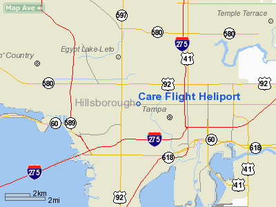
Care Flight Heliport
Address:
Hillsborough County, FL
Tel:
813-870-4445,
813-554-8464
Images
and information placed above are from
http://www.airport-data.com/airport/FL38/
We
thank them for the data!
| General
Info |
| Country |
United
States |
| State |
FLORIDA
|
| FAA ID |
FL38
|
| Latitude |
27-58-55.072N
|
| Longitude |
082-29-29.342W
|
| Elevation |
29 feet
|
| Near City |
TAMPA
|
We don't guarantee the information is fresh and accurate. The data may
be wrong or outdated.
For more up-to-date information please refer to other sources.
|
|


