 |
|
Location
& QuickFacts
|
FAA
Information Effective: |
2006-09-28 |
|
Airport
Identifier: |
2DE2 |
|
Longitude/Latitude: |
075-34-19.9400W/38-51-18.1200N
-75.572206/38.855033 (Estimated) |
|
Elevation: |
63 ft / 19.20 m () |
|
Land: |
0 acres |
|
From
nearest city: |
1 nautical miles SE of Farmington, DE |
|
Location: |
Kent County, DE |
|
Magnetic Variation: |
12W (2000) |
Owner
& Manager
|
Ownership: |
Privately owned |
|
Owner: |
Daniel E. Williams Iii |
|
Address: |
21733 S. Dupont Highway
Greenwood, DE 19950 |
|
Manager: |
Daniel E. Williams Iii |
|
Address: |
21733 S. Dupont Highway
Greenwood, DE 19950 |
|
Phone number: |
302-398-3106 |
Airport
Operations and Facilities
|
Airport
Use: |
Private |
|
Wind
indicator: |
Yes |
|
Segmented
Circle: |
No |
|
Control
Tower: |
No |
|
Attendance
Schedule: |
UNATNDD |
|
Sectional
chart: |
Washington |
|
Region: |
AEA - Eastern |
|
Boundary
ARTCC: |
ZDC - Washington |
|
Tie-in
FSS: |
MIV - Millville |
|
FSS
Phone: |
856-825-8090 |
|
FSS
Toll Free: |
1-800-WX-BRIEF |
|
Runway Information
Runway 16/34
|
Dimension: |
2400 x 75 ft / 731.5 x 22.9 m |
|
Surface: |
TURF, |
|
|
Runway 16 |
Runway 34 |
|
Traffic
Pattern: |
Left |
Left |
|
Radio Navigation
Aids
|
ID |
Type |
Name |
Ch |
Freq |
Var |
Dist |
|
ESN |
NDB |
Easton |
|
212.00 |
10W |
23.5 nm |
|
CGE |
NDB |
Cambridge |
|
355.00 |
10W |
28.8 nm |
|
OX |
NDB |
Landy |
|
407.00 |
12W |
34.4 nm |
|
RNB |
NDB |
Rainbow |
|
363.00 |
11W |
39.5 nm |
|
MTN |
NDB |
Martin |
|
342.00 |
11W |
46.2 nm |
|
APG |
NDB |
Aberdeen |
|
349.00 |
11W |
47.9 nm |
|
DOV |
TACAN |
Dover |
037X |
|
09W |
17.4 nm |
|
MTN |
TACAN |
Martin |
068X |
|
11W |
48.5 nm |
|
ATR |
VOR/DME |
Waterloo |
073X |
112.60 |
09W |
17.1 nm |
|
PPM |
VOR/DME |
Phillips |
021X |
108.40 |
09W |
46.2 nm |
|
ENO |
VORTAC |
Smyrna |
051X |
111.40 |
09W |
22.8 nm |
|
SBY |
VORTAC |
Salisbury |
049X |
111.20 |
12W |
30.8 nm |
|
SIE |
VORTAC |
Sea Isle |
095X |
114.80 |
09W |
38.9 nm |
|
SWL |
VORTAC |
Snow Hill |
071X |
112.40 |
08W |
48.3 nm |
|
OOD |
VORTAC |
Woodstown |
075X |
112.80 |
10W |
48.6 nm |
|
DQO |
VORTAC |
Dupont |
087X |
114.00 |
10W |
49.5 nm |
|
VCN |
VORTAC |
Cedar Lake |
099X |
115.20 |
10W |
49.8 nm |
Remarks
- PRVDD
VFR; A CLEAR 20:1 APCH/DEP; A LOA WITH THE OWNERS OF CHORMAN ARPT TO
CO-ORDINATE TFC PATTERNS.
Based Aircraft
|
Aircraft
based on field: |
2 |
|
Single
Engine Airplanes: |
1 |
|
Ultralights: |
1 |
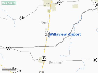
Willaview Airport
Address:
Kent County, DE
Tel:
302-398-3106
Images
and information placed above are from
http://www.airport-data.com/airport/2DE2/
We
thank them for the data!
| General
Info |
| Country |
United
States |
| State |
DELAWARE
|
| FAA ID |
2DE2
|
| Latitude |
38-51-18.120N
|
| Longitude |
075-34-19.940W
|
| Elevation |
63 feet
|
| Near City |
FARMINGTON
|
We don't guarantee the information is fresh and accurate. The data may
be wrong or outdated.
For more up-to-date information please refer to other sources.
|
|


