 |
|
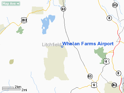
Location
& QuickFacts
|
FAA
Information Effective: |
2006-09-28 |
|
Airport
Identifier: |
CT01 |
|
Longitude/Latitude: |
073-11-20.4060W/41-39-58.3470N
-73.189002/41.666208 (Estimated) |
|
Elevation: |
1020 ft / 310.90 m (Estimated) |
|
Land: |
35 acres |
|
From
nearest city: |
2 nautical miles NE of Bethlehem, CT |
|
Location: |
Litchfield County, CT |
|
Magnetic Variation: |
14W (1985) |
Owner
& Manager
|
Ownership: |
Privately owned |
|
Owner: |
Thomas M. Whelan |
|
Address: |
249 North Hard Hill Rd
Bethlehem, CT 06751 |
|
Phone number: |
203-266-5300 |
|
Manager: |
Thomas M. Whelan |
|
Address: |
Box 293
Bethlehem, CT 06751 |
|
Phone number: |
203-266-5300 |
Airport
Operations and Facilities
|
Airport
Use: |
Private |
|
Wind
indicator: |
Yes |
|
Segmented
Circle: |
No |
|
Control
Tower: |
No |
|
Attendance
Schedule: |
UNATNDD |
|
Sectional
chart: |
New York |
|
Region: |
ANE - New England |
|
Boundary
ARTCC: |
ZBW - Boston |
|
Tie-in
FSS: |
BDR - Bridgeport |
|
FSS
Phone: |
866-293-5149 |
|
FSS
Toll Free: |
1-800-WX-BRIEF |
|
Runway Information
Runway 01/19
|
Dimension: |
1400 x 150 ft / 426.7 x 45.7 m |
|
Surface: |
TURF, |
| |
Runway 01 |
Runway 19 |
|
Traffic
Pattern: |
Right |
Left |
|
Radio Navigation
Aids
|
ID |
Type |
Name |
Ch |
Freq |
Var |
Dist |
|
GBR |
FAN MARKER |
Sheffield |
|
|
13W |
28.8 nm |
|
SKU |
FAN MARKER |
Stanwyck |
|
|
12W |
39.4 nm |
|
PSF |
FAN MARKER |
Abyss |
|
|
13W |
47.5 nm |
|
TBY |
NDB |
Waterbury |
|
257.00 |
14W |
8.5 nm |
|
MMK |
NDB |
Meriden |
|
238.00 |
14W |
18.7 nm |
|
HF |
NDB |
Lomis |
|
244.00 |
15W |
25.4 nm |
|
GBR |
NDB |
Great Barrington |
|
395.00 |
14W |
32.5 nm |
|
PO |
NDB |
Meier |
|
403.00 |
12W |
35.3 nm |
|
SKU |
NDB |
Stanwyck |
|
261.00 |
12W |
39.4 nm |
|
OP |
NDB |
Old Field Point Light |
|
316.00 |
13W |
41.5 nm |
|
PFH |
NDB |
Philmont |
|
272.00 |
13W |
42.6 nm |
|
SW |
NDB |
Neely |
|
335.00 |
14W |
48.0 nm |
|
DXT |
NDB |
Dalton |
|
370.00 |
15W |
48.4 nm |
|
PWL |
VOR/DME |
Pawling |
090X |
114.30 |
12W |
19.5 nm |
|
HVN |
VOR/DME |
New Haven |
035X |
109.80 |
13W |
27.9 nm |
|
IGN |
VOR/DME |
Kingston |
123X |
117.60 |
12W |
28.4 nm |
|
HFD |
VOR/DME |
Hartford |
096X |
114.90 |
13W |
28.9 nm |
|
CMK |
VOR/DME |
Carmel |
113X |
116.60 |
12W |
29.2 nm |
|
BDR |
VOR/DME |
Bridgeport |
25X |
108.80 |
12W |
30.5 nm |
|
MAD |
VOR/DME |
Madison |
041X |
110.40 |
13W |
30.8 nm |
|
CTR |
VOR/DME |
Chester |
098X |
115.10 |
13W |
39.1 nm |
|
CCC |
VOR/DME |
Calverton |
119X |
117.20 |
13W |
47.7 nm |
|
BDL |
VORTAC |
Bradley |
027X |
109.00 |
14W |
27.8 nm |
|
BAF |
VORTAC |
Barnes |
077X |
113.00 |
14W |
36.5 nm |
|
CEF |
VORTAC |
Westover |
87X |
114.00 |
14W |
43.6 nm |
|
HFD |
VOT |
Hartford |
|
108.20 |
|
24.5 nm |
|
BDL |
VOT |
Bradley Intl |
|
111.40 |
|
28.0 nm |
|
BDR |
VOT |
Bridgeport |
|
109.25 |
|
30.5 nm |
Remarks
- VFR
USE ONLY; CLEAR RY APPROACHES ESTABLISHED.
Based Aircraft
|
Aircraft
based on field: |
8 |
|
Single
Engine Airplanes: |
6 |
|
Gliders: |
1 |
|
Ultralights: |
1 |
Whelan Farms Airport
Address:
Litchfield County, CT
Tel:
203-266-5300
Images
and information placed above are from
http://www.airport-data.com/airport/CT01/
We
thank them for the data!
| General
Info |
| Country |
United
States |
| State |
CONNECTICUT
|
| FAA ID |
CT01
|
| Latitude |
41-39-58.347N
|
| Longitude |
073-11-20.406W
|
| Elevation |
1020 feet
|
| Near City |
BETHLEHEM
|
We don't guarantee the information is fresh and accurate. The data may
be wrong or outdated.
For more up-to-date information please refer to other sources.
|
|


