|
|
| Waterbury-Oxford Airport |
 |
| IATA: OXC – ICAO: KOXC – FAA LID: OXC |
| Summary |
| Airport type |
Public |
| Owner |
Connecticut Department of Transportation (ConnDOT) |
| Operator |
State of Connecticut, DOT |
| Location |
Oxford, Connecticut |
| Elevation AMSL |
726 ft / 221 m |
| Coordinates |
41°28′43″N 073°08′07″W / 41.47861°N 73.13528°W / 41.47861; -73.13528 |
| Website |
http://www.ct.gov/dot/cwp/view.asp?q=260076 |
| Runways |
| Direction |
Length |
Surface |
| ft |
m |
| 18/36 |
5,800 |
1,768 |
Asphalt |
| Statistics (2001) |
| Aircraft operations |
151,095 |
| Based aircraft |
241 |
| Source: Federal Aviation Administration |
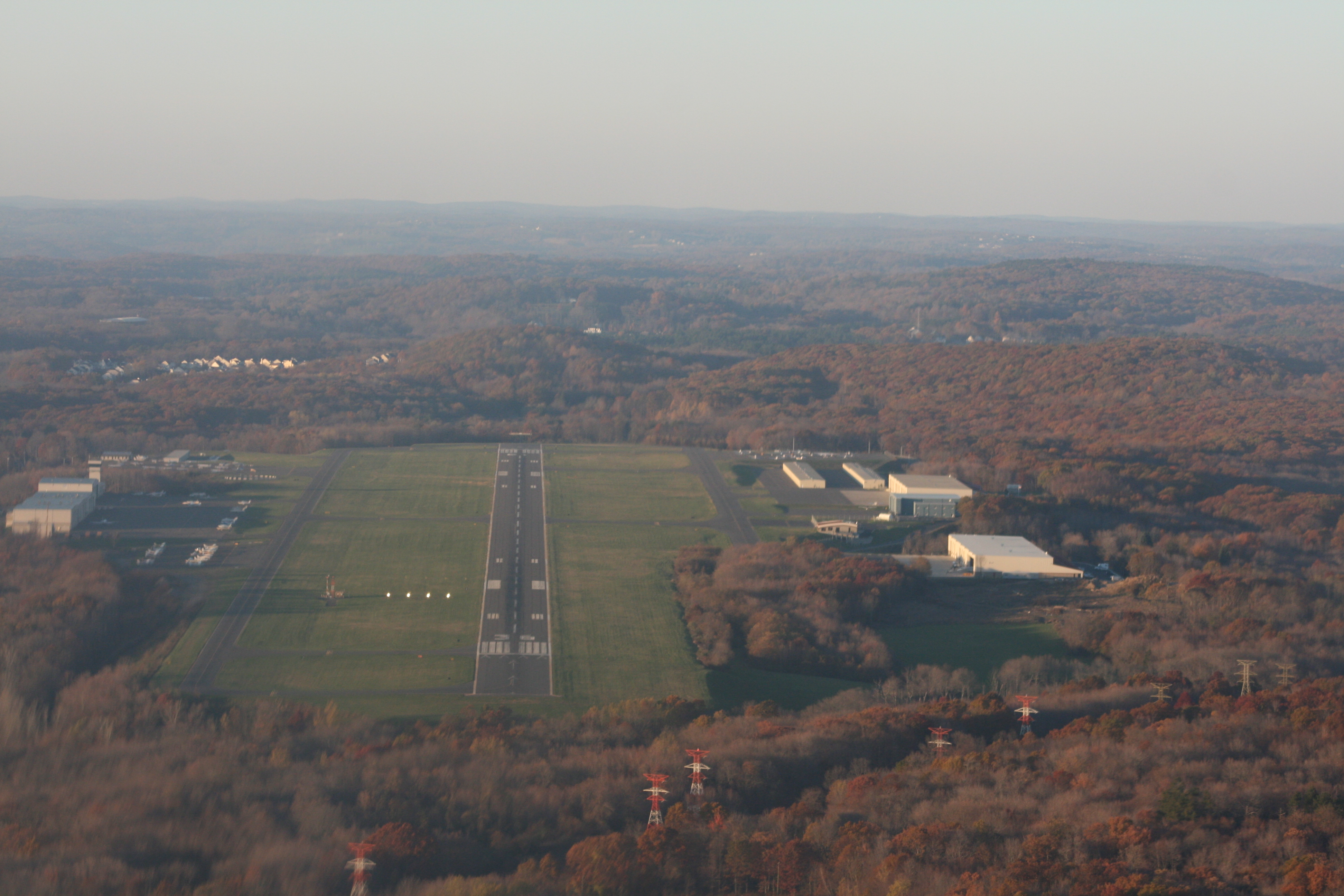
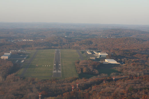
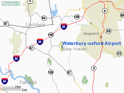
Waterbury-Oxford Airport (IATA: OXC, ICAO: KOXC, FAA LID: OXC) is a public airport located three miles (5 km) north of the central business district of Oxford, a town in New Haven County, Connecticut, United States. It is owned by the Connecticut Department of Transportation (ConnDOT).. The airport opened in December of of 1969. Airport Upgrades
In 2008, a 61 million dollar upgrade took place, runway 18/36 was extended, taxiways where widened and new taxiways were paved. The 61 million dollar upgrade also included the building of new hangers, and the installation of a state-of-the-art noise abatement program. These improvements have allowed for much larger aircraft to land at Oxford.
Facilities and aircraft
Waterbury-Oxford Airport covers an area of 424 acres (172 ha) which contains one asphalt paved runway (18/36) measuring 5,800 x 100 ft (1,768 x 30 m).
For 12-month period ending 31 December 2007 the airport had: Aircraft based on the field:199 Single engine airplanes:143 Multi engine airplanes:12 Jet airplanes:43 Helicopters:1
In January 2008, the restaurant and bar called 121 Restaurant @ OXC opened in a building constructed adjacent to the airport's runway.
The above content comes from Wikipedia and is published under free licenses – click here to read more.
Location
& QuickFacts
|
FAA
Information Effective: |
2006-09-28 |
|
Airport
Identifier: |
OXC |
|
Longitude/Latitude: |
073-08-06.9000W/41-28-42.8000N
-73.135250/41.478556 (Estimated) |
|
Elevation: |
726 ft / 221.28 m (Surveyed) |
|
Land: |
424 acres |
|
From
nearest city: |
3 nautical miles N of Oxford, CT |
|
Location: |
New Haven County, CT |
|
Magnetic Variation: |
14W (1995) |
Owner
& Manager
|
Ownership: |
Publicly owned |
|
Owner: |
State Of Conn |
|
Address: |
2800 Berlin Turnpike
Newington, CT 06111 |
|
Phone number: |
860-594-2537 |
|
Manager: |
Matthew J. Kelly |
|
Address: |
300 Christian St
Oxford, CT 06478 |
|
Phone number: |
203-264-8010 |
Airport
Operations and Facilities
|
Airport
Use: |
Open to public |
|
Wind
indicator: |
Yes |
|
Segmented
Circle: |
Yes |
|
Control
Tower: |
Yes |
|
Attendance
Schedule: |
ALL/ALL/ALL |
|
Lighting
Schedule: |
DUSK-DAWN
ACTVT HIRL RY 18/36 - CTAF. |
|
Beacon
Color: |
Clear-Green (lighted land airport) |
|
Landing
fee charge: |
No
LANDING FEE FOR BUSINESS/CORPORATE & REVENUE PRODUCING
ACFT. |
|
Sectional
chart: |
New York |
|
Region: |
ANE - New England |
|
Boundary
ARTCC: |
ZBW - Boston |
|
Responsible
ARTCC: |
ZNY - New York |
|
Tie-in
FSS: |
BDR - Bridgeport |
|
FSS
on Airport: |
No |
|
FSS
Phone: |
866-293-5149 |
|
FSS
Toll Free: |
1-800-WX-BRIEF |
|
NOTAMs
Facility: |
OXC (NOTAM-d service avaliable) |
|
Federal Agreements: |
NGY |
Airport
Communications
|
CTAF: |
118.475 |
|
Unicom: |
122.700 |
Airport
Services
|
Fuel
available: |
100LLA |
|
Airframe
Repair: |
MAJOR |
|
Power
Plant Repair: |
MAJOR |
|
Bottled
Oxygen: |
NONE |
|
Bulk
Oxygen: |
NONE |
|
Runway Information
Runway 18/36
|
Dimension: |
5800 x 100 ft / 1767.8 x 30.5 m |
|
Surface: |
ASPH, Good Condition |
|
Surface
Treatment: |
Saw-cut or plastic Grooved |
|
Weight
Limit: |
Single wheel: 50000 lbs.
Dual wheel: 85000 lbs.
Dual
tandem wheel: 145000 lbs. |
|
Edge
Lights: |
High |
| |
Runway 18 |
Runway 36 |
|
Longitude: |
073-08-12.7783W |
073-08-00.5659W |
|
Latitude: |
41-29-10.0979N |
41-28-13.5324N |
|
Elevation: |
725.00 ft |
679.00 ft |
|
Alignment: |
127 |
127 |
|
ILS
Type: |
|
ILS/DME |
|
Traffic
Pattern: |
Left |
Left |
|
Markings: |
Precision instrument, Good Condition |
Precision instrument, Good Condition |
|
Crossing
Height: |
56.00 ft |
56.00 ft |
|
Displaced
threshold: |
300.00 ft |
500.00 ft |
|
VASI: |
4-box on left side |
4-light PAPI on left side |
|
Visual
Glide Angle: |
3.00� |
3.00� |
|
Runway
End Identifier: |
No |
Yes |
|
Obstruction: |
27 ft tree, 1100.0 ft from runway, 33:1 slope
to clear
+10 FT MOUND 100 FT FM THLD 300 FT L. |
50 ft pline, 1000.0 ft from runway, 600 ft
right of centerline, 16:1 slope to clear
PLINE RUNS DIAGONALLY ACROSS THE APCH. |
|
Decleard
distances: |
Take off run available 5800.00 ft
Take off distance available 5800.00 ft
Actual stop distance available 5300.00 ft
Landing distance available 5000.00 ft |
Take off run available 5800.00 ft
Take off distance available 5800.00 ft
Actual stop distance available 5500.00 ft
Landing distance available 5000.00 ft |
|
Radio Navigation
Aids
|
ID |
Type |
Name |
Ch |
Freq |
Var |
Dist |
|
GBR |
FAN MARKER |
Sheffield |
|
|
13W |
40.3 nm |
|
SKU |
FAN MARKER |
Stanwyck |
|
|
12W |
41.1 nm |
|
TBY |
NDB |
Waterbury |
|
257.00 |
14W |
3.1 nm |
|
MMK |
NDB |
Meriden |
|
238.00 |
14W |
13.9 nm |
|
HF |
NDB |
Lomis |
|
244.00 |
15W |
24.8 nm |
|
OP |
NDB |
Old Field Point Light |
|
316.00 |
13W |
30.2 nm |
|
PO |
NDB |
Meier |
|
403.00 |
12W |
37.8 nm |
|
SKU |
NDB |
Stanwyck |
|
261.00 |
12W |
41.1 nm |
|
GBR |
NDB |
Great Barrington |
|
395.00 |
14W |
44.0 nm |
|
SW |
NDB |
Neely |
|
335.00 |
14W |
49.2 nm |
|
BBN |
NDB |
Babylon |
|
275.00 |
14W |
49.8 nm |
|
FOK |
TACAN |
Suffolk Co |
047X |
|
13W |
44.7 nm |
|
HVN |
VOR/DME |
New Haven |
035X |
109.80 |
13W |
17.2 nm |
|
BDR |
VOR/DME |
Bridgeport |
25X |
108.80 |
12W |
19.1 nm |
|
MAD |
VOR/DME |
Madison |
041X |
110.40 |
13W |
22.3 nm |
|
CMK |
VOR/DME |
Carmel |
113X |
116.60 |
12W |
23.4 nm |
|
PWL |
VOR/DME |
Pawling |
090X |
114.30 |
12W |
27.3 nm |
|
HFD |
VOR/DME |
Hartford |
096X |
114.90 |
13W |
28.2 nm |
|
IGN |
VOR/DME |
Kingston |
123X |
117.60 |
12W |
32.9 nm |
|
CCC |
VOR/DME |
Calverton |
119X |
117.20 |
13W |
36.3 nm |
|
DPK |
VOR/DME |
Deer Park |
124X |
117.70 |
12W |
42.0 nm |
|
CTR |
VOR/DME |
Chester |
098X |
115.10 |
13W |
49.6 nm |
|
GON |
VOR/DME |
Groton |
45Y |
110.85 |
14W |
49.6 nm |
|
BDL |
VORTAC |
Bradley |
027X |
109.00 |
14W |
34.3 nm |
|
BAF |
VORTAC |
Barnes |
077X |
113.00 |
14W |
45.2 nm |
|
BDR |
VOT |
Bridgeport |
|
109.25 |
|
19.1 nm |
|
HFD |
VOT |
Hartford |
|
108.20 |
|
26.7 nm |
|
BDL |
VOT |
Bradley Intl |
|
111.40 |
|
34.3 nm |
|
ISP |
VOT |
Long Island Mac Arthur |
|
109.40 |
|
41.5 nm |
|
GON |
VOT |
Groton |
|
110.25 |
|
49.8 nm |
Remarks
- TGL
AND PRACTICE LOW APPROACHES PROHIBITED 2300-0700.
- PLA
RY 36 NA WHEN RY 18 ACTV
- ARPT
CLSD TO ACR OPNS.
- PAEW
VICINITY RY 18/36 SAFETY ZONE SUMMER ONLY SR-SS (MOWING IN PROGRESS
DAILY).
- RY
36 CALM WIND RY.
- 748
FT ELEC TRANSMISSION TWRS RUNNING NE TO SW 0.2 MI N OF MID MKR.
- DEER
& BIRDS ON & INVOF ARPT.
- ALL
SOD AREAS CLSD.
Based Aircraft
|
Aircraft
based on field: |
254 |
|
Single
Engine Airplanes: |
180 |
|
Multi
Engine Airplanes: |
29 |
|
Jet Engine
Airplanes: |
44 |
|
Helicopters: |
1 |
Operational Statistics
|
Aircraft
Operations: |
414/Day |
|
Air Taxi: |
1.5% |
|
General
Aviation Local: |
67.8% |
|
General
Aviation Itinerant: |
30.4% |
|
Military: |
0.3% |
Waterbury-oxford Airport
Address:
New Haven County, CT
Tel:
860-594-2537, 203-264-8010
Images
and information placed above are from
http://www.airport-data.com/airport/OXC/
We
thank them for the data!
| General
Info |
| Country |
United
States |
| State |
CONNECTICUT
|
| FAA ID |
OXC
|
| Latitude |
41-28-42.800N
|
| Longitude |
073-08-06.900W
|
| Elevation |
726 feet
|
| Near City |
OXFORD
|
We don't guarantee the information is fresh and accurate. The data may
be wrong or outdated.
For more up-to-date information please refer to other sources.
|
|