 |
|
Location
& QuickFacts
|
FAA
Information Effective: |
2006-09-28 |
|
Airport
Identifier: |
07CT |
|
Longitude/Latitude: |
072-14-58.7100W/41-27-10.5500N
-72.249642/41.452931 (Estimated) |
|
Elevation: |
430 ft / 131.06 m (Estimated) |
|
Land: |
0 acres |
|
From
nearest city: |
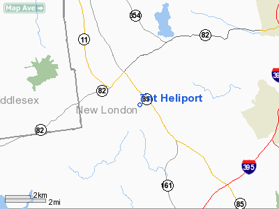
3 nautical miles SS of Salem, CT |
|
Location: |
New London County, CT |
|
Magnetic Variation: |
15W (2000) |
Owner
& Manager
|
Ownership: |
Privately owned |
|
Owner: |
Thomas Thill |
|
Address: |
95 Beckwith Hill
Salem, CT 06420 |
|
Phone number: |
860-886-7558 |
|
Manager: |
Thomas Thill |
|
Address: |
95 Beckwith Hill
Salem, CT 06420 |
|
Phone number: |
860-886-7558 |
Airport
Operations and Facilities
|
Airport
Use: |
Private |
|
Segmented
Circle: |
No |
|
Control
Tower: |
No |
|
Attendance
Schedule: |
UNATNDD |
|
Sectional
chart: |
New York |
|
Region: |
ANE - New England |
|
Boundary
ARTCC: |
ZBW - Boston |
|
Tie-in
FSS: |
BDR - Bridgeport |
|
FSS
Phone: |
866-293-5149 |
|
FSS
Toll Free: |
1-800-WX-BRIEF |
|
Runway Information
Helipad H1
|
Dimension: |
35 x 35 ft / 10.7 x 10.7 m |
|
Surface: |
TURF, |
| |
Runway H1 |
Runway |
|
Traffic
Pattern: |
Left |
Left |
|
Radio Navigation
Aids
|
ID |
Type |
Name |
Ch |
Freq |
Var |
Dist |
|
HF |
NDB |
Lomis |
|
244.00 |
15W |
20.2 nm |
|
MMK |
NDB |
Meriden |
|
238.00 |
14W |
26.3 nm |
|
TBY |
NDB |
Waterbury |
|
257.00 |
14W |
40.5 nm |
|
SFZ |
NDB |
Central |
|
241.00 |
15W |
44.2 nm |
|
OP |
NDB |
Old Field Point Light |
|
316.00 |
13W |
48.6 nm |
|
FOK |
TACAN |
Suffolk Co |
047X |
|
13W |
40.8 nm |
|
GON |
VOR/DME |
Groton |
45Y |
110.85 |
14W |
11.6 nm |
|
ORW |
VOR/DME |
Norwich |
037X |
110.00 |
14W |
12.9 nm |
|
HFD |
VOR/DME |
Hartford |
096X |
114.90 |
13W |
17.5 nm |
|
MAD |
VOR/DME |
Madison |
041X |
110.40 |
13W |
21.6 nm |
|
HVN |
VOR/DME |
New Haven |
035X |
109.80 |
13W |
30.9 nm |
|
SEY |
VOR/DME |
Sandy Point |
125X |
117.80 |
15W |
34.9 nm |
|
PUT |
VOR/DME |
Putnam |
121X |
117.40 |
14W |
35.3 nm |
|
CCC |
VOR/DME |
Calverton |
119X |
117.20 |
13W |
40.1 nm |
|
BDR |
VOR/DME |
Bridgeport |
25X |
108.80 |
12W |
43.2 nm |
|
HTO |
VORTAC |
Hampton |
083X |
113.60 |
13W |
32.2 nm |
|
BDL |
VORTAC |
Bradley |
027X |
109.00 |
14W |
35.3 nm |
|
PVD |
VORTAC |
Providence |
103X |
115.60 |
14W |
40.3 nm |
|
CEF |
VORTAC |
Westover |
87X |
114.00 |
14W |
46.4 nm |
|
BAF |
VORTAC |
Barnes |
077X |
113.00 |
14W |
47.5 nm |
|
GON |
VOT |
Groton |
|
110.25 |
|
11.8 nm |
|
HFD |
VOT |
Hartford |
|
108.20 |
|
24.8 nm |
|
BDL |
VOT |
Bradley Intl |
|
111.40 |
|
35.1 nm |
|
PVD |
VOT |
Providence |
|
108.20 |
|
40.4 nm |
|
BDR |
VOT |
Bridgeport |
|
109.25 |
|
43.3 nm |
Remarks
- TREES
ALL QUADRANTS.
- PRVDD
INGRESS & EGRESS ROUTES AVOID NEARBY HOMES; INCREASE THE HEIGHT
OF THE WINDSOCK; VFR OPNS; AND ALL USERS ARE NOTIFIED AND COMPLY WITH
THESE CONDITIONS.
Tnt Heliport
Address:
New London County, CT
Tel:
860-886-7558
Images
and information placed above are from
http://www.airport-data.com/airport/07CT/
We
thank them for the data!
| General
Info |
| Country |
United
States |
| State |
CONNECTICUT
|
| FAA ID |
07CT
|
| Latitude |
41-27-10.550N
|
| Longitude |
072-14-58.710W
|
| Elevation |
430 feet
|
| Near City |
SALEM
|
We don't guarantee the information is fresh and accurate. The data may
be wrong or outdated.
For more up-to-date information please refer to other sources.
|
|


