|
|
| Simsbury Airport |
 |
| IATA: none – ICAO: none – FAA LID: 4B9 |
| Summary |
| Airport type |
Public |
| Owner |
Airport Realty Association, LLC |
| Operator |
Simsbury Flying Club |
| Location |
Simsbury, Connecticut |
| Elevation AMSL |
195 ft / 59 m |
| Coordinates |
41°55′00″N 072°46′38″W / 41.9166667°N 72.77722°W / 41.9166667; -72.77722 |
| Website |
www.simsburyairport.com |
| Runways |
| Direction |
Length |
Surface |
| ft |
m |
| 3/21 |
2,205 |
672 |
Asphalt |
| Statistics (1997) |
| Aircraft operations |
9,452 |
| Based aircraft |
54 |
| Source: Federal Aviation Administration |
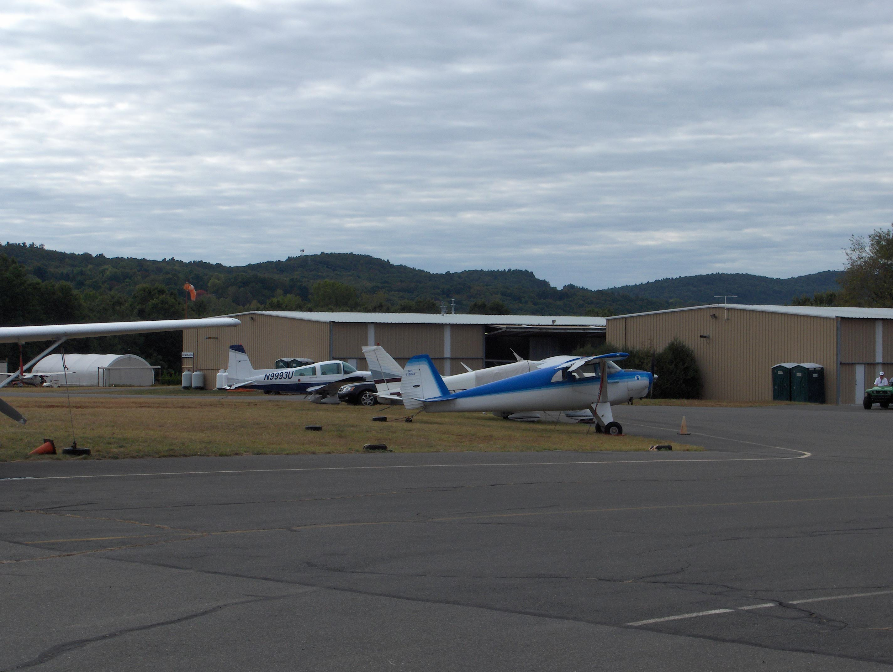
Simsbury Airport (FAA LID: 4B9) is a public use airport located in Simsbury and East Granby, both towns in Hartford County, Connecticut, United States. It is privately owned by the Airport Realty Association, LLC. The airport is operated by the Simsbury Flying Club, a not-for-profit group that operates an FBO at the airport. Fly-In
The Simsbury Fly-In is held on the third Sunday each September. The event, which as many as 10,000 people, 150 airplanes, and over 200 classic autos have attended in the past, also showcases parachute jumpers, a simulated rescue by a LifeStar helicopter, and has vendors and manufacturers displaying their products.
Facilities and aircraft
Simsbury Airport covers an area of 103 acres (42 ha) which contains one asphalt paved runway (3/21) measuring 2,205 x 50 ft (672 x 15 m).
For the 12-month period ending December 10, 1997, the airport had 9,452 aircraft operations, an average of 25 per day: 99% general aviation and 1% air taxi. There are 54 aircraft based at this airport: 87% single engine, 9% ultralight, 2% multi-engine and 2% helicopters.
The above content comes from Wikipedia and is published under free licenses – click here to read more.

Location
& QuickFacts
|
FAA
Information Effective: |
2006-09-28 |
|
Airport
Identifier: |
4B9 |
|
Longitude/Latitude: |
072-46-38.3440W/41-55-00.3500N
-72.777318/41.916764 (Estimated) |
|
Elevation: |
195 ft / 59.44 m (Estimated) |
|
Land: |
103 acres |
|
From
nearest city: |
3 nautical miles NE of Simsbury, CT |
|
Location: |
Hartford County, CT |
|
Magnetic Variation: |
14W (1985) |
Owner
& Manager
|
Ownership: |
Privately owned |
|
Owner: |
Airport Realty Assoc. Llc |
|
Address: |
37 Sunset Farms Road
West Hartford, CT 06107 |
|
Phone number: |
860-236-3301 |
|
Manager: |
Tom Andersen |
|
Address: |
94 Wolcott Rd
Simsbury, CT 06070 |
|
Phone number: |
860-658-2025 |
Airport
Operations and Facilities
|
Airport
Use: |
Open to public |
|
Wind
indicator: |
Yes |
|
Segmented
Circle: |
Yes |
|
Control
Tower: |
No |
|
Attendance
Schedule: |
ALL/ALL/0830-1700 |
|
Lighting
Schedule: |
DUSK-DAWN |
|
Landing
fee charge: |
No |
|
Sectional
chart: |
New York |
|
Region: |
ANE - New England |
|
Boundary
ARTCC: |
ZBW - Boston |
|
Tie-in
FSS: |
BDR - Bridgeport |
|
FSS
on Airport: |
No |
|
FSS
Phone: |
866-293-5149 |
|
FSS
Toll Free: |
1-800-WX-BRIEF |
|
NOTAMs
Facility: |
BDR (NOTAM-d service avaliable) |
|
Federal Agreements: |
N |
Airport
Communications
|
CTAF: |
122.700 |
|
Unicom: |
122.700 |
Airport
Services
|
Fuel
available: |
100LL |
|
Airframe
Repair: |
MAJOR |
|
Power
Plant Repair: |
MAJOR |
|
Bottled
Oxygen: |
NONE |
|
Bulk
Oxygen: |
NONE |
|
Runway Information
Runway 03/21
|
Dimension: |
2205 x 50 ft / 672.1 x 15.2 m |
|
Surface: |
ASPH, Good Condition |
|
Weight
Limit: |
Single wheel: 25000 lbs. |
|
Edge
Lights: |
Low |
|
|
Runway 03 |
Runway 21 |
|
Traffic
Pattern: |
Left |
Left |
|
Markings: |
Basic, Fair Condition |
Basic, Fair Condition |
|
Displaced
threshold: |
0.00
ft |
270.00 ft |
|
Runway
End Identifier: |
No |
No |
|
Centerline
Lights: |
No |
No |
|
Touchdown
Lights: |
No |
No |
|
Obstruction: |
35 ft trees, 600.0 ft from runway, 150 ft left
of centerline, 11:1 slope to clear
+4 FT BUSH 5 FT FM THR 10 FT R. |
15 ft road, 200.0 ft from runway, 120 ft right
of centerline
APCH RATIO 21:1 TO DSPLCD THLD.
WALCOTT ROAD AT THR 60 FT R. |
|
Radio Navigation
Aids
|
ID |
Type |
Name |
Ch |
Freq |
Var |
Dist |
|
GBR |
FAN MARKER |
Sheffield |
|
|
13W |
29.1 nm |
|
PSF |
FAN MARKER |
Abyss |
|
|
13W |
37.8 nm |
|
HF |
NDB |
Lomis |
|
244.00 |
15W |
18.2 nm |
|
MMK |
NDB |
Meriden |
|
238.00 |
14W |
24.5 nm |
|
TBY |
NDB |
Waterbury |
|
257.00 |
14W |
28.5 nm |
|
GBR |
NDB |
Great Barrington |
|
395.00 |
14W |
32.2 nm |
|
DXT |
NDB |
Dalton |
|
370.00 |
15W |
37.6 nm |
|
ORE |
NDB |
Orange |
|
205.00 |
15W |
44.9 nm |
|
PFH |
NDB |
Philmont |
|
272.00 |
13W |
46.8 nm |
|
HFD |
VOR/DME |
Hartford |
096X |
114.90 |
13W |
19.5 nm |
|
CTR |
VOR/DME |
Chester |
098X |
115.10 |
13W |
23.8 nm |
|
MAD |
VOR/DME |
Madison |
041X |
110.40 |
13W |
36.4 nm |
|
PWL |
VOR/DME |
Pawling |
090X |
114.30 |
12W |
37.9 nm |
|
HVN |
VOR/DME |
New Haven |
035X |
109.80 |
13W |
39.6 nm |
|
ORW |
VOR/DME |
Norwich |
037X |
110.00 |
14W |
41.1 nm |
|
PUT |
VOR/DME |
Putnam |
121X |
117.40 |
14W |
41.8 nm |
|
GON |
VOR/DME |
Groton |
45Y |
110.85 |
14W |
48.0 nm |
|
BDR |
VOR/DME |
Bridgeport |
25X |
108.80 |
12W |
48.1 nm |
|
IGN |
VOR/DME |
Kingston |
123X |
117.60 |
12W |
49.2 nm |
|
BDL |
VORTAC |
Bradley |
027X |
109.00 |
14W |
4.2 nm |
|
BAF |
VORTAC |
Barnes |
077X |
113.00 |
14W |
15.0 nm |
|
CEF |
VORTAC |
Westover |
87X |
114.00 |
14W |
20.3 nm |
|
GDM |
VORTAC |
Gardner |
043X |
110.60 |
14W |
49.5 nm |
|
BDL |
VOT |
Bradley Intl |
|
111.40 |
|
4.4 nm |
|
HFD |
VOT |
Hartford |
|
108.20 |
|
12.3 nm |
|
ORH |
VOT |
Worcester |
|
108.20 |
|
45.7 nm |
|
BDR |
VOT |
Bridgeport |
|
109.25 |
|
48.0 nm |
|
GON |
VOT |
Groton |
|
110.25 |
|
48.3 nm |
Remarks
- CAUTION
BIRDS FREQUENTLY ON & IN VICINITY OF ARPT - PARTICULARLY IN APCH
TO RWY 03.
- RWY
3 HAS AN UP-HILL GRADE.
- EXISTED
PRIOR TO 1959.
Based Aircraft
|
Aircraft
based on field: |
54 |
|
Single
Engine Airplanes: |
47 |
|
Multi
Engine Airplanes: |
1 |
|
Helicopters: |
1 |
|
Ultralights: |
5 |
Operational Statistics
|
Aircraft
Operations: |
182/Week |
|
Air Taxi: |
0.6% |
|
General
Aviation Local: |
89.9% |
|
General
Aviation Itinerant: |
9.5% |
Simsbury Airport
Address:
Hartford County, CT
Tel:
860-236-3301, 860-658-2025
Images
and information placed above are from
http://www.airport-data.com/airport/4B9/
We
thank them for the data!
| General
Info |
| Country |
United
States |
| State |
CONNECTICUT
|
| FAA ID |
4B9
|
| Latitude |
41-55-00.350N
|
| Longitude |
072-46-38.344W
|
| Elevation |
195 feet
|
| Near City |
SIMSBURY
|
We don't guarantee the information is fresh and accurate. The data may
be wrong or outdated.
For more up-to-date information please refer to other sources.
|
|