 |
|
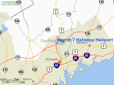
Merritt 7 Helistop Heliport |
|
|
Location
& QuickFacts
|
FAA
Information Effective: |
2006-09-28 |
|
Airport
Identifier: |
CT79 |
|
Longitude/Latitude: |
073-25-41.4320W/41-08-41.3470N
-73.428176/41.144819 (Estimated) |
|
Elevation: |
105 ft / 32.00 m (Estimated) |
|
Land: |
1 acres |
|
From
nearest city: |
3 nautical miles N of Norwalk, CT |
|
Location: |
Fairfield County, CT |
|
Magnetic Variation: |
13W (1985) |
Owner
& Manager
|
Ownership: |
Privately owned |
|
Owner: |
Fairfield Investors Inc |
|
Address: |
Merritt 7 Corp Park
Norwalk, CT 06851 |
|
Phone
number: |
203-966-9391 |
|
Manager: |
Carlton S. Raymond Jr.
CONNECTICUT COPTER CORP; LLOYD TACKLING, PRES. |
|
Address: |
144 South Ave
New Canaan, CT 06840 |
|
Phone number: |
203-966-9391 |
Airport
Operations and Facilities
|
Airport
Use: |
Private |
|
Wind
indicator: |
Yes |
|
Segmented
Circle: |
No |
|
Control
Tower: |
No |
|
Attendance
Schedule: |
ALL/MON-FRI/0700-2000
ATNDNC SKED SAT-SUN PRIOR REQ PHONE 203-996-9391. |
|
Landing fee charge: |
Yes |
|
Sectional chart: |
New York |
|
Region: |
ANE - New England |
|
Boundary ARTCC: |
ZBW - Boston |
|
Tie-in FSS: |
BDR - Bridgeport |
|
FSS on Airport: |
No |
|
FSS Phone: |
866-293-5149 |
|
FSS Toll Free: |
1-800-WX-BRIEF |
Airport
Communications
|
Runway Information
Helipad H1
|
Dimension: |
40 x 40 ft / 12.2 x 12.2 m
HELIPAD CIRCULAR IN SHAPE. |
|
Surface: |
CONC, |
|
|
Runway H1 |
Runway |
|
Traffic
Pattern: |
Left |
Left |
|
Radio Navigation
Aids
|
ID |
Type |
Name |
Ch |
Freq |
Var |
Dist |
|
SKU |
FAN MARKER |
Stanwyck |
|
|
12W |
36.1 nm |
|
EWR |
FAN MARKER |
Maryann |
|
|
11W |
43.5 nm |
|
OP |
NDB |
Old Field Point Light |
|
316.00 |
13W |
17.3 nm |
|
TBY |
NDB |
Waterbury |
|
257.00 |
14W |
26.4 nm |
|
BBN |
NDB |
Babylon |
|
275.00 |
14W |
28.5 nm |
|
PNJ |
NDB |
Paterson |
|
347.00 |
12W |
34.9 nm |
|
MMK |
NDB |
Meriden |
|
238.00 |
14W |
34.9 nm |
|
PO |
NDB |
Meier |
|
403.00 |
12W |
35.4 nm |
|
SKU |
NDB |
Stanwyck |
|
261.00 |
12W |
36.1 nm |
|
OGY |
NDB |
Bridge |
|
414.00 |
12W |
40.4 nm |
|
SW |
NDB |
Neely |
|
335.00 |
14W |
41.5 nm |
|
HF |
NDB |
Lomis |
|
244.00 |
15W |
46.7 nm |
|
FOK |
TACAN |
Suffolk Co |
047X |
|
13W |
40.6 nm |
|
CMK |
VOR/DME |
Carmel |
113X |
116.60 |
12W |
10.7 nm |
|
BDR |
VOR/DME |
Bridgeport |
25X |
108.80 |
12W |
13.8 nm |
|
DPK |
VOR/DME |
Deer Park |
124X |
117.70 |
12W |
22.0 nm |
|
HVN |
VOR/DME |
New Haven |
035X |
109.80 |
13W |
25.6 nm |
|
LGA |
VOR/DME |
La Guardia |
078X |
113.10 |
12W |
29.5 nm |
|
CCC |
VOR/DME |
Calverton |
119X |
117.20 |
13W |
31.3 nm |
|
TEB |
VOR/DME |
Teterboro |
021X |
108.40 |
11W |
33.8 nm |
|
JFK |
VOR/DME |
Kennedy |
106X |
115.90 |
12W |
34.5 nm |
|
MAD |
VOR/DME |
Madison |
041X |
110.40 |
13W |
34.8 nm |
|
IGN |
VOR/DME |
Kingston |
123X |
117.60 |
12W |
36.0 nm |
|
PWL |
VOR/DME |
Pawling |
090X |
114.30 |
12W |
38.4 nm |
|
CRI |
VOR/DME |
Canarsie |
070X |
112.30 |
11W |
38.4 nm |
|
HFD |
VOR/DME |
Hartford |
096X |
114.90 |
13W |
49.7 nm |
|
BDR |
VOT |
Bridgeport |
|
109.25 |
|
13.7 nm |
|
ISP |
VOT |
Long Island Mac Arthur |
|
109.40 |
|
26.2 nm |
|
JFK |
VOT |
Kennedy |
|
115.10 |
|
34.6 nm |
|
HFD |
VOT |
Hartford |
|
108.20 |
|
49.8 nm |
Remarks
Merritt 7 Helistop Heliport
Address:
Fairfield County, CT
Tel:
203-966-9391
Images
and information placed above are from
http://www.airport-data.com/airport/CT79/
We
thank them for the data!
| General
Info |
| Country |
United
States |
| State |
CONNECTICUT
|
| FAA ID |
CT79
|
| Latitude |
41-08-41.347N
|
| Longitude |
073-25-41.432W
|
| Elevation |
105 feet
|
| Near City |
NORWALK
|
We don't guarantee the information is fresh and accurate. The data may
be wrong or outdated.
For more up-to-date information please refer to other sources.
|
|


