 |
|
Mashantucket Pequot Tribal Nation Heliport |
Location
& QuickFacts
|
FAA
Information Effective: |
2006-09-28 |
|
Airport
Identifier: |
14CT |
|
Longitude/Latitude: |
071-58-22.4100W/41-29-05.0600N
-71.972892/41.484739 (Estimated) |
|
Elevation: |
124 ft / 37.80 m (Estimated) |
|
Land: |
0 acres |
|
From
nearest city: |
1 nautical miles SS of Mashantucket, CT |
|
Location: |
New London County, CT |
|
Magnetic Variation: |
15W (2000) |
Owner
& Manager
|
Ownership: |
Privately owned |
|
Owner: |
Mashantucket Pequot Tribal Nation |
|
Address: |
1 Matt's Path, P.o. Box 3007
Mashantucket, CT 06339-3007 |
|
Phone
number: |
860-312-7911 |
|
Manager: |
Mashantucket Pequot Tribal Nation |
|
Address: |
1 Matt's Path, P.o. Box 3007
Mashantucket, CT 06339-3007 |
|
Phone number: |
860-312-7911 |
Airport
Operations and Facilities
|
Airport
Use: |
Private |
|
Segmented
Circle: |
No |
|
Control
Tower: |
No |
|
Attendance
Schedule: |
UNATNDD |
|
Region: |
ANE - New England |
|
Boundary
ARTCC: |
ZBW - Boston |
|
Tie-in
FSS: |
BDR - Bridgeport |
|
FSS
Phone: |
866-293-5149 |
|
FSS
Toll Free: |
1-800-WX-BRIEF |
|
Runway Information
Helipad H1
|
Dimension: |
80 x 25 ft / 24.4 x 7.6 m |
|
Surface: |
CONC, |
|
|
Runway H1 |
Runway |
|
Traffic
Pattern: |
Left |
Left |
|
Radio Navigation
Aids
|
ID |
Type |
Name |
Ch |
Freq |
Var |
Dist |
|
HF |
NDB |
Lomis |
|
244.00 |
15W |
30.7 nm |
|
SFZ |
NDB |
Central |
|
241.00 |
15W |
34.0 nm |
|
MMK |
NDB |
Meriden |
|
238.00 |
14W |
38.5 nm |
|
IHM |
NDB |
Mansfield |
|
220.00 |
16W |
46.7 nm |
|
TAN |
NDB |
Taunton |
|
227.00 |
16W |
48.9 nm |
|
FOK |
TACAN |
Suffolk Co |
047X |
|
13W |
49.0 nm |
|
ORW |
VOR/DME |
Norwich |
037X |
110.00 |
14W |
4.5 nm |
|
GON |
VOR/DME |
Groton |
45Y |
110.85 |
14W |
9.9 nm |
|
SEY |
VOR/DME |
Sandy Point |
125X |
117.80 |
15W |
26.2 nm |
|
HFD |
VOR/DME |
Hartford |
096X |
114.90 |
13W |
27.5 nm |
|
PUT |
VOR/DME |
Putnam |
121X |
117.40 |
14W |
28.9 nm |
|
MAD |
VOR/DME |
Madison |
041X |
110.40 |
13W |
34.0 nm |
|
HVN |
VOR/DME |
New Haven |
035X |
109.80 |
13W |
43.3 nm |
|
PVD |
VORTAC |
Providence |
103X |
115.60 |
14W |
28.3 nm |
|
HTO |
VORTAC |
Hampton |
083X |
113.60 |
13W |
37.4 nm |
|
BDL |
VORTAC |
Bradley |
027X |
109.00 |
14W |
42.2 nm |
|
CEF |
VORTAC |
Westover |
87X |
114.00 |
14W |
49.5 nm |
|
GON |
VOT |
Groton |
|
110.25 |
|
10.2 nm |
|
PVD |
VOT |
Providence |
|
108.20 |
|
28.4 nm |
|
HFD |
VOT |
Hartford |
|
108.20 |
|
34.0 nm |
|
BDL |
VOT |
Bradley Intl |
|
111.40 |
|
42.0 nm |
|
ORH |
VOT |
Worcester |
|
108.20 |
|
47.2 nm |
Remarks
- 6
POLES ADJACENT TO LNDG SITE TO BE REMOVED, INSTALL LIGHTING FOR NIGHT
OPN, IINGRESS FM S & ENE; EGRESS TO NNW, ENE & S, VFR ONLY.
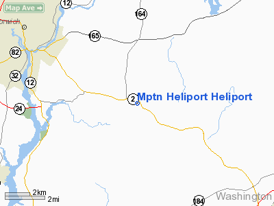
Mptn Heliport Heliport
Address:
New London County, CT
Tel:
860-312-7911
Images
and information placed above are from
http://www.airport-data.com/airport/14CT/
We
thank them for the data!
| General
Info |
| Country |
United
States |
| State |
CONNECTICUT
|
| FAA ID |
14CT
|
| Latitude |
41-29-05.060N
|
| Longitude |
071-58-22.410W
|
| Elevation |
124 feet
|
| Near City |
MASHANTUCKET
|
We don't guarantee the information is fresh and accurate. The data may
be wrong or outdated.
For more up-to-date information please refer to other sources.
|
|


