 |
|
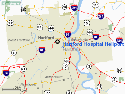
Hartford Hospital Heliport |
|
|
Location
& QuickFacts
|
FAA
Information Effective: |
2006-09-28 |
|
Airport
Identifier: |
0CT9 |
|
Longitude/Latitude: |
072-40-43.3340W/41-45-16.3600N
-72.678704/41.754544 (Estimated) |
|
Elevation: |
211 ft / 64.31 m (Estimated) |
|
Land: |
0 acres |
|
From
nearest city: |
1 nautical miles S of Hartford, CT |
|
Location: |
Hartford County, CT |
|
Magnetic Variation: |
14W (1985) |
Owner
& Manager
|
Ownership: |
Privately owned |
|
Owner: |
Hartford Hospital |
|
Address: |
80 Seymour Street
Hartford, CT 06115 |
|
Phone number: |
203-524-3011 |
|
Manager: |
S. Wainman |
|
Address: |
80 Seymour Street
Hartford, CT 06115 |
|
Phone number: |
203-524-2103 |
Airport
Operations and Facilities
|
Airport
Use: |
Private
MEDICAL USE |
|
Wind
indicator: |
Yes |
|
Segmented
Circle: |
No |
|
Control
Tower: |
No |
|
Attendance
Schedule: |
ALL/ALL/ALL |
|
Lighting
Schedule: |
PHONE REQ
FOR PERIMETER LGTS PHONE 203-524-2103. |
|
Sectional
chart: |
New York |
|
Region: |
ANE - New England |
|
Boundary
ARTCC: |
ZBW - Boston |
|
Responsible
ARTCC: |
ZNY - New York |
|
Tie-in
FSS: |
BDR - Bridgeport |
|
FSS
Phone: |
866-293-5149 |
|
FSS
Toll Free: |
1-800-WX-BRIEF |
|
Runway Information
Helipad H1
|
Dimension: |
60 x 75 ft / 18.3 x 22.9 m |
|
Surface: |
CONC, |
|
|
Runway H1 |
Runway |
|
Traffic
Pattern: |
Left |
Left |
|
Radio Navigation
Aids
|
ID |
Type |
Name |
Ch |
Freq |
Var |
Dist |
|
GBR |
FAN MARKER |
Sheffield |
|
|
13W |
38.0 nm |
|
PSF |
FAN MARKER |
Abyss |
|
|
13W |
48.4 nm |
|
HF |
NDB |
Lomis |
|
244.00 |
15W |
7.5 nm |
|
MMK |
NDB |
Meriden |
|
238.00 |
14W |
16.1 nm |
|
TBY |
NDB |
Waterbury |
|
257.00 |
14W |
24.9 nm |
|
GBR |
NDB |
Great Barrington |
|
395.00 |
14W |
41.4 nm |
|
DXT |
NDB |
Dalton |
|
370.00 |
15W |
48.3 nm |
|
HFD |
VOR/DME |
Hartford |
096X |
114.90 |
13W |
9.0 nm |
|
MAD |
VOR/DME |
Madison |
041X |
110.40 |
13W |
26.5 nm |
|
HVN |
VOR/DME |
New Haven |
035X |
109.80 |
13W |
31.0 nm |
|
ORW |
VOR/DME |
Norwich |
037X |
110.00 |
14W |
32.8 nm |
|
CTR |
VOR/DME |
Chester |
098X |
115.10 |
13W |
34.5 nm |
|
GON |
VOR/DME |
Groton |
45Y |
110.85 |
14W |
38.0 nm |
|
PUT |
VOR/DME |
Putnam |
121X |
117.40 |
14W |
39.3 nm |
|
BDR |
VOR/DME |
Bridgeport |
25X |
108.80 |
12W |
41.0 nm |
|
PWL |
VOR/DME |
Pawling |
090X |
114.30 |
12W |
41.3 nm |
|
CMK |
VOR/DME |
Carmel |
113X |
116.60 |
12W |
49.6 nm |
|
CCC |
VOR/DME |
Calverton |
119X |
117.20 |
13W |
49.9 nm |
|
BDL |
VORTAC |
Bradley |
027X |
109.00 |
14W |
11.2 nm |
|
BAF |
VORTAC |
Barnes |
077X |
113.00 |
14W |
24.5 nm |
|
CEF |
VORTAC |
Westover |
87X |
114.00 |
14W |
27.5 nm |
|
HFD |
VOT |
Hartford |
|
108.20 |
|
1.7 nm |
|
BDL |
VOT |
Bradley Intl |
|
111.40 |
|
11.1 nm |
|
GON |
VOT |
Groton |
|
110.25 |
|
38.3 nm |
|
BDR |
VOT |
Bridgeport |
|
109.25 |
|
40.9 nm |
|
ORH |
VOT |
Worcester |
|
108.20 |
|
47.5 nm |
Remarks
- DAYTIME
VFR UNTIL LIGHTING SYSTEM IS INSTALLED; LIMITED TO MEDICAL EMERGENCIES
AND OPERATIONS PERFORMED BY MULTI-ENGINE HELICOPTERS; INGRESS/EGRESS
14 DEGREES, 104 DEGREES, AND 239 DEGREES.
Based Aircraft
|
Aircraft
based on field: |
2 |
|
Helicopters: |
2 |
Hartford Hospital Heliport
Address:
Hartford County, CT
Tel:
203-524-3011, 203-524-2103
Images
and information placed above are from
http://www.airport-data.com/airport/0CT9/
We
thank them for the data!
| General
Info |
| Country |
United
States |
| State |
CONNECTICUT
|
| FAA ID |
0CT9
|
| Latitude |
41-45-16.360N
|
| Longitude |
072-40-43.334W
|
| Elevation |
211 feet
|
| Near City |
HARTFORD
|
We don't guarantee the information is fresh and accurate. The data may
be wrong or outdated.
For more up-to-date information please refer to other sources.
|
|


